It's my big day in the mountains. Nanci is dropping me off at the Fork Ridge Trailhead on Clingman Dome Road. She has decided to do her own hike today, at the Pigeon Forge Outlets. I start at 8:45am in 53 degree weather. There is very short connecter trail to the AT and I head left, or southbound on the AT. The Mt Collins trail shelter is not far, so I'm greeting AT hikers until I pass the shelter. At .5 mile from the trailhead I turn right on Sugarland Mountain Trail. Very soon I pass the shelter where I can see several more hikers preparing for the day, drinking coffee or maybe tea while taking down tents and packing up.
It is a beautiful spruce-fir forest in the morning mist. The trail is generally smooth. Lichen and mosses, some 4 inches high, give the forest floor a lush and soft look.
Check out this epiphytic Yellow Birch. It began life growing on top of the fertile surface of a rotting log. Its roots made their way to the ground and when the log finally rotted away, it was left supported by those roots. The logs are often called nurse logs.
I'm still in the Spruce-Fir forest but it's about to give way to a several mile long hike on an open ridge.
When the forest fades behind me, I have open views. Mt LeConte is the large presence on my right and a wild and unspoiled bowl is on my left.
This knife edge ridge was impacted by the Dec 2016 Chimney Tops 2 fire. Standing dead trees line the trail. Those dead trees are toppling, sometimes across the trail. Recent storms have sent a number of the dead trees down. I had heard that most trails in the fire area have sustained considerable damage. Bullhead Trail is open but has numerous trees down. Without counting the trees across the trail today, I estimated there were 40 that I had to go under, over, around or through.
I have cell service here!! I can give Nanci an update on my progress as she is picking me up in Elkmont later.
About 3 miles of trail looked like this. Sometimes the drop off was to my right and sometimes to my left and occasionally both sides. It was a spectacular ridge walk.
Generally, the footing was good along here. I could enjoy the open views.
Those two peaks under the dark cloud look like the Chimney Tops but so do many others in the area. I did notice the scramble route between my trail, Sugarland Mountain Trail and Chimney Tops Trail. The two come very close to each other. So close, it was inevitable that there would be a manway between them. When I saw the manway, it was almost straight down. I doubt you could take a step without a handhold. The really cool part is that I was looking down on the Chimney Tops.
Here is my turn. I have walked about 5 miles and have 7 to go but I'm now headed down in earnest and looking forward to leaving the blowdowns behind me.
Suddenly, there are flowers and lots of them. My phone camera can't stop taking photos.
And then this. It doesn't look like much, just a tree across the trail. However, this was a significant challenge. It was too big to scramble over, too close to the ground to squeeze under, so climbing around the rootball was the only option. It was a fairly easy climb up but once I got to the other side of the rootball, it was straight down. Someone had left a paracord tied to a root. I slid down using the paracord to break my fall. So much for leaving the deadfalls behind. There was many more to come, probably 20 on the way down.
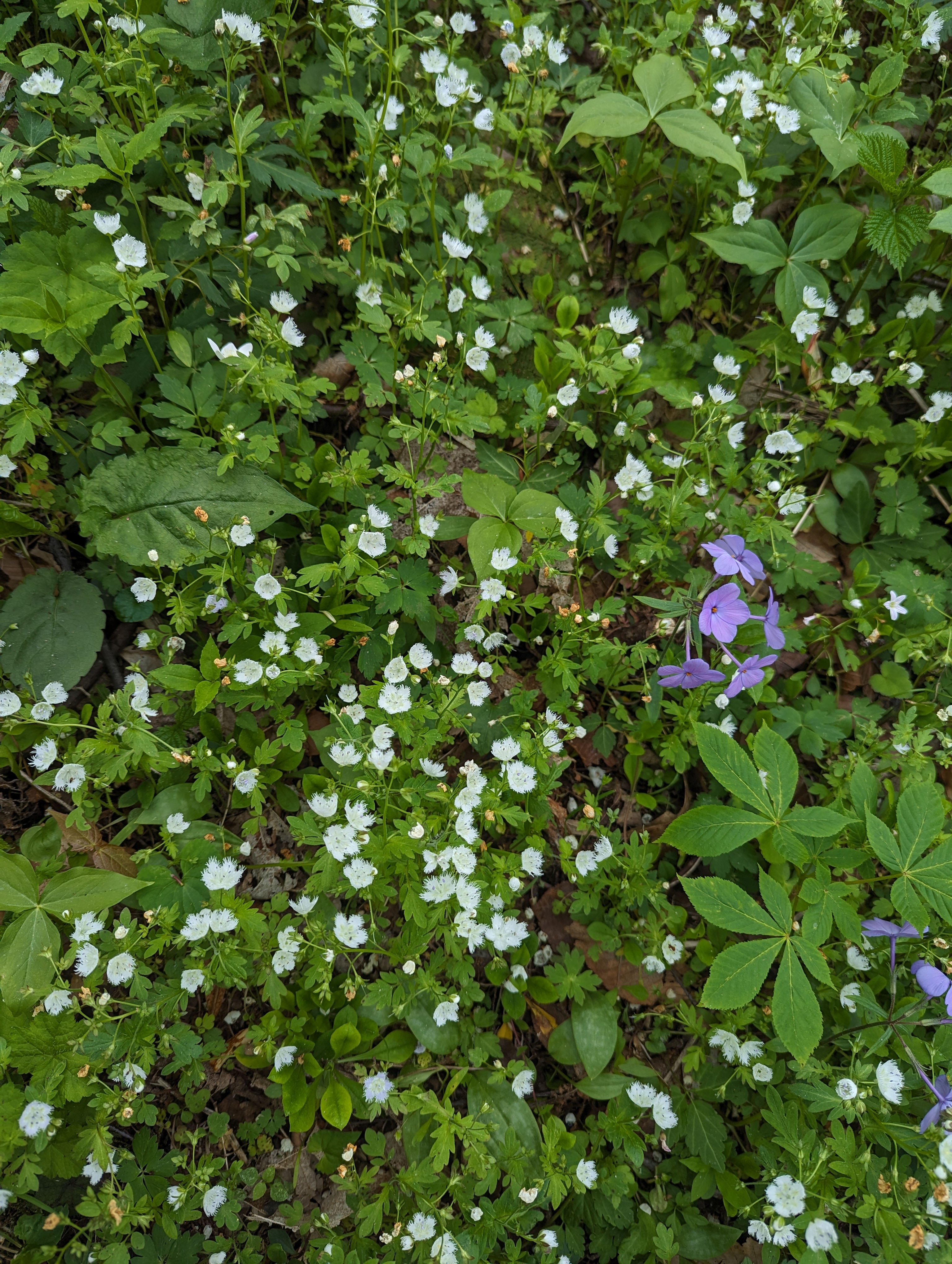
The Fringed Phacelia I didn't get to see yesterday, was all here. As far as you could see in every direction it looked like a light coating of snow.
Dutchmans Breeches
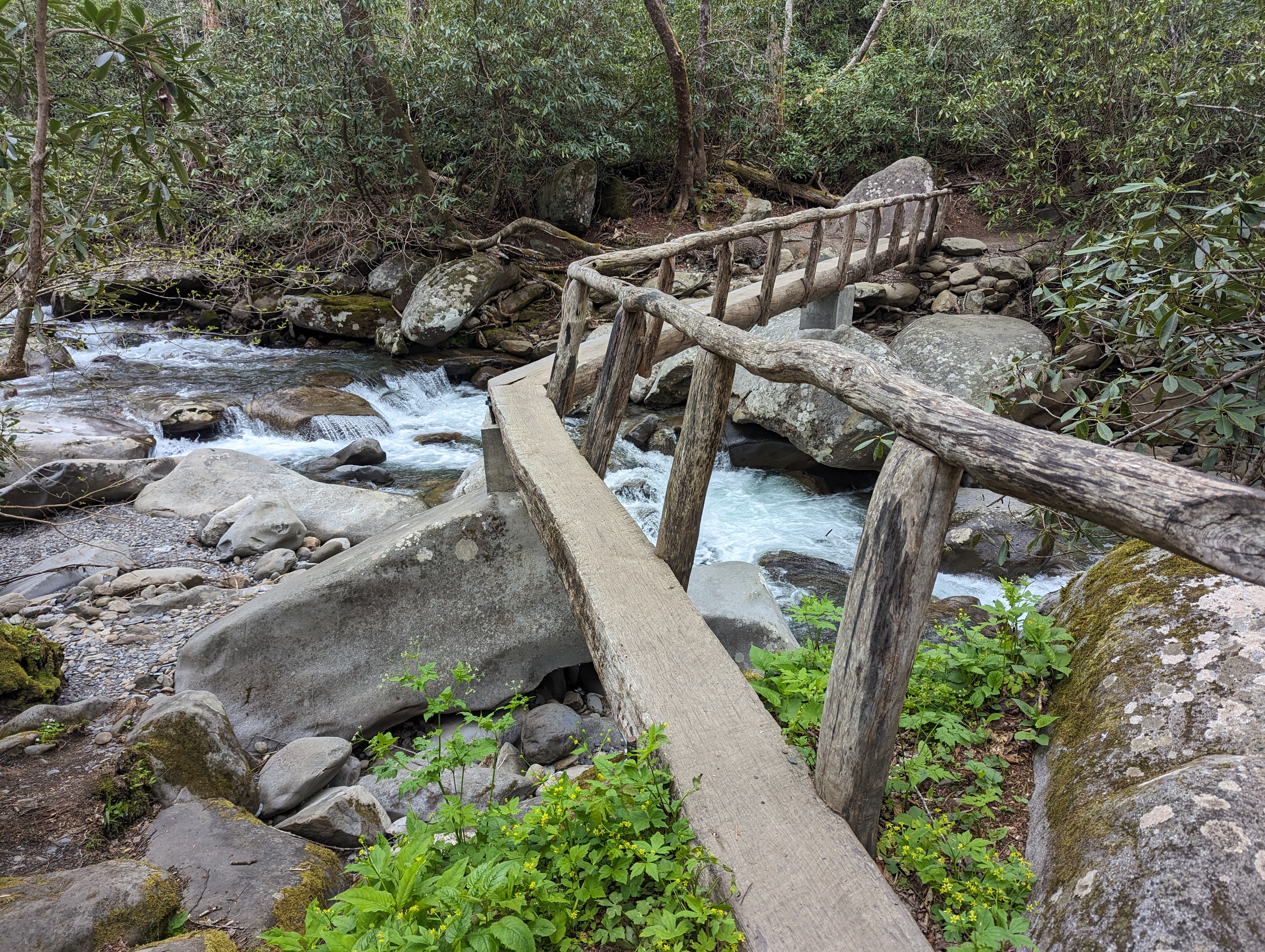
Rough Creek Trail eventually hooks up with Rough Creek. This is a tributary waterfall spilling into Rough Creek. It was along here I encountered several tributaries and Rough Creek that needed to be forded. Two of the crossings appeared too dangerous to try to rock hop, so off came my boots and socks.
Finally, I turn onto Little River trail and a bit past the half way point. I'm glad I don't have more creek crossings. That was not the case. A tributary presented another challenge. It looked like I would have to remove my boots and socks again. Then I spotted a log across the water. It was not ideal and I debated walking across on it. Too tired to do the barefoot ford again, I took a running couple of leaps and a final jump onto some small loose rock and I was across.
Then it was an easy 4 miles into Elkmont. I began seeing other hikers, something I had not seen since passing the shelter at Mt Collins. It began to rain but I was so close to finishing, I just flipped up my umbrella and kept on going.