Sunday, April 18, 2010
Daniel Boone Scout Trail to Calloway Peak
Hike leader, Jim Pritchett dubs this "Grandfather Light" since it is a relatively easy hike to the top of this magnificent mountain. Now a North Carolina State Park, Grandfather Mountain is the a wonderful unspoiled jewel set in Northwestern North Carolina. Views, limited somewhat today, extend south to the Blacks and north to the Virginia Highlands with Roan to the west.
Spring bloom was in its earliest stage. A few trout lilies, chickweed, wake robin trillium, halbred violet, lilies of the valley and lots of spring beauties were trailside.
This very rough and steep terrain is easily traversed with the help of some cable and several wood ladder. Lunch space on the top was limited as there were several other parties making the trek. Hold onto everything, it was windy.
Below the peak there is the wreckage of a twin engine cessna which crashed in September 1979 killing the pilot. It appears the wings sheared off and the fuselage continued another 100 feet.
On the return we hiked down Cragway and Nuwati trails back to the vehicles on the BRP. Passing the Tanawha Trail near the parkway, it looked like it needed considerable maintenance.
More Photos of this Hike
Friday, April 16, 2010
Finally - A Trail Sign
This junction has been without a sign for some time. I think it may be the cause of hiker confusion and possibly led to some unnecessary wandering. The Randolph County Search and Rescue team had a practice rescue out here this past weekend. Did they put up this sign? It doesn't look like US Forest Service signs.
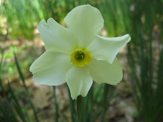
Heirloom Daffodils
Small Harvest of Uwharrie Morels
Tuesday, April 13, 2010
Day 3 on the New River
>
It was a cold 32 degree morning. We packed up and loaded the boats for a short 4 mile paddle into Virginia.
We spied some Cormorants and another Marten?. There was some development but also some older properties were riverside. We bounced around in some long riffles and tried to stay in the sun.
There is a hexagon shaped house where the river meets Rt 58. We traveled alongside Rt 58 for a short distance and took out at the Rt 93 bridge. The parking area here is large enough to accommodate a number of vehicles.
More Photos of this paddle
Day 2 on the New River
We awoke to a calm day with a hint of frost. Ate, packed, loaded the boats and drove our shuttle. By 10 we were ready to slide into the river. Shortly, we passed under the Rt 221 bridge, an old structure in place since 1922. On either side of the river were some old businesses, a general store on river left and an old gas station on river right. Soon we passed an outfitter with a lawn full of red canoes. Development continued unabated. We had a few unspoiled stretches in the morning.
I spotted what appeared to be a marten although they are not supposed to be in this area. As before, Canadas ruled the river. A few Kingfishers had their stakes but the geese were everywhere.
We stopped on a nice sandy beach for a break and later lunched at the King's Road access. Upon leaving here, the river passed Twin Rivers Family campground and took on a wilder appearance. We had to negotiate a class 2 rapid in which I sideswiped a rock and just barely slipped through. This rapid looks like it has caused a number of spills. I should have been watching Will ahead as he was motioning me to move left but I was not paying attention. We learned later, one of the boy scout canoes overturned here.
The mile of river before the confluence is simply beautiful. We stopped at the confluence (South Fork and North Fork) on a wedge island for a little sightseeing. After the confluence, the development continues. Especially annoying was a line of log condominium building on river right.
Just beyond here is the Allegany Access campground. Pay attention it comes upon you quickly. We grabbed campsite #1 for a great view of a nearby rock cliff on the river.
We met Ranger J Shimmel and had a pleasant conversation with him. In the course of which we learned the State Park system derives income for land acquisitions from a portion of real estate transactions taxes. Obviously, this income has declined in recent years as the number of real estate transactions has.
It was another nice night with a roaring fire. The scouts staying in the campground had an hour long "Capture the Flag" activity that occurred in the dark. It was blur of flashlights and yells and rushing through the dark woods. The scouts had great fun that night. We finally ventured out into the open field to view the stars and were treated to a wonderful display of stars and constellations. I heard Great Horned Owls during the night.
Day 1 on the New River
The plan is to paddle 3 days and 2 nights on the South Fork of the New River from Rt 88 bridge near West Jefferson, NC to Rt 93 bridge near Mouth of Wilson, Virginia.
After viewing the fast moving river at the Rt 88 bridge, a bit of anxiety set in. The flow looked mighty fast and it was quite windy. With my paddling partner, Will, I drove downriver to survey the conditions. I felt better after seeing this and we decided to put the boats in. There is a staircase leading to the river directly under the Rt 88 bridge for the purpose of launching boats. We shoved off at 11:55. The flow was very swift and choppy. At times the wind was all I could handle. The forecast called for 21 mph wind, not a good paddling condition. It was immediately noticeable from the start, the high level of development along the river. We commented on this for the full 3 days.
A Canada flew right at Will, coming perhaps a foot from his head. We suspected "she" must have a nearby nest.
In a little under an hour we were at the Wagoner Road access, 5 miles downriver. I'd had enough of the wind and called it quits. Will, in his low sleek kayak, was in a much better situation to deal with wind, so he continued on to Rt 221 Access campground. He made the 11 mile paddle in a bit under 2 hours. Now that is a swift current.
I joined up with him at the campsite. There are a dozen or more riverside campsites, many of which had already been reserved. I suspect, reservations are a must throughout the warmer weather season. We had a roaring fire into the night. It was chilly and quite windy. In the early morning hours the wind died.
Mount Jefferson State Park
With a couple hours to spare on a windy afternoon, I visited this State Park virtually in the town of West Jefferson. On the drive up, there are a couple overlooks and a spring. Picnic area and trailhead is near the top. A short trail goes to the summit which has a small communication tower. There are two other short loop trails near here also. You can hike everyone in about an hour's time.
One sign stated the area was once part of the State of Franklin, an area that seceded from NC in 1784 but failed to be admitted to the union and eventually joined back with NC when Indian troubles developed. All sources I have checked indicate it was several counties in present day Tennessee and not any in NC that were part of Franklin.
Great views in all directions from the top and Luther Rock.
Tuesday, April 6, 2010
Two Pizzas
Monday, April 5, 2010
Spring Float on the Uwharrie
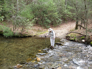
It was a truly fine day for some time on the river. I am always amazed at the quickness of the Uwharrie's flow. The river level was lower than most trips but we encountered no problems bottoming out. There was one riffle we had to drag around. A tree had lodged across the riffle providing no passage through.
We saw the standard quota of ducks, kingfishers and GB Herons. And many turtles out soaking up the sun. Toward the end of our float we kept hearing singing. It sounded like someone was singing in the woods but it stayed at the same volume as we floated downriver. Could some be paddling behind us and singing? After loading the boats and heading to the Eldorado Outpost for some Blenheim Ginger Ale, the mystery was solved. There sat the singer with more watts of amplifying power than you could imagine.
Doughton Park Primitive Loop
Today's hike was up the Primitive Trail and down cedar Ridge Trail. It was a mild Spring day with intermittent sunshine. There were 17 of us led by Jon Maxwell. Primitive Trail is a steep 2.8 mile. If you are not in condition it will let you know. Today I walked at the rear making sure no one became a "Primitive" victim. The slow pace was a big change for me. It took 2 1/2 hours to make the short 2.8 mile ascent.
The walk along Bluff Mountain is beautiful but I was hurried today. The pace was quick down Cedar Ridge Trail as well.
Grandfather Mtn in the Snow
Beginning from the BRP on the Daniel Boone Scout Trail, I along with 3 others, hiked up into the new Grandfather Mountain State Park. About 2 miles in, snow became a factor, obscuring the trail. We spend alot of time looking for white blazes and backtracking. Our goal was Calloway Peak, but we did not make it that far. At the Viaduct View the snow became too deep and too soft to continue. We retraced our steps back down the mountain to a nice lunch break at Flat Rock View.
Subscribe to:
Posts (Atom)
Nov 19 Quechee Gorge
At 165 feet deep, Quechee Gorge is the deepest gorge in Vermont. The Ottauquechee River flows through it. The name is derived from a Natic...
-
In May of 1963, a Piper aircraft carrying 5 persons crashed into the north side of Hanging Rock Ridge. Two persons died as a result of ...
-
Hidden in Hanging Rock State Park are many scenic gems. This is one of those places. Along Cascade Creek, you will find this pool of re...
-
In southern Randolph County, tucked away in a secluded field, in the flood plain of a tributary of Deep River, sits this Indian mound. It is...