Monday, September 20, 2010

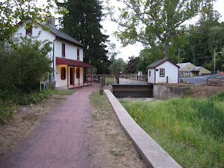
Sept 12 Biking the Delaware River canals


I had a bit of rain today but still a wonderful ride. From New Hope I headed north on the PA side for only 3 miles and then crossed over the NJ and rode the rail trail north. There is no canal on the NJ side at this point. The town of Frenchtown is a neat spot, very touristy. I followed the rail trail north of here toward Milford. After a couple miles, the trail got very faint and rough. I continued following it but gave up when I had an opportunity to walk across a field toward the road. Here I met someone walking her dog and she told me I'd have to ride the road into Milford since the railtrail was blocked at the old paper mill.

Milford is a bit less touristy than New Hope, Lambertville and Frenchtown. However, it does have a brewpub which is where I ate lunch.


I crossed over to PA and rode south toward New Hope. There is about a 4 mile section along here where the trail surface is larger gravel. This slows you down. It seemed worse in the 1/2 mile just south of the Black Bass Inn.


Finally, the trail improved and I was able to ride along at a better clip. Three miles from New Hope, I crossed over to NJ and rode the rail trail into Lambertville. I learned later, I should have followed the canal towpath as it was in better shape.

Sept 11 Biking the Delaware River canals


The D&L Canal originated in the Scranton area, followed the Lehigh River to Easton, then followed the Delaware River to Philadelphia. On the New Jersey side, the D&R Canal was designed to move freight from the D&R Canal, across the Delaware and toward New York City. It runs for 30 miles along the Delaware River but doglegs toward the east at Trenton. Here it hooks up with the Raritan River cutting eastward across New Jersey.


I based my rides out of New Hope, PA, about 15 miles north of Trenton. Today I rode south on the PA side to Morrisville. All indications were I could continue to Bristol, another 10 miles. However, about a mile south of Morrisville I ran into a divided highway that obliterated the canal. I rode around looking for where it picked up on the other side but gave up after some time. Turning around, I retraced back to Morrisville. On this short return, I saw 2 dirt bikes and an ATV roar along the towpath, spewing red dust into the air. I guessed this was not a well traveled part of the towpath.


Morrisville and Trenton have 4 bridges between them. Rt 1 and I-95 are not open to pedestrians. One other bridge was closed for repairs, so I crossed on the only open bridge. Once on the Trenton side, I had to find the canal. Trenton is not a nice venue for riding around lost. Finally, I did locate the D&R Canal and began north. I quickly learned the canal and towpath were popular hangouts for colorful groups of Trentonians to gather and consume something out of large cans. It also was a popular place to sleep for some individuals who may have had a few cans of whatever that was.


The colorful aspect of Trenton gave way to working class backyards and finally a relatively remote area on the way to Lambertville. This is the area made famous by Washington's Crossing. I rolled into Lambertville mid afternoon and quickly learned the local brewery, River Horse, had 25 cent samples of their brews. Needless to report, it was a packed house.


The final part of today's journey was a walk across the bridge from NJ to PA.

Biking the Dunn-Erwin Rail Trail


Sandwiched between wedding events Labor Day weekend, I rode this rail trail from Dunn to Erwin and back. The track was abandoned in 1998 and the trail created shortly thereafter. Conditionwise, this trail was only in fair shape. Weeds are encroaching in many spots. The other unappealing thing is the number of road crossing. The trail is only 5 miles long but probably has 10 crossings.


The above bridges avert a busy road crossing.


Pine Creek Trail - Day 2


We got a nice an early start today for our ride through the "Grand Canyon" and on to Wellsboro.
We passed a small community with a general store and a bed and breakfast which may have been closed. After this point, the road left our side and it was just Pine Creek and the rail trail inside the gorge.


We passed many folks riding south on the trail. We learned later, there was an outfitter/rental place which operated a shuttle.


The photo above was taken after we finished our ride and drove to a view of the gorge we passed through earlier.


The final few miles were remote and scenic. Our final chore was to ride the shoulder of a busy highway about 3 miles into Wellsboro.

Nov 19 Quechee Gorge

  At 165 feet deep, Quechee Gorge is the deepest gorge in Vermont. The Ottauquechee River flows through it. The name is derived from a Natic...