Wednesday, January 17, 2018

Jan 16 Walker Creek Ramble

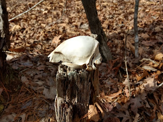
Raccoon?

Beginning at the end of Eagles Field Road, I head into the woods along an old road. Eventually, this road peters out in a stand of pine. Following the edge of the pine stand, I spot a 5 trunked tree which I recognize. Here I turn right and follow another old road looking left for a giant Poplar tree. Yeah, I navigate by sight a lot. After spotting the Poplar, I head toward the mature oak forest, noting its chanterelle potential. Then it is onto a familiar wood road which fords Walker Creek. It is near here, a massive chimney with many large cedars beckons a closer look. 

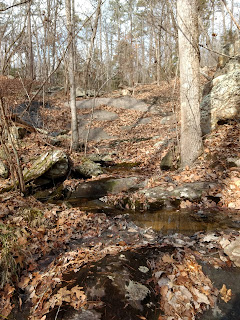
Cool spot with little riffles on Walker Creek

After a short investigation of the area around the chimney, I head back on the old road through beautiful open oak forest. More mushroom potential here. In about a half mile, the road continues to Lassiter Mill Road with a Forest Service gate across it. It is hard to tell if the final part of the road is Forest Service or private property. In the latter case, the Forest Service would have an easement on the road. I note that there is parking here but only along the side of the road. 

Big cedars in this old homesite

Heading back on the old road, I head off on a road which was used for a timber cut within the past few years. It is not long before this road gets mired in timber debris and an exit out of the area is necessary. After some bobbing and weaving, I manage to make it to open forest on the edge of Walker Creek. The creek is never visible as the mountain laurel cloaks it from view.

Massive chimney

Eventually, I manage to get to the creek in a very scenic spot. However, crossing it looks ominous. The opposite side is much steeper and more gnarly than I care to deal with. So I walk along the laurel accompanying the creek until I end up back the chimney.

My big Poplar Tree

Retracing along the old road, I look for someplace new to explore. I end up at the inholding property at the end of Eagles Field Road and decide to make my way around it and call it day. 


Sliding rock on a side creek to Walker Creek
Jan 13 Uwharrie Trailblazers hike


Our "members only" hike had a rousing 24 participants. We began our day at Tot Hill Golf Course where we had been granted permission to park. Tot Hill GC has been extremely supportive of our group.

After the short walk to the trailhead, we head into the "designated" wilderness. After a few minutes, our group turns left onto a social trail which follows Talbot Branch. It is well worn and well maintained. We cross the creek several times before our leader, Don with the GPS, says "turn left". At this point, we head up into the forest on private property. Mr Dassow has been extremely generous in allowing hikers, hunters and campers to cross his property for as long as I can remember. We are talking 50 years or more. Shortly, we arrive at a mine of sorts. There is quartz rock, blown apart, and strewn about. A few old tires round out the site. It is not much to talk about, but we do our best to talk it up. 

Now we are headed onto the ridge which I refer to as "Dassow Ridge". It is the highlight of my hike. A wonderful open forest with wondwerful Winter views of Coolers Knob. Native Americans quarried the ryolite in this area for tools. We find examples of worked rock throughout this area, Most often, where trees grow, quarry debris is found around the base of the tree. 

We hike along the ridge until we end up on the Camp 3 trail near the Boggs place. At this spot, we run into PHOC hikers, 27 strong. I spend several minutes exchanging greetings before moving along. Next stop is the camp we don't have a definitive number for. Anyway, there is a nice spring box there - pictured above. 

Don carefully navigates us to the private property we have to avoid. We look at the possible ways to walk around the property and promptly decide to cross it. It is barely 100 yards wide and we manage it without incident. 

Now we are in "no man's land". An area we have not explored before. Miraculously we traverse it to the road used by the inholding property owners. A short walk from here puts us at the old road to the Tadlock homesite and the spot Joe Moffitt designated for a camp, again the camp number is in question. We lingered at the brass sign on the dead tree upon which Joe Moffitt placed the brass sign 50 some years back. Then it was on to the Tadlock graves, not far away. We spend several minutes looking around here for corners and an old sign before moving on.


Our fearless leader, David stirs chili while food maestro Karen supervises. David color coordinated his wardrobe with the Rock 92 beer can produced and provided for our guzzling by Gibbs Hundred. 


Mr Dassow, generously allowed us to picnic on his private lake. Merritt brought firewood for a campfire. We seemed to have everything we needed for a lovely cookout. Cheers.


Dec 17 Long Mountain


This off trail outing began at Jumpin Off Rock trailhead. Here the Uwharrie Trail heads into the woods by the homemade sign. A bit further into the wood, there is a nicer sign, placed there to prevent vandalism. 

One of the renditions of the Joe Moffitt era Uwharrie Trail, went right over Long Mountain. Several years back, I was able to decipher some trail blazes heading that way but they have had their day and are no more. I took a likely route, following an old road. That road soon ended on private property with major league deer stands. A gnarly bushwhack got me back on track and it was up the side of Long Mountain. 


Once I was on the long ridge of Long Mountain, I could walk more easily, following an old road which, apparently, ran the length of the ridge. It is not driveable today but was back in the day. The remnants of this old school bus must have arrived here by some motorized means.


As with Little Long Mountain, Long Mountain sports a healthy community of Prickly Pear cactus. It, also, is facing south, as the cactus on Little Long does.


GIS and my gps say this is state land but, oh no, even the state has restrictions. It looks something grows here that is worth preserving. There was also a sliver of private property that invaded the top of the ridge. So I had to make a detour down the side of the mountain, dodging eroded roadbeds and a steep hillside. A small price to pay.


I end up back on top of the ridge and things are looking good until the tire dump makes its ugly appearance. Who hauls worn tires to the top of a mountain? Oh, never mind, we're in Montgomery County.

The walk down to Poison Branch was through nice forest and the walk along that branch is exceptional. I paid a visit to Dania Woodell's gravesite and had lunch with her. The penny I left there in early October was still there.

Dec 11 My Forest Disappears


Between early October and mid December, we had about 40 acres clearcut and 60 acres selectively cut. It was an emotional experience to see your forest drive past you every day. For the first month, the cutting was occurring about a half mile from the house. So, it was far enough away to not be heard too loudly. However, that last month, it was up close and personal. I saw the huge cedars get knocked down when the road was pushed. A maple fell on my blueberry bushes. The only stand of mountain laurel on the property took a hit. And one of the Pinxter Azalea communities was eliminated. My hiking trails could no longer be followed. I didn't recognize where I was on the property anymore. All that being said, wood is a renewal resource and will return. I don't expect to see the forest again in my lifetime, but someone will. It seemed to me, we are going about the forest management in a poor direction. In order to get an 80% reduction on my taxes, I have to have a forest management plan - a plan to timber my land. By doing this, we are destroying the habitat for wildlife, severing the mycorrlizal relationship with plants and cutting the largest, strongest and most prolific trees. It seems to me, the tax break should apply to those who do not cut timber and allow the forest to fully mature. That is something we are missing. Virgin tree communities in the eastern US are confines to very small areas now. That is my take on it.


Grab and go, much like fast food. 


The tree cutter can slice through a tree with its inch thick chain saw, hold the tree upright and move to a spot where the tree can be dropped with the least amount of damage. In theory!


Here goes a load of firewood. The crew found time to cut and split some prime oak for firewood.


Dragging a load of pine is a breeze for this piece of equipment. It takes some talent to do this. Francisco asked me several times to operate this thing on the weekends so he would not have to. I always said I would but, ultimately, left all the work for him.
\

You think he is stuck. Think again. Nothing stops this. Nice piece of cedar getting hauled here.


Need firewood - call me.


An attempt was made to split this piece of red oak. Do you care to take a swing at it?

Nov 19 Quechee Gorge

  At 165 feet deep, Quechee Gorge is the deepest gorge in Vermont. The Ottauquechee River flows through it. The name is derived from a Natic...