Tuesday, February 18, 2025

Feb 17 Check Dam on Uwharrie Tributary


I'm call it a check dam but it has some differences from others we have seen in the Caraway Creek basin. This dam is located on an unnamed tributary of the Uwharrie River. It is about 200 yards from the Uwharrie. It spans the tributary in a tight spot. It is only about 150 feet wide and has the classic check dam spillway flanked with higher abutment walls. The center was breached in 1954 by Hurricane Hazel so there is no sign of conduit holes in the dam. It is also narrower than the Carraway check dams and made with smaller rock. It does have the slanted top, lower on the upcreek side. The top is capped with larger flattish rocks but much harder to walk on. 

A local coyote has claimed the top of the dam.

Top surface

Breached by Hurricane Hazel 


The upcreek side has been reinforced with mortar. I suspect this was done after it was built, not during construction.


After viewing the dam, we toured the rest of the 750 acre property. It is bordered on two sides by the Uwharrie River. We walked to the Uwharrie in a couple spots. It was flowing hard. 

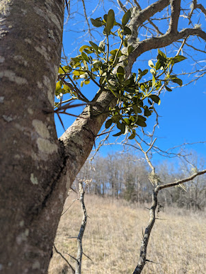
Above is some  mistletoe in a Honey Locust. Look closely at where the mistletoe attaches to the tree. It actually taps into the trees vascular system to divert water and nutrients.  


This is the "Hughes House", probably just over 100 years old. It has a frame structure covered with weather boards. An addition was added on to the back. The house is beginning to collapse. 

We also visited a rock foundation and chimney fall on the property. A piece of metal which looked like the door for a cook stove showed an 1855 date on it. 

Rounding out our tour we visited a pond with a nice waterfall at its outlet and a spot by the Uwharrie known as "Cooners Knob", a favorite spot for coon hunting.

A final special treat was to see a Northern Harrier in a field.


Feb 10 Tanyard Creek Visit


This property is located along the Dan River close to the NC/VA state boundary. This is the house that had the very large European bee hive on my previous visit. The home sits high on the property with views of the surrounding fields. The Dan River is barely visible. 

A side tributary, Tanyard Creek flows into the Dan nearby. The name of the creek would indicate a tannery may have been located near here. 


During our visit, we scrambled along the the creek seeing many polypores or  shelf  fungus. 


The real treat was the rock here. During the Triassic period, 200 million years ago, this was an inland sea. Rivers fed the sea depositing sand, silt, rocks, smooth river stones and trees. The resulting accumulations were fused together under pressure forming the Triassic conglomerate rock found here. It also turned submerged logs into petrified wood.  


Note the small rocks embedded in the conglomerate rock. Many small and smooth river stones dot the rock surface. 


A nice cascade has smoothed out the rock here.


This is a view of the Dan River looking downriver. I was told that batteaux structures were in this vicinity. Although these in the photo look like naturally occurring rocks, the batteaux navigation system allowed boats to travel through the area both directions. In the mid 1800s, the US Army Core of Engineers improved navigation by blasting ledges and rapids, creating channels for boats to pass. 


A nice hunk of petrified wood. 


Sunday, February 9, 2025

Feb 1 Bote Mountain Trail


Lung Lichen

Our hike is led by Joey and Roger, both former park employees. We started hiking on Lead Cove Trail, transitioned to Bote Mountain Trail and ending near Schoolhouse Gap. The Lead Cove trail is named for the lead deposits in the area which were mined by locals. Bote Mountain trail is named such because the Cherokee who were paid to build it, were given the choice of going up this ridge or the one next to it. They voted on this ridge. Since they did not have a "v" sound in their language, they pronounced vote as "bote". The ridge they did not choose is known as Defeat Ridge. 


Joey points to a bear hair on this tree. Bears bite trees or claw them to claim territory. Bite marks are usually about 6 feet up. Looking closely around the bite mark, often yields some hair. 


This small PVC pipe stuck in the ground, marks the spot a young woman is buried. The story is that she and a boyfriend planned to elope. One story has the boyfriend as a Cherokee, the other does not. Depending on the story, either the girl's father or uncle attempted to shoot the young man. The girl stepped in front to protect him and took the bullet. She died at the site and the boy got away. Having just killed the girl, the father or uncle must not have wanted to tell anyone what had happened, so the grave was dug atop a knoll. The PVC pipe is in a slight depression like you would expect a grave to be. It's unclear how the story survived. Did the boy tell it? Did the father or uncle ever confide in someone? That part will likely not ever be known. 


What is puzzling, there is a second pipe in the ground about 200 feet down from the top of the knoll. It is not in a depression and does not fit with the story of the girl being buried atop the knoll. Someone is messing with us?


Roger and Joey emerge from the Lead Cove Trail onto the Bote Mountain Trail which was built as a road and still resembles one. 

Dancing across the creek


We saw two chimney falls on Lead Cove. The first was just as we began hiking. This one was located right beside a creek and was likely not a home since there was no even remotely level ground around it. Possibly, it was a hunting cabin or shelter on the route to Spence Ridge which was used for summer grazing.


I found this area fascinating. Acres of muscadine covered and has killed some trees. Muscadine really takes over when there are timber cuts. Opening up the canopy and disturbing the leave litter allows seedbank seeds to sprout. The size of some of these vines indicate that this probably dates back to the last timber cut here in the 1920s or 1930s. 


Jan 31 Birding at Seven Islands


We are at Seven Islands State Birding Park in Kodak, Tennessee. Yes, it is a state birding park. Named for the 7 islands in the French Broad River, it has several bird habitants. The river attracts waterfowl, eagles and hawks. The brushy areas support Sparrows, Towees, Brown thrashers and we saw a number of Flickers. The wooded areas support other birds and the feeders by this barn, are popular with the Cardinals, Titmouses, Chickadees and Finches. Blue Jays and Bluebirds add some color as well.

Not birds. There were nine deer swimming across the river.

Our outing is led by another Keith. He is an avid birder and local musician. Rain came and went throughout the morning before giving way to a steady drenching in the afternoon. We sheltered in the barn which had feeders on either side. When radar showed a break in the rain, we walked to the bridge over the river. The bridge was a controversial one. A local couple wanted it and funded it with the help of a state senator, although, the state and most other locals did not want it. We were able to see some geese and ducks from the bridge, but the best show was 9 deer crossing it. We also spotted a Sharp Shinned Hawk in a tree by the river.


On the return to the barn, Keith spotted a Orange Crowned Warbler. He used his long lens camera to snap a few photos in which you could see a rather faint patch of orange on its head. 

Sheltering in the barn from the rain.


After leaving the park, Keith took us to Lake Douglas where he hoped we'd see some gulls. Keith pointed out that they were gulls not seagulls. There is only one of two species that breed near the sea. All other breed inland and migrate to the coast. In the dense mist, he was able to put his spotting scope on a few Bonaparte Gulls and some Ringbill Gulls. Although, he estimated 2500 Bonapartes we could only vaguely see them. 

Keith also spoke about the "diamonds" found near the lake. These diamonds are quartz crystals, similar to Herkimer Diamonds which are quartz crystals found near Herkimer NY. Folks come here and dig them as souvenirs. 


Jan 30 Alright Grove


This grove of old growth forest is named for Horace Albright, the second director of the NPS. He was also legal assistant to the first director, Stephen Mather. He further padded his résumé by being superintendent of Yellowstone and Yosemite. As a personal friend and philanthropic advisor to John D Rockefeller Jr., he was instrumental in obtaining the land for Grand Teton NP and Great Smoky Mountain NP. 


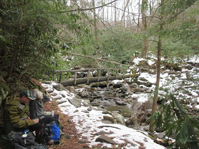
Once again Keith is leading our small band of hikers. The forecast was for a bit of rain and that is just what we got. Once it quit, we decided to eat lunch before it started up again. 


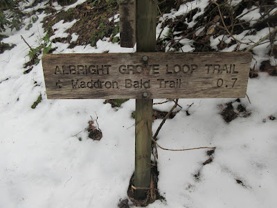
After a quick lunch we crossed the bridge over Indian Camp Creek. From that point it is just a short uphill to the beginning of the Albright Loop. We have already been walking in old growth forest but it is about to get more obvious. The grove used to have many giant Hemlocks which gave it a magical feel. Today, most of those Hemlocks are dead, some standing and others on the ground. The maples, oaks, silverbells and tuliptrees are massive.

A big silverbell


The loop had a lot of snow and ice and some steep spots. We took our time walking the loop. It is much as I remembered it. Always a great visit.


Jan 29 Baskins Creek Falls


Just outside the Gatlinburg city limits is this very pretty waterfall. It is quite sheltered and you must drop down a precarious area with unstable ground and few handholds to reach it. 

Our group was led by Keith, a seasoned hiker with a gregarious personality. Our sweep was Todd, another seasoned hiker. We were on this hike with Keith and his friend Jen last year and again this time. This hike is between 4 and 5 miles as an out and back. 


Beginning at the junction of Cherokee Orchard and Roaring Fork roads, we hiked a few minutes on pavement, soon heading onto natural surface trail. There was some snow and ice but lots of mud. This area burned during the Nov 2016 Chimney Tops 2 fire. It is recovering. Some areas are a dense thicket of pines. Others are rejuvenating Rhododendron and Mountain Laurel. We also passed by some quartzite stones. A few were quite large. 


There was one creek crossing that offered some hikers a balancing act as they crossed. Then we headed down a long decline. This was where I put on my microspikes. Ice had built up on the trail and it was slick. 


Just before reaching the precarious slide down, we passed a chimney fall. There was very little land around it to support much of a garden. However, someone must have lived out here since there was a side trail to a cemetery. 


We ate lunch with this view. It was first come first seated. A rock ledge was crowded with diners.


This gentleman had fished out his cushioned seat and offered it to Jen.


This caulk drawing is sheltered, so it may take a while for it to weather away. The rock around the waterfall is an attractive spot for graffiti. 


Apr 2 Indian Gap Rocks

  Along the BRP in this area, I kept noticing large piles of boulders capping small peaks. This one called Indian Gap Rocks is located just ...