Tuesday, June 23, 2020

June 20 Uwharrie Trailblazers' Adopt Hiking Trails


The Uwharrie Trailblazers rolled out their trail adoption program earlier this year. The kick off was delayed due to the pandemic's restrictions. Volunteer work in the National Forest was not allowed for a couple months. Finally, that restriction was lifted and we are back working on trails. 

The club signed a trail adoption agreement with the forest service, adopting all hiking trails in the forest. We divided them up into 18 sections and asked members to adopt them. As of today, we have 17 of the 18 adopted, thanks to a great group of volunteers. Some are long time members and others just joining. 

Today was our orientation event, held at the future Walker Creek Trailhead. Earlier in the week, we had the area mowed since it was waist high and not conducive for such a gathering. We limited the number to under 20 (we had 19) and we established a 10 foot physical distancing guideline. Everyone showed up with face masks. Mine was dangling from my ear during the presentation. 


David Craft kicked things off, asking everyone to say a bit about themselves, where they lived and how they get involved. We had adopters from Angiers to Greensboro to Charlotte, and places between. Some are military veterans, several are involved with scouting, one adopting team is a Christian fathers and sons group, a tax specialist, a cowgirl (maybe that should be an equestrian), a couple of textile guys. an insurance man - and everyone is volunteer minded.

After introductions, I gave an overview of the adoption program. Dave Gardener lectured on trail safety. Finally, Gifford Del Grande showed off some brand new tools and how to use them.  

A short question and answer period added some good discussion. The painted trail blaze vs plastic "reassurance marker" subject was covered. When is the "gap" going to be closed. No definitive answer to that one. Can we use battery operated tools in the Wilderness? No. Seemingly, we covered it all except for the raging Bigfoot controversy. Dave failed to add that to his safety commentary. Just be mindful out in the forest. Especially if you carry candy bars. Bigfoot has a big sweet tooth for Zagat bars.  


Then we headed to the forest. Dave Gardener led a session on lopping. You may wonder why a session on lopping. There is more to it than you think. First off, you need a good lopper. Friskers is the brand of choice for the UTB work crew. Snip branches near the main stem or trunk of the tree to prevent a repeat cut for this season. Cut as if you are carrying a 4x8 piece of plywood through the forest. However, the first couple feet from the ground can be a narrower swath. And those pine trees don't grow back if you cut them at ground level, but other trees do. 

Gifford Del Grande led the other break out group. He demonstrated how to construct a run out. Once you know how it is constructed, you are better able to clear and repair one. Above, the guys and gals are embedding rocks on the lower side of the run out. Then packing soil on it.


After the work was done, Giff and I enjoyed some lemonade in the forest, face masks still partially attached.

Thanks to all our adopters who were able to make the orientation. It really felt like a community of kindred spirits.

Tuesday, June 2, 2020

Jun 1 Three Sisters Ridge


June 1 was a splendid day for a hike at Hanging Rock State Park. Sunny, low temperatures and low humidity was on the menu. Will and I met at the beginning of Orrell Road to set up our shuttle. Wearing Covid facemasks, we carpooled to the Visitor Center where we stepped on the trail to Hanging Rock itself. The first mile or so was on trail and then we stepped off toward the Three Sisters. We spent much time at the start of our off trail taking in the north and south views.


We had to make the obligatory stop at this cantelevered rock which has been discovered and vandalized with multiple spray paint taggings. The stone furniture here, gets more elaborate each visit.


Next stop was the big cave at the base of the cliffs. Not as "discovered" as the cantelevered rock, it does have some graffiti etched onto its sides. From here, we wanted to find a way back up on top of the outcropping without backtracking. We did find a scramble route up the rock face.


We stopped at this viewpoint to see the Indian face side of Moores Knob. Heading on, we followed the spine of the ridge as best we could, looking for easily traversed forest. The greenbrier covered pathways were behind us now.


It was a gnarley climb up Big Sister. We found this wonderful lookout on top. It continued to be a rough scramble atop Big Sister until we headed to the gap. At the gap with Middle Sister, there is remnants of an old road which crosses from one side to the other. The climb up Middle Sister is much easier, especially if you walk around to the other (East) side and backtrack to the top. We enjoyed a leisurely lunch here.


Little Sister has an old road along one side which some folks use to avoid the climb. I have found the climb easier than battling the Laurel and Rhododendron in the old road. Once on top, there is a long gradual decline down to Sheeprock. We tried to stay as close to the south side of the ridge to look for interesting views and outcroppings. Above is one we took advantage of. Note Will is sitting on top. We also located the keyhole we have seen previously. It is much more obscured with the trees fully leafed out. 


Finally, at Sheeprock, we spotted several patches of Greenland Stitchwort hiding in the rock crevices. Now, it is time to leave the ridge and look for a way down the mountainside. We follow my previous gps track and Will sees an possible route down on Avensa which we take. It was just 5 or 10 minutes of steepness we had to negotiate before we reached the old road with rock wall. I am surprised to see some recent trees chainsawed off the trail. It appears horses are using this old road often enough for there to be some heavy duty sawing.


We follow the old road back to the intersection with an another old road alongside the fields by Mill Creek. We pass several tobacco barns. We are just 10 minutes from the car when we decide to take a loop on old roads which I had a gps track of. These roads were not as easy to follow and we did have to push our way through some tall vegetation at a couple points.


Once we exit the forest, we are in the field with this beautiful chimney. We stopped to admire the rockwork. While there, I noticed a couple pines that appeared to have pink blooms in them. Wondering what kind of a vine that was, we investigated and see that it is Roses which have gone wild and are blooming all over the field. 


Great hike. I did pick up 4 ticks and have some other bites which could be early chiggers. That is my cue to "chigger up" for the summer.

Saturday, May 23, 2020

May 17 Russell Dome


The bars are closed in NC during Phase 1 of reopening, so are the mines. A sign warns you not to commit tresspass. Tress is the Latin word for beyond. 

We started with an exploration of the Russell Mine area. I had never been to the area referred to as the Big Cut. We made our way to the area with the barred off shaft above. You could feel the cool air coming from it. To get to the Big Cut, we headed off on some old roads.


The first thing we saw, was another barred off shaft which resembles a culvert opening. Then we made a detour around a huge depression, possibly the Big Cut. 


Giving up, we headed on an old road and came upon this hard to miss structure. There was a vertical drop off just beyond this barred off area. The exclosure is roughly square and quite tall and large in area. It's a great place to grow vines.


Next stop is an unnamed mountain which I am going to call "Russell Dome". That is the name I saw on a geologic map of the area back in the mining days. It was a bit of a trek to get to the base of the dome. We followed a graveled Forest Service road until we saw a 4 wheeler track going up. It was really steep but only about 200' TEG. Not much to brag about on top. No open area, no view. Just a bunch of grape vines taking over from the last timber cut.


After a brief rest on top, we head back down. Now we head toward the Uwharrie River and walk toward Big Creek for a look see off the confluence. Then it is back to the gravel road abd back to the Russell Mine. While here, it is hard not to visit the massive rock structure that housed the mining operation.


May 14 Little Long Mountain's Prickly Pear


It's that time of year again. During the 2nd Thru Hike, we got to cross Little Long Mountain about this time in May. That's when the Pickly Pear blooms. I started out from Joe Moffitt Trailhead and headed up. Near the top there is a patch of Galax before leaving the forest. This one is almost fully bloomed out.


Now it is showtime. Pickly Pear blooms are stunning. Check these out.


A little bit of Yarrow tried to crowd in

Blue Eyed Grass


The view has a nice background and foreground today.


Fire Pink trailside. The shelter is sporting a new logbook. I don't know who put it there the day before yesterday, but thank you.

May 8 Birkhead South


Following CDC and Mandy Cohen's guidelines for safely hiking, ten of us spread out for this jaunt into the forest. We were checking the condition of Birkhead Mountain Trail, the southern dead end portion. It hasn't been used much lately. We also wanted to see how we could cross Hannahs Creek near the trail. A scout built bridge washed away years ago and the trail was abandoned south of Water Camp. When we arrived at Water Camp, we met a backpacker out for an overnight. 

We walked toward Hannahs Creek. The group crossed in 3 different places each one a wet one. Once we reached Malfunction Junction, I led a group to Bingham Graveyard while others wanted to check on a downed tree that had been reported.


Once we reunited, we split again, with a couple headed on the Birkhead Mountain Trail and I leading a group on Plantation Road. Never having been on Plantation Rd before, I needed to rely on the GPSers with us. When we came to the creek crossing, we spotted the aluminum plate sign informing us the scouts had constructed a bridge here March 6 1978.

Twayblade Orchid

After finishing the hike, driving along Strieby Church Road, this guy was watching us.


May 1 Checking out Silver Run


Robbins Branch Trail looks like it has hail on it. It is just another Uwharrie quartz deposit. This section of trail has a lot of it at its high point.


To get to Silver Run, you have to figure out which tiny creek on Thornburg Trail is the right one. Or just take any tiny creek, they all end up in Silver Run. This area suffered quite a bit during the wind event last June. Many large oaks uprooted making for many detours as I followed the creek.


Mouse Ear Coreopsis made an appearance for me today.


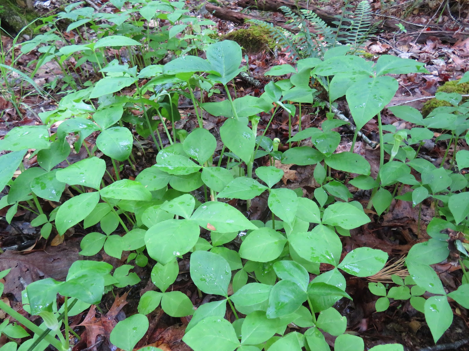
I walked a long way downstream before I spotted a Jack-in-the-Pulpit and then they were everywhere. I got a bit off track and ended up following some old roads which led me back toward the junction of Thornburg and Robbins Branch trails. That was not what I wanted. Eventually, I got some phone signal and got Geo Tracker fired up, located the trailhead and headed the right way.

Apr 10 Cooper Mtn Hike


Hiking Cooper Mountain Trail requires crossing Hannahs Creek. It almost always is a wet crossing. I knew that and prepared with high boots and gaiters so I didn't get wet. The trails are being used a lot. Robbins Branch looks like a boulevard. A muddy one. A bit more trash than normal too. 


Right by the crossing, I spotted a Crossvine bloom on the ground. Looking up, I could see a wonderful sight. It looked like the tree was blooming.


For a very short period of time, this White Fringetree blooms with its strikingly long wispy petals.


A Nodding Trillium tries to hide under its foliage. 


Foam Flower right next to the creek, trying to catch my attention.


Another bloom trying to hide, this Mayapple looks like it has a Christmas Fern growing from it.

Nov 8 Petrified Forest

  Just outside Escalante is the Petrified Forest State Park. We hiked a several mile route to view many specimens of petrified wood. These s...