Friday, August 29, 2014

Aug 25 Neuse River Greenway South


Having previously bicycled from Falls Lake State Park to Anderson Point Park, today's ride began at Anderson Point Park heading toward Clayton. The Neuse River Greenway is 28-29 miles depending on what description you read. Anderson is about MP18. We bicycled 10 miles south through rural farmland, The northern section of the trail was very different, being always close to developed areas. Again, I was quite impressed with the 10 foot wide, super smooth pavement. 


Much of the land we passed through was City of Raleigh property, which included their waste treatment plant. Several of the hayfields, so designated as City property, had irrigation spigots in them which I assumed were diverting Neuse River water to the fields. However, an information sign read otherwise. The irrigation system was for spreading a byproduct from the waste treatment plant onto the fields. The city did not wish to dump this waste into the Neuse but, somehow, it was "safe" to solidify it and then mix it for spreading on the fields. We did not see the system in action so I can't describe what it might smell like but we did notice only one home located anywhere near the fields.

Once we reached the end of the Neuse River Greenway, we began riding on the Clayton River Walk. On a map this looks like a seamless continuation of the NRG but it has more age on it and is narrower. My riding companions, both on road bikes, didn't like the root upheavals in the pavement so we turned back.


On our return, we decided to ride a connecting trail, Walnut Creek Trail. In about 3 miles we encountered a "trail closed" sign. The trail is being paved this week. We turned back. What really impressed us with this trail were the long boardwalks. One measured .35 mile. That made a nice side excursion. Later I learned this trail connected with others to go right downtown. 


Sunday, August 24, 2014

Aug 22 New River Trail Bicycle Ride


Our outing club does not normally have scheduled Friday outings, but here we are heading to Virginia and the scenic New River Trail with a group of 6 for a nice bicycle ride. The proposed route is from Cliffview to Fries and back, about 31 miles. Weather is threatening but never rains. It is very mild but quite humid. I'm dripping wet by the end of the day.

The pace was fast. We went along at almost 12 mph for the ride over to Fries and only slightly for the return. Above, is the scene from our lunch stop along the river in Fries. It appears there is some construction occurring on the dam which can be seen in the background. 


Tricky little mushroom here. I knew it could not be Cibarius due to the pine needles but it sure looked like it until I flipped it over. Could we have Hygrophoropsis aurantiaca here?


This is our final stop, by Chestnut Creek Falls before the final few miles back to Cliffview.

Aug 21 Coleridge Dam Paddle


This photo is below the powerhouse at the Coleridge Dam. The metal tube with water dripping off it, it the dam's draft tube. It normally should extend down to below the water level. Draft tubes connect the turbine to the tail race, which is the lowest point in a dam, where the water ends up before flowing out and downriver. My friend, Bill, who owns this powerhouse, had to cut the tube since it had corroded. rather than replace the tube, he is going to cover the openings, seen below, with metal, in effect, creating a draft tube.


Here we are paddling away from the powerhouse. The two openings Bill is going to cover are the two which form the corner of the building right behind the canoe.

The purpose of out outing was to look at a rock garden, about 2/10s of a mile downriver. Bill thought he could remove some of the rocks in the rock garden, creating more declivity and a quicker current away from the powerhouse. It looked like bedrock to me so I don't think this can be accomplished.


Here is a bonus. We saw lots of Cardinal flower on this short paddle.

Aug 16 AT on Roan Mountain


Today's PHOC hike is led by Dave Lowe. It is a key swap hike with a total of 23 hikers. Some heading south on the AT from US 19 to Carver's Gap, on Roan Mountain. The others will travel with me in the opposite direction. Temperatures were mild and the ski was mostly clear. We had very favorable hiking conditions. About half this hike is open bald and considered by some as the most scenic hike on the AT.


We see some late summer wildflowers. Some Bee balm, my favorite and many sunflowers. We spotted a pea which I could not identify. There was Rattlesnake plantain blooming as well. 


Above is the lunch spot we normally meet at. There was open seating today and plenty of room. For us, northbounders, we had Big Hump to climb straightaway after lunch. Once that has been tackled, it was downhill the rest of the way. Once off the bald and back in the forest, there is a couple mile stretch of rocky trail to traverse. The rockiness continued on and off for the remainder of the hike.


This guy is part of the Baatany Project to restore Grassy Bald and Alder Bald using goats. The 22 goats are now in their 7th season of this experiment. The goats will be herded off the mountain in mid September. Many southern balds are growing back now that grazing has been discontinued. The Great Smoky Mountain National Park had 22 miles of continuous balds at one time but only 2 are being actively restored (using powered mowers). Grayson Highlands has ponies grazing to keep the vegetation down. Blackberry is the most prolific invasive on Roan. Guess what the goats love to eat.  

Friday, August 15, 2014

Aug 15 Friday Forage

Black trumpets

After finding a basket of cibarius chanterelles yesterday by Walker Creek, I decided to head to the Birkhead Wilderness for more. I have noted during hikes where the mature white oak forests are. There are many. There are more potential foraging areas than I have time for. So if I have 2 hours to forage, there are places to go and if I have longer, there are more far flung spots. Today, I spent 3 hours in the forest and never got to the most productive area. I'll return there on Sunday.

Lots of white russula, cinnabars and a nice spot of shaggy stalked boletes. The trumpets I found looked past prime but the area was loaded with them and I can return again.

? a bolete maybe?

Shaggy stalked bolete

I have a few foraging tips. I like low level light. So early in the morning or in the evening. Once the sun gets up high enough in the canopy to start filtering through, it reflects off the leaf litter. Sometimes that is blinding which is never good when you are in prime rattlesnake area. Also, make note of the most likely host tree when you find a chanterelle. For me, there is, 95% of the time, a mature white oak near. I look for similar trees nearby. The ground should not be hard. It needs a little give. 

dinner

Aug 14 Finally

Finally, we have chanterelles this year. Cibarius needs a lot of rain to just get started. My experience has been, it needs 2 inches or more. Tuesday we have 4 inches and that was the trick. Other mushrooms, like the usual summer suspects, Amanitas, Boletes and Russulas come up with much less rain.

A group of four of us were scouting a route for the Forest Service which will become a continuation of the Uwharrie Trail. The first thing I saw in the wood was a cibarius chanterelle. Over the course of the 4 hour hike, I was able to fill my basket. I was optimistic and had stashed a basket in my pack.

Our route tuned out to be nice. We found some interesting features and waypointed them on the gps track.

Ready for the frying pan

I believe this is a confusus mushroom.


Very similar to Old Man mushroom but with erect spikes on cap

Slate quarry on McAurther Property

Yellow patches


Thursday, August 7, 2014

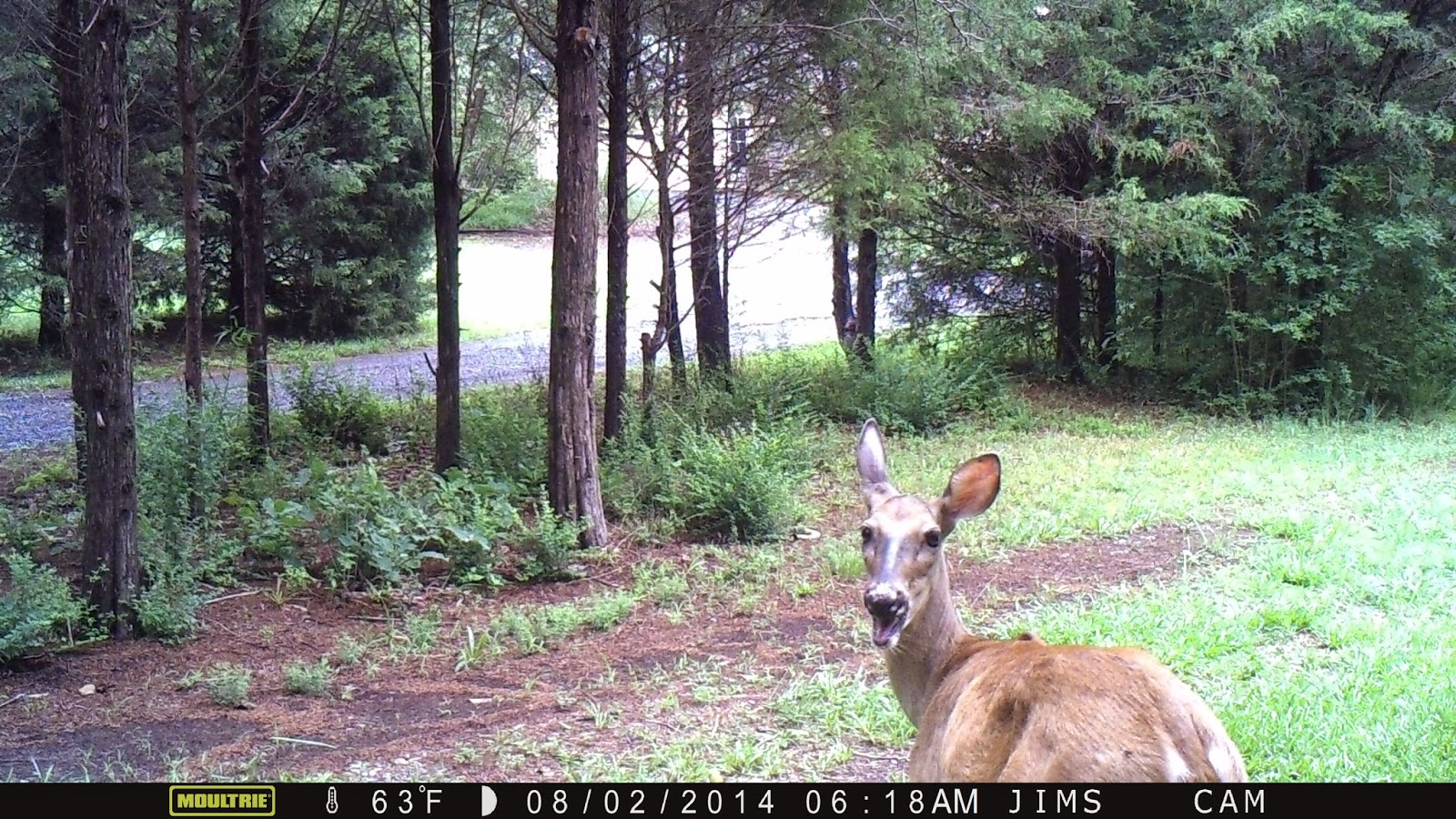
July 2014 Trail Cam


The camera is on a pear tree next to our driveway. Our yellow house is vaguely discernible in the color photos. There were many outtakes with the 2 fawns and mama doe. 


Saturday, August 2, 2014

August 1 Pizza Adventure

Grill the flatbread for a few minutes on the grill. Flip it over for the toppings.

Add tomatoes.

Add ground beef.

Add mushrooms.

Add cheese, but not too much.

Grill for a few minutes.

Finished

Friday, August 1, 2014

July 30 Greenbrier River Trail north

Bridge leading to Sharps Tunnel

Nine miles north of Marlinton the trail transforms. The rural countryside changes here. I had been viewing long fields and pastures on both side of the river. At this spot, the river makes an sharp bend in a vary narrow gorge. So narrow, the railroad could not be built alongside it. This tunnel had to be built to pick up the river once again on the other side of the sharp bend. Once through the tunnel, you emerge into a more wilderness setting. No development is seen for 6 miles until the tiny community of Cloverlick.

Telltale seen from in Sharps Tunnel

Telltales warn folks on top of a train to duck, quickly.

Depot at Cloverlick

This beautifully restored depot has a great resting spot here. I don't know what it is used for but the restoration must have been costly. This was my turn around spot. I had hoped to make it to Cass and back but I just had too much trouble getting into a good cadence today. So although I only rode 30 miles, my average speed was less than the 52 miles yesterday. 

Cardinal Flower

Trail and river in tandem 

July 29 Falls of Hill Creek


West Virginia State Parks spent a small fortune here building staircases to these waterfalls. I have pictured only a fraction of the 1700' walkway. There is one section which is metal and attached to the rock cliff beside it.

Middle Falls is 45' and lower falls at 63', is the second highest in the state.


July 29 Cranberry Glades


The photo below shows a typical scene in one of the several bogs which make up the Cranberry Glades. The elevation here is between 3400-3500 feet. I've read there are 60 unique plant species here. Their ancestry goes back 10,000 years. As ice sheets from the Wisconsin glaciation covered the northern part of the US, it forced many arctic plants ahead of it. Although the glaciers never made it into West Virginia, these plants did. When the ice receded, some of those plants remained where conditions were tolerable.

Cranberries grow low to the ground and make up much of the greenery seen below. Right now there have green berries with just a few beginning to turn red. The 1/2 mile boardwalk travels through 3 of the bogs. The total area here is about 750 acres and includes 5 bogs. These are peat bogs where the peat may be 10 feet deep. Stepping off the boardwalk, you sink in a spongy peat soil covered in moss and cranberries. 


I was unable to locate any Sundew plants here but saw many Pitcher plants which have just finished blooming. I was dismayed to see some Dodder vine here. It has been destructive in the mountains to the south. Other flowers include Great Rhododendron, Jewelweed, Purple phlox, bee balm and mountain mint. Cinnamon ferns taller than me were prolific. 

Purple phlox

Pitcher plants

base of Pitcher plants

Insects are attracted to the base of the Pitcher plant. The leaves form a cup which fills with water. The slippery sides insure insects slip into the water. Downward facing hairs prevent the insects from easily climbing back out. The insects are dissolved over time and nourish the plant. 

Nov 19 Quechee Gorge

  At 165 feet deep, Quechee Gorge is the deepest gorge in Vermont. The Ottauquechee River flows through it. The name is derived from a Natic...