The Capital Bikeway is a new trail, opened during 2015, connecting Richmond with Jamestown Settlement. From Jamestown one can proceed to Williamsburg via the Colonial Parkway. Thus the trail is said to connect the old capital with the new capital.
I'm riding a portion of the 53 mile trail today. Beginning in Charles City and pedaling 20 miles to Jamestown and back. It is paved surface so the route is rather easy. Driving along Route 5 prior to stopping at a trailhead, I noted the trail right next to the road. It was in the open, passing through huge soybean fields. Did I forget sunscreen? Yes.
Fortunately, I was able to get some sunscreen from a local couple. They spoke highly of the trail and suggested I take the route toward Jamestown since it was shaded most of the way. In the first few miles, there were power trucks restoring electricity lost during Hurricane Matthew. One place still had a generator roaring out back. The wind had left a lot of little debris on the trail but only one tree partially blocking the trail.
There was one long high bridge over the Chickahominy River. I never saw the James River although Rt 5 roughly follows it from Richmond to Jamestown. Almost all the time I was next to or close to Rt 5 until the final 2 miles to Jamestown.
Rt 5 and the trail
On my second day of riding, I visited the Shockoe Bottom area of Richmond. The trail officially starts beneath I-95. When you travel northbound on I-95, cross the James River and the magnificent Union Station building appears right next to the highway, you are directly above the trail. Not only the trail, also, the canal and an elevated railway.
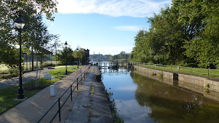
The James River has some rapids just downstream from downtown Richmond. To avoid these and get ships navigated to downtown, a canal was built around 1820 to bypass the rapids and provide access to downtown. There was a 12 block long wharf where ships could dock for loading and unloading. The canal front is lined with 3 to 6 story high warehouses. Now being converted to luxury lofts and offices, the area appears to be thriving again.
Bicycling out from Richmond, the trail quickly opens up into soybean fields alongside Rt 5. I rode for several miles before deciding to turn back at the overpass on Pocahontas Parkway, below.
Here is the scene as you enter the canal area. The large brick building is prime real estate now. Just a few years ago, that would not have been the case.
The restored canal and canal walk in the I-95 area.


No comments:
Post a Comment