Sunday, November 3, 2013

Nov 1 Uwharrie Storytelling

Bonfire at Thornburg House in the Uwharries

The Land Trust for Central North Carolina held a storytelling event in the Uwharries today. Designed with kids in mind, this big kid enjoyed the festivities as well. Starting mid afternoon we hiked out to the Cooper Mountain Cemetery, in the rain. When we arrived back at the recently restored Thornburg home, there was a fire blazing and food cooking. 

Charlotte Ross (center) tells stories and legends

Held the day after Halloween, ghost stories were on the agenda. Professional storyteller and oral history historian, Charlotte Ross was the main attraction. We had to wait until a wonderful chicken barbeque dinner was cooked and served and the rainy day turned in a rainy night before Charlotte got going.

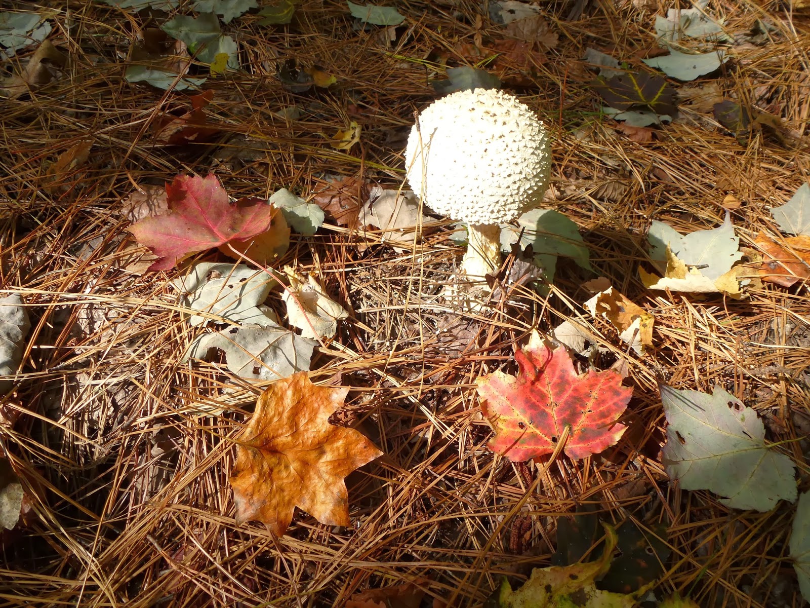
Amanita mushroom

She began by relating her own personal experience with a ghost, the ghost of her great grandmother telling little Charlotte where to find her grandmother's lost wedding ring.

From there she jumped to Appalachian legends. They were ghost stories too but she gave us the background of these stories. they were all based on true events and had been passed orally. Once a legend or story is written, it becomes fixed but the stories passed on beside wagon train campfires take on a life of their own. "Long Dog" was based on an actual robbery and murder of a family traveling in East Tennessee in a Conestoga wagon in 1805. It became a tourist attraction and spun off in many ways. She followed this with "Ghost Voice" based on another event which took place in the Asheville-Morganton area. Hunters hear a voice from the woods advising them not to build a fire in the rocks. Over 100 years after the actual event, a current account was reported in the Asheville Citizen in 1965. Finally, she told the legend of a West Virginia family murdered in 1865. Three young children were left in one of 67 limestone caves in the area. For several nights, locals heard babies crying from a cave but despite their searches, could not find the children. Over 100 years later a young couple moved into the home and the young woman found the skeletons in one of the caves. 

The stories went well into the evening and it was quite late when I left for home.

Marbled Orb Weaver

October 31 Saxapahaw Dam Visit

Debris pile next to power plant

Many of the rivers I paddle have dams which once powered textile mills. This dam on the Haw River is one of those places. The textile mill in the town of Saxaphahaw NC first began operations in 1844. Later a more substantial brick mill building was constructed. That mill operated up to 1994 finally succumbing to the effects of a tornado which ripped the roof off. It last operated as Dixie Yarns. 

To power the mill, a dam was constructed on the Haw River and water was diverted in a sluice to a powerhouse which operated the mill. In 1938, the mill's power needs outstripped the ability of the powerhouse. A larger and much higher dam was constructed a bit further downriver, impounding 300 acres. That is the current day dam. The hydraulic turbine from the old powerhouse was moved to the new one and a second one was purchased and installed in 1939.

Grills at the turbine intake strain debris

A friend owns this dam along with two others on the Deep River in Randolph County. Since he is in the process of selling this one, he gathered up a group of friends to take a look at it and learn some of the history on Saxapahaw. Dam ownership and power generation is a cottage industry perfectly suited for mechanically minded entrepreneurs. The current trend is for larger private corporations to bundle dam ownership and market shares to investors. Hence, the opportunity for my friend to sell this powerplant and dam. Along with the dam comes the 300 acre dam impounded lake, all surrounding land to the 100 year high water line and about 20 acres adjacent to the dam. The local power company, Duke, is required by law to purchase the power generated here and fed onto the local energy grid. Bill says his dam powers about 600 local homes.


Turbines and control panel

I can't say I understand how this place works. Power generation is a rather complicated process to learn. Bill showed us how increasing the amount of water allowed to flow into the turbines effected the power generated. He has to maintain a balance between, voltage, amps, water intake and keeping the water level at a point which still allows 100 cfs of flow over the dam. 

Governor

Next to the turbine is a governor. Its purpose is to regulate the water flow to the turbine. It was essential when all of the power was used in the mill. When the mill's power load backed off, the governor would adjust the flow to create less power. These governors are not needed as much today since all power is going to a common grid and power flow is controlled once it is on the grid.

After touring the dam and powerhouse, we checked out the renovation of the mill building which has been converted to apartments, condominiums, a restaurant, pub, outdoor amphitheater and a ballroom in the former dye house. Bill did mention the river is cleaner today than when he first came to town. Then, the color of the river was determined by what color dye was being used upriver at the Moses Cone mill in Greensboro. The rocks in the river would be dyed that color until the next color came along.

Today, this is pretty town with a lot of potential. Its proximity to college town, Chapel Hill is a great asset. 

Sunday, October 20, 2013

Oct 19 Henson Creek - Linville Gorge

How might we cross???

Today's PHOC hike in Linville Gorge is led by Ben Harris. There are 19 of us. The plan is simple, hike down Devils Hole Trail, cross the river, hike upriver on Linville River Trail, find somewhere to cross back over the river, scramble up a rocky spire, drop back down to the river, scramble up Henson Creek and then catch some great views from the ridge before finishing. Ben has thought of everything, excitement, danger and lunch with a view.

Nurse Debby nimbly crosses 

Ben leads us up from the road on an off trail short cut to Devils Hole trail, just to get things warmed up a bit. We make the descent on steep and rocky Devils Hole trail. At the bottom there is some confusion. Most folks do not attempt to cross the river here so the trail is not easy to follow. There are cairns in the river but they are of little use. You need to find the best way across and that is not readily apparent. We find a long piece of lumber and float it downriver to a point at which we can utilize it to cross a tricky spot. Kyle is absolutely catlike on the river rocks and bounds back and forth with ease. Ernest with his AT thru hiking experience is comfortable here as well. The rest of us sign onto the plan and make the crossing with their guidance. No major mishaps here, just some bumps and scrapes.

You are such a hot shot

This was an exciting crossing. We're all relieved to regroup on the other side, enjoy the scenery and roar of the river. It is just a short uphill climb to the Linville River Trail. There is a faint trail here leading up which indicates to me, this is not a river crossing often used. Current river flow is 62 cubic feet per second. Most of this spring and summer, this would have been a highly dangerous crossing.


We hike upriver along the river trail to a point, near a nice campsite, where some of our group has made previous crossings. Some of us rock hop upriver and some bushwhack riverside until we see a crossable spot. This crossing is deeper than the last but doesn't have the danger of swift water in tight channels that could really be problematic. I miscalculate my route across and end up having to be dragged up a rock by two companions. Of course I don't have photos of my ungracious river exit but I suspect some will surface on the PHOC website. Not only did I get skinned up getting pulled up the rock, I managed to get waist deep during the water crossing. Although, I had a full change of clothes, I never felt uncomfortable. 

From this point we head straight up in very steep terrain with a moderate amount of greenbrier. I was 5th in line when Bill (third in line) yells out. The first two scramblers have just passed right by a coiled rattlesnake. Everyone wants to get a photo but I head up, my eyes fixed on the ground. I saw the snake and am stunned at how camouflaged it is.

We manage to make it to a wall, then follow a trail alongside it until there is a 40 foot crack in the wall. Now we scramble up a very steep slope to the rocky spire above, our lunch stop. We are on the rocky spire which is just across the river from Babel Tower and Avatar. From here we can see a campsite on Babel and fellow hikers enjoying the view about a quarter mile away. To join them would be a herculean task.   


Hiking with Ben, assures me we'll always have lunch with a view. No restaurant can compete with this setting. I need the break, rest and refuel well. 


After the lunch break, we're back scrambling down the crack in the wall we came up. Then we pick up a faint trail at the base of the wall and continue until we're at the mouth of Henson Creek. Another break is in order. Some of our group head to the river for some river karma, I scout up Henson a bit. Once we regroup, Ben reviews the "rules" of hiking Henson Creek. "Stay together." 

A side channel of Henson Creek near the mouth


The water level of the creek is very low. We'll be able to stay in the creek bed for most of the ascent. There are some tricky spots including one which only 4 of us attempt before we advise the others to find another way. It required a spot which I refer to as a "leap of faith". You have to make a move which you hope will hold. Bill made it up unaided, He helped me through it. In turn I dragged Dina and Gary up. That was it. We told the others to find another route.


Henson Creek is a steep stream bed bordered by rock walls. Large, sharp, jagged rocks fill the course. There are lots of leg scrapes and bruises associated with this scramble. Finally, it looked like we had reached an insurmountable headwall. Somehow, there was a route through it and we were back on trail. Here is where I expended most of my day's energy. For whatever reason, I pushed and pushed myself along this trail and then the never ending Red Trail and the so called "rabbit trail". When that finally leveled out, I was still second in line but spent. I was so glad, our point, Matt decided to wait for the others. 


While resting, I saw some Bottle gentian and took this photo. Linville Gorge offered up some great adventures today and finished off with this beautiful wildflower. 


The last landmark we pass on our hike today is Sitting Bear, a rock spire formation. Pretty odd, huh?

Friday, October 18, 2013

Oct 14 & 15 Greenbrier River Trail


Running alongside the Greenbrier River Trail is its namesake, the Greenbrier River, for the full 77 miles, North Caldwell to Cass WV. Last operated by the C&O in 1978, this trail and its corridor is owned and operated as a West Virginia State Park. Condition of the tread-way is excellent, crushed gravel and a 4 mile paved section through Marlinton.

I used Marlinton as my base for two days of riding. Marlinton is the largest community for some distance in all directions. Somehow it survived after the logging era ended. Prior to the railroad being built in the early 1900's, logs were floated down river to Roncerverte in the spring runoff. Once the railroad was built, logging could proceed on a much grander scale. Many small communities rose up along the tracks. many of these places are long gone today. A few remnants remain but you need to search for them.


Heading north out of Marlinton, the trail follows the east side of the river with mountains rising up right next to it. On the west side of the river is a long fertile valley, still in use as pastureland. Nine mile from Marlinton everything changes. The trail crosses the river and immediately into the 500 foot Sharps Tunnel, seen above.


Note the still standing, tell-tail to warn persons on top of the train to get down. I hope those trains were traveling slowly as there does not appear to be much warning. Once through the tunnel, the trail is on the west side and you are in a gorge. Mountains rise up on both sides. Scenery changes and weather changes. I've noted this transition before. Now there are many more maples and the fall colors are more vibrant.


Here is one of those whistlestop towns. Cloverlick is a tiny place with just a few homes but it does boast this beautiful train station.


I continued on to Cass which was a major base for a timber operation. The trail ends here but the railroad lives on with a tourist attraction train. The Cass train works its way up a mountain using switchbacks in which the entire train is pulled onto a spur at the apex of each swithback, then the track is switched, the steam engine reverses and the train slowly makes it way up or down.


The obligatory self portrait on my return ride to Marlinton. The ride today was about 47 miles in perfect fall weather as you may see from the photo background.


The last time I was here, this was a charred skeleton. Now rebuilt it looks as spiffy as ever.


The following day, I rode the opposite direction out of Marlinton. Above, in the former community of Watoga, is this bank vault trailside. You can see it from the trail but it is easy to miss. I understand it was part of the company store. The concrete vault is about the size of a large closet. It sports a steel door and frame. There are pieces of the foundation crumbling nearby but the vault was built to last.


There are a few houses along the trail. In Seebert there is a parallel road for about a mile, lined with small vacation homes. It seems every trail I've ridden in WV has a prison on it. This is no exception. Denmar Correctional Center is trailside. Originally a hospital for tuberculosis and later, other terminal diseases, it occupies such a bucolic setting. There is also a federal prison in Anthony a bit further south near the trail.


I didn't have the legs to make it all the way to the Droop tunnel, my original plan. I turned back at MP 33, stopped for lunch at Jack Horners Corner in Seebert and finished up just before 3pm having traveled 49 miles.

Oct 4 Pizza


My standard pizza, loaded with ground beef and chanterelles, sprinkled with spinach. We used the last of the frozen puttanesca sauce. However, I didn't make enough dough and didn't let it fully rise. Still this pizza was delicious despite the irregular shape. 

Sunday, October 6, 2013

Oct 5 Grandfather Mtn Profile to Swinging Bridge and Back


Rt 105 to the swinging bridge and back is one of my favorite hikes. Joining other PHOC members, we start up Profile Trail about 10 am. Although the distances aren't that great, the effort is. Profile Trail starts out relativity tame but eventually gets your attention. It is steep and rocky. I mean to emphasize "rocky".  There is a potable spring .4 mile from the end for those needing a drink. The trail ends at a "T" with either way headed to the two peaks of Grandfather Mountain, Calloway to the left and MacRae to the right. Today we're going to MacRae on our way to swinging bridge. 


The route to MacRae begins innocuously enough along a relatively flat and wooded trail but soon gives way to the first challenge. Negotiating up a boulder outcropping leaves 2 of our group unable to continue. Lyn with her broken arm sustained at Mt Sterling two weeks prior, knows this is her turn around spot. The other gal just wasn't prepared for this Grandfather obstacle. The views are wonderful as we hike along the ridgeline. Not long later we encounter the first ladder of the day. Immediately afterward is "the Chute" which earns this hike the moniker "chutes and ladders". Going up the chute may be a bit easier than going down but either way it is a slow process requiring accurate foot and hand holds. At the bottom is a pile of boulders you actually hike into through passageways underneath the jumble. There are 3 short ladders here. When you emerge you're at MacRae Gap and it is just a 2 ladder climb to the top. About 30 folks are sitting here but there is ample room for our group of 16 to settle in for lunch.


Lunch is over and we're on the move to swinging bridge via Grandfather Trail on the multiple ladder route. Photo above is the series of three ladders, always a bottleneck. Later in the day 2 rangers with walkie talkies were stationed here directing the up and down hikers like you'd see at a road construction site. Finally we make it to the parking area which is actually part of the "grandfather attraction" maintained by the heirs of Hugh Morton. It costs $18 per vehicle to enter and drive up. I'm pretty tired and want a little extra time walking back so I ask Debby our hike leader if I can return without the obligatory visit to the bridge, gift shop and restroom. I'm headed back at a much slower pace and decide to hike on the Underwood Trail, an alternate, more sheltered route back to MacRae Gap. This route turns out to be very rocky and very slow going. I make it back to the gap and wonder if I'm ahead of the group or now behind them. 


I feel my strength gone and am very tired. I know this feeling and know I can pace myself out but I am concerned I'm behind the group and will be MIA at their hike finish.

About 4 pm I'm slowly making my way down Profile and Matt comes up from behind and informs me he is ahead of 3 others who took the Underwood route but is unsure if the main group is ahead or behind. I enjoy our conversation for next couple miles on the slow descent. We arrive at the trailhead to find only Lyn and Diane, the gals who opted out early on hike at the first obstacle. We wait almost an hour before the remainder of our group arrive. Everyone is tired but quite satisfied with our day on the mountain.


Wednesday, October 2, 2013

October 2 Guest in the House


Someone told me, when you choose to live somewhere, you agree to live with the species already there.
So I am happy to share my home with this guy. I would prefer it not leave its skin lying around - that way I would not know of its presence and would be quite happier right now.


Aug 5 Natural Bridge State Park

  It's the largest limestone arch in North America. Key word there is limestone. The arches at Big South Fork are sandstone. As are the ...