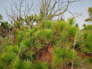
Maritime Grasslands
Our "First Day" hike is a new one for me. Bird Island Nature Trail is accessed via Sunset Beach NC with a one mile beach walk. Just before reaching the Kindred Spirit mailbox, a nondescript sign atop the sand dune, indicates the trailhead. The beach walk was into a stiff headwind. Visibility was impaired due to the wind kicking moisture and sand up to resemble fog.
Salt Marsh
Once we stepped over the dune, the wind relented and visibility improved. The trail is less than a mile and is a lollipop loop.
Bird Island is no longer an island. Mad Inlet separated it from Sunset Beach, a barrier island itself. In 1954, Hurricane Hazel moved the inlet about a mile east which now would be where the main road deadends at the Sunset Beach pier. Over the next 45 years, it migrated back to its original location. During this time, it significantly narrowed, going from 1700' feet to 200' in width. Hurricane Bonnie, in 1998 shifted sand in the inlet and over the course of the next year, closed it up altogether. Previously, one would only have been able to access Bird Island by wading across at low tide. Now you can barely see where Mad Inlet used to be.
Salt and Mud Flats
The island is a North Carolina Coastal Reserve. The previous owner had plans to develop the island and build a mile long bridge from Sunset Beach to access it. The developer requested permission to build the bridge. That action prompted locals to form the Bird Island Preservation Society. Their effort resulted in the state denying the request in 1996. Several entities teamed up to purchase the island in several transactions during 2002 and 2003.
Maritime Shrub Thicket
Sand Dunes


No comments:
Post a Comment