Monday, March 20, 2017

Mar 19 Icy Mount Mitchell


Our hike today is from Black Mountain Campground to the top of Mitchell and back. It is a 12 mile roundtrip with 3689 feet of total elevation gain. Starting out at 9:30am we didn't get back until 5:30pm. A long but enjoyable day on the mountainside. 


Conditions were great, a temperatures in the 40s and just about freezing on top with light winds and mostly sunny skies but almost no view at the top. Trail conditions were good on the lower half but turned icy for the second half. We struggled on the patches of ice. Finally, I gave in and took out the katoolas for some foot traction. From that point on, we had solid ice on the trail the rest of the way. Without foot traction, it was very treacherous and many hikers fell.


Once at the top, we were greeted by a small crowd. the park had opened and folks could drive to within a quarter mile of the top. We found a spot out of the wind to sit and eat, although my sandwich was partially frozen.


After about 30 minutes on top waiting for the clouds to clear, we decided to head back. I gave one katoola to a hiking buddy so we'd both have some traction. I managed to stay upright but it was much easier with both feet having traction.After about 2 miles we took off the spikes and worked our way around the few remaining icy spots. The trail now was thawed some and very muddy.


We had nice views to the east at times. We saw more hikers on the trail than I thought we would. Some were still headed up on our way down. Unless they were super hikers, they were not going to make it to the top and then down in daylight.


By 5:30 I was pretty tired and ready to get in the car for the ride home. Great day and great hike.


Saturday, March 11, 2017

March 11 Faith Rock


Here is the spot Andrew Hunter plunged into Deep River while trying to escape from the British during the Revolutionary War. Mac Whatley has written a wonderful account of the incident and events leading up to it. From his blog https://randolphhistory.wordpress.com/ is the following:

While taking a wagon of produce to trade for salt at the Pedee River market on May 2, 1782, local resident Andrew Hunter was captured by the notorious Tory guerrilla leader David Fanning. Facing immediate execution, Hunter made a desperate escape. In Fanning’s words, Hunter “sprung upon my riding mare, and went off with my saddle, holsters, pistols, and all my papers… We fired two guns at him; he received two balls through his body but it did not prevent him from sitting the saddle, and make his escape.” [David Fanning, The Narrative of Colonel David Fanning (Spartanburg: The Reprint Company, 1973; pp. 59-62.]
Enraged, Fanning plundered Hunter’s home, holding his pregnant wife hostage for the return of the horse, “a mare I set great store by, and gave One Hundred and Ten guineas for her.” [ibid.]  However, Fanning’s guerrilla band was forced to release Mrs. Hunter and ride out to join the British evacuation of Charleston, South Carolina.
But Fanning risked a final return to Randolph on September 5, 1782, solely in an attempt to recover his mare. The incident at Faith Rock must have occurred at this time. Hunter “was riding the Bay Doe, on the high ground south of Deep River, and not far above the …ford; but found they were heading him in that direction. He then turned his course up the river, but they were there ready to receive him. The only alternative was to surrender, which would be certain and instant death, or to make a desperate plunge down a precipice, some fifty feet high into the river. He chose the latter… It was such a daring adventure that his pursuers… stopped short, in a kind of amazement, and contented themselves with firing two or three pistols after him. As there was no level ground at the bottom of the descent, he plunged right into the river… sometimes swimming and sometimes floundering over rocks, until he found a place where he got out on the north side and made his escape.” [E.W. Caruthers, Revolutionary Incidents And Sketches of Character Chiefly in the “Old North State.” Philadelphia: Hayes and Zell, 1856; pp. 280-281.]


Today's hike was led by Franklinville mayor, Perry Conner and organized by Piedmont Land Conservancy. The property was purchased by Mayor Conner several years ago, then acquired by PLC with help of a grant. It is slated to be transferred to the town of Franklinville. A loop trail of 3/4 mile is being constructed now. The trail is accessed from town via a pedestrian bridge. That bridge has been rebuilt at least once and was originally constructed by the adjacent textile and grain mill which operated years ago. The bridge allowed workers living south of Deep River, an easier way to get to work.


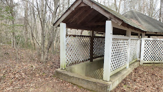
The mill also held picnics on the south side of the river, for employees and customers. The concrete tables are still standing. There are concrete structures which may have been water fountains also still standing. 


The Faith Rock property connects via the bridge to town property which includes a ballfield and a playground. All of which will someday be part of the Deep River Trail. A railroad spur, now abandoned, is being revived as a multi-purpose trail. The railroad connected the river communities of Cedar Falls, Franklinville and Ramseur with Greensboro and beyond. Portions of this trail have already been constructed and can enjoyed today. 

Thursday, March 9, 2017

Mar 8 Paddle on Cox Lake

Must be something important in this heron nest. These guys didn't want to leave it.


Our group of 3 is doing some field work today. The objective it to assess 2 miles of the north side of Deep River as a possible land trail along the river. Putting in at Central Falls, we almost immediately saw this that this was not a good option. Landowners had fields and trimmed lawns to the river. After that, the north side became a virtual wetland. Tributaries backed up into marshes and small ponds. Finally the terrain rose up high. Then the long arm of a tributary appeared right before Cox Dam. In the arm or alcove, I counted 9 nests high in trees. Most were leaves and likely squirrel homes, but a few were sticks, likely created by birds. I saw 3 Great blue herons hanging out on and near one. They did not move off as I approached. 


Cox Dam powerhouse is still actively producing power. The dam is quite high, made of rock covered with concrete. An extension, built with boards covered with metal and supported by metal braces, raises the dam level by about 3 feet. This structure looks precarious and is damaged in several spots, probably by logs traveling downriver. Should this structure be removed, there would be a big change in water level for at least a couple miles of river.

It looks like an infinity pool. Note the metal rim.


This photo gives you a good perspective on the dam and the extension. On the far side, the extension has been breached slightly. That is the main channel of the river and where logs will impact the dam.

Note the log trying to get over the dam

There is a rock and steep trail on this side, used as a portage


Mar 4 Outlaw Trail and Cave


On the south side of the Yadkin, a sliver of Pilot Mountain State Park follows several miles of riverside. I'm part of a small group that walked along a social trail known as the Outlaw Trail. The trail follows the river bank where it can and rises high above when the obstacles become too great.

Our first attraction is the nesting Bald Eagle. Most often viewed from the opposite side of the river, we were careful not is get to close but our advantage was that we were above the next on a high bluff.


I knew immediately when we approached this cave, I would not be squirming down the hole. Two our group, the tallest and smallest did make it in. It requires that you enter head first, reach a area wide enough to turn and continue in tight quarters. About 10 feet in the cave constricts to a size which was unacceptable to continue. Although, it did appear that if one could make it through, there was a chamber beyond. We were told that it was large enough to stand in. 

I hope we don't loose our tour guide!


The Outlaw Trail has this wonderful passage bluffside and riverside. We managed to find some wonderfully scenic spots along the river like the one below.


At this point, we are looking at only half the Yadkin River. What appears to be the opposite side, is an island. The river can be forded and there is a trail on the island, as well as primitive camp sites. Horses used to ford the river, cross the island, ford the other side of the Yadkin and continue on. However, that all cam to an end when the state park and the railroad realized there was no agreement for horses to cross an active railroad. 


Our tour guide takes a break on this natural bench overlooking the river.

Feb 24 Jones Lake State Park


It looks just like Bay Tree Lake but it is about 20 minutes away. Jones Lake first developed in the 1930s as a segregated park for blacks, now surrounds both Jones lake and Salters lake. There is a nice Visitors Center with much information about bay lakes. One difference I noted, there are many Atlantic White Cedars and Cypress trees here. I saw none at Bay Tree Lake. The Atlantic White Cedars are very large compared to the Eastern red Cedars I am familiar with in the piedmont area. 


Feb 24 Bay Tree Lake State Park


Never heard of it? That is because it is an undeveloped state park. It is one of the famous Carolina Bay Lakes located where there are already several state parks at bay lakes - Singletary State Park, a group state park, Jones Lake state park which encompasses two bay lakes and Lake Waccamaw State Park. Thus, this one will not likely be developed. It is a maze of sand roads which are frequented by 4 wheel drive vehicles and ATVs. The sand is difficult to walk on, so there is not much foot traffic here. I walked in to the lake which is about a mile from a sandy parking area off Rt 41.

Long Leaf Pine

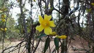
Everywhere there is Jasmine 


Bay Lakes are shallow. The deepest one, Waccamaw has its deepest spot measured at 11 feet. They are very sandy but often the northwest side has a peat bank. The water acidity level limits the species of fish in the lake to just a few. That doesn't seem to deter fishermen. There were obvious signs of fishing spots, often little with fire rings and beer cans.


Feb 10 Birkhead Hike

Lithics at Camp 5

It is still pointed in the right direction 


Holy Litter

Firepit or Trash Receptacle? 

Camp 3 Spring House

Feb 8 Vade Mecum Spring


Once the source of highly sought after spring water with healing powers, the spring water doesn't seem too appealing today. This remnant from the past is preserved inside this spring house within Hanging Rock State Park on its recently acquired Vade Mecum property. Plans are afoot to restore some of the buildings of Vade Mecum resort which operated a century ago. A historic hotel, the spring house and then some buildings associated with the 4H camp which later occupied the property, are now the subject of scrutiny to determine their place in today's world. How much time, effort and money do we invest in this restoration is being decided in our world of constant budget battles.


The Friends of Sauratown Mountains is assisting the state park in keeping this property up while its fate is being decided. Hopes were raised when this property was added to the NC Connect Bond issue, passed last year. That funding could make some restoration possible if it can survive as a viable project. 


In May, FSM will open the property to the public for one weekend a month, offering property tours and hiking on the trail system. Later, the group has plans to rent the facility for special events and weddings. 

How long has this rake been here?

This relic from the 4H era is just weird

And so is this

A deluxe outhouse

We are this close to Moores Knob

Jan 4 Upper North Prong Hannahs Creek

  Hiking from the dam at  Plantation Road, up the creek toward Fern Valley. I've did this years ago but don't have any photos, so he...