Tuesday, September 28, 2021

Sep 25 Chestnut Bald via Art Loeb and Little Sam


It is Saturday and the parking areas are already full. Parking roadside is the only option. We find a space and are able to squeeze just off the road. Our hike begins as a road walk on Black Balsam Road. We walk about a quarter mile and head into the dark forest on Art Loeb and the MST. 


The trail is eroded but there is very good ground nearby to easily walk on. Our first prominence of note is Silvermine Bald. The trail goes fairly close to the highest point. We wade through some vegetation to try to locate the highest point. On to Chestnut Bald! The trail skirts the side of Chestnut, so a bushwhack up is needed. We follow a social trail to the top. The pile of rocks above, form a arrow, pointed at the highest point which is among a clump of fallen trees.


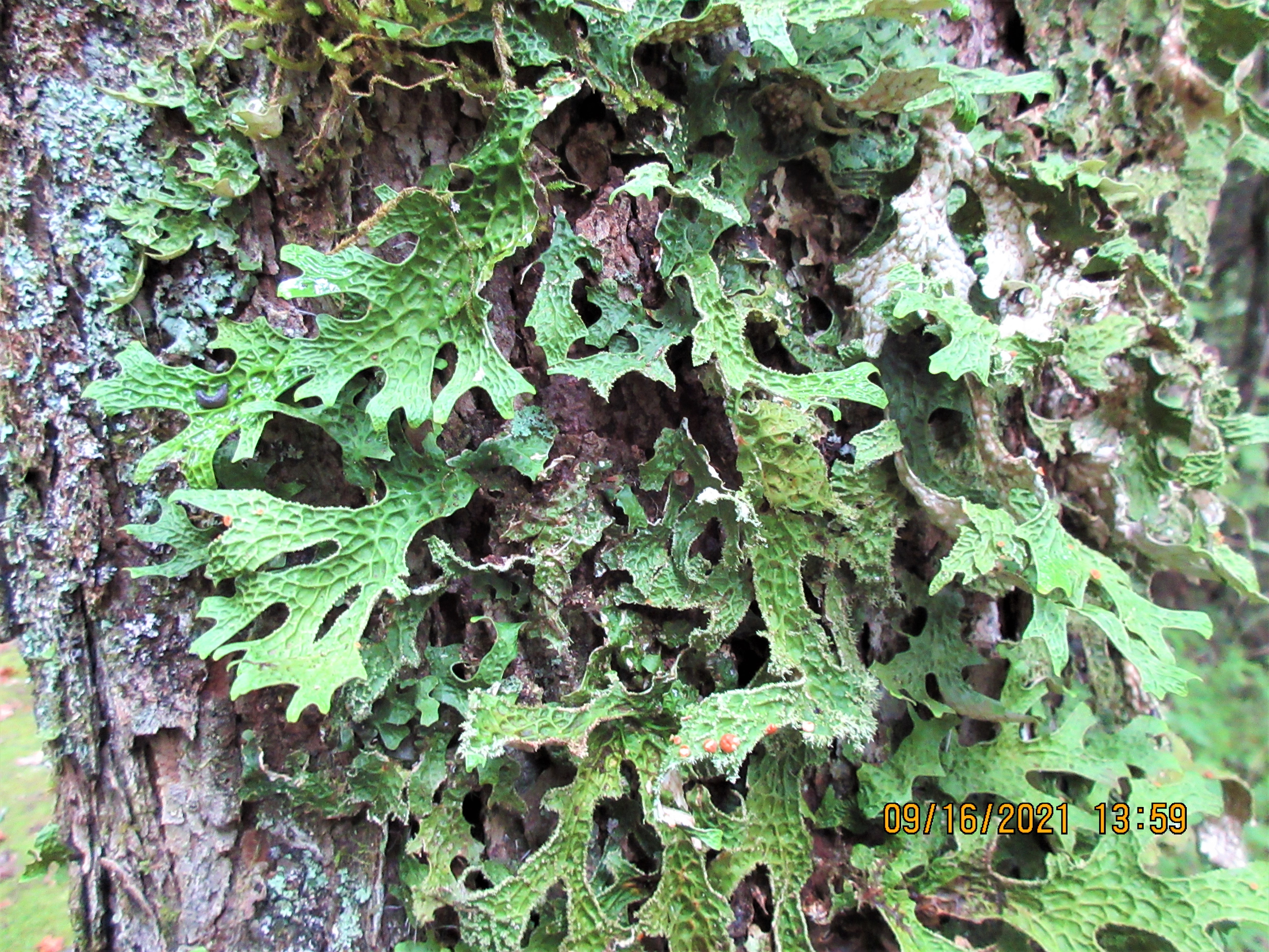
The rest of the hike takes us to an access trail from Devils Courthouse parking area. At that point we make an abrupt right turn onto Little Sam Trail. It is an old railroad bed. At one point, we stop to eat a snack and see a large amount of twisted wire cable intertwined in the tree roots.


To finish off the hike, we turn onto Flat Laurel Creek trail. It is wet, with running water most of the way. Still, we manage to keep fairly dry boots through here. 


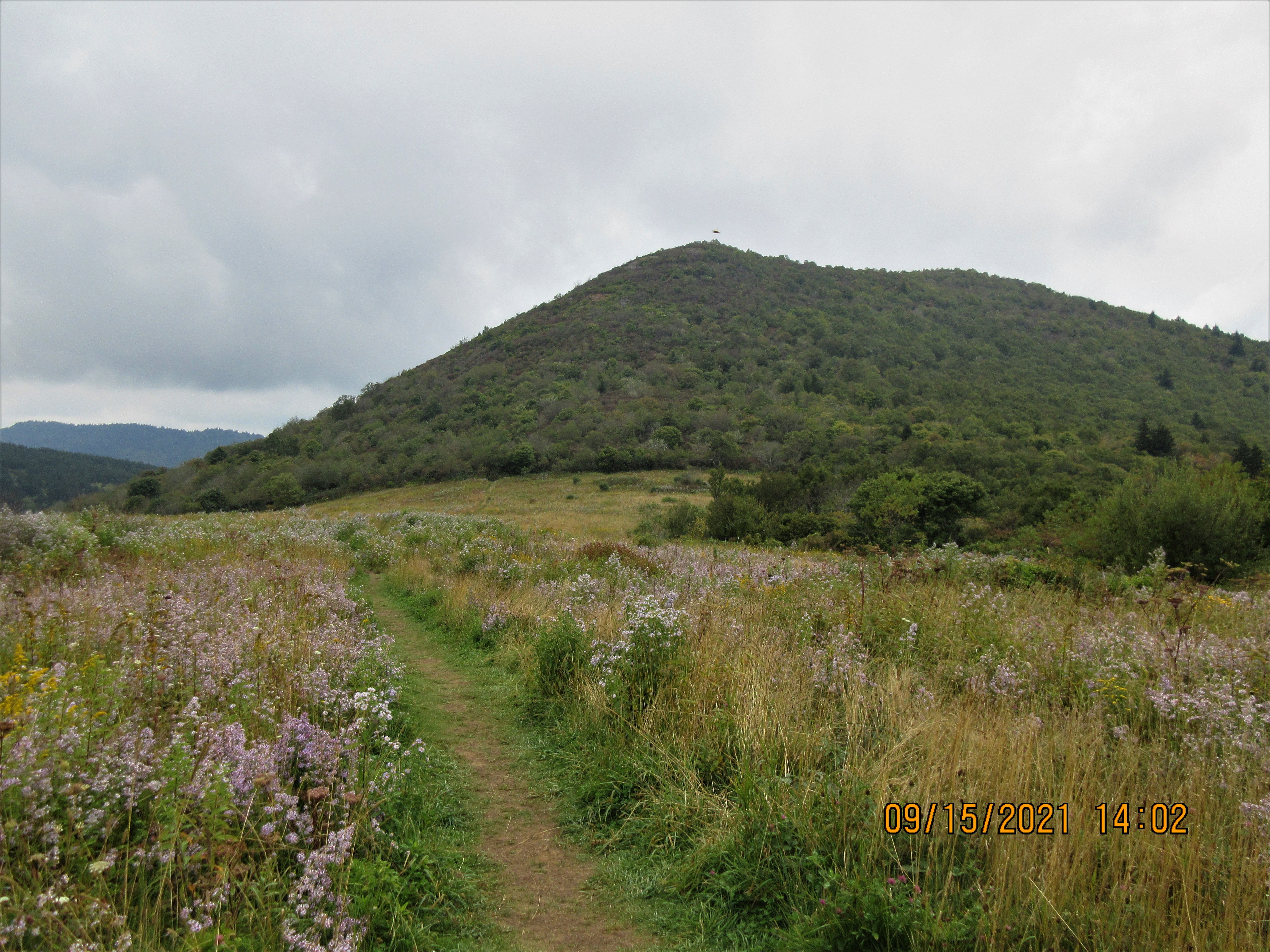
Just shy of the parking area, we enter this gorgeous meadow ablaze in early Fall colors.


We are pleased to see that we have hiked 5.2 miles with about 600' in elevation gain, thus just barely meeting the SB6000 Challenge criteria to count this 6000'+ peak.


Sep 24 Waterrock Knob, Mt Lyn Lowry and Yellow Face


In 1983 a Cessna airplane crashed into the side of Browning Knob near Waterrock Knob. Thus, now it is a popular hiking destination from the Waterrock Knob parking area. It was of little interest to us. Our plan was to hike Yellow Face (6032'), Waterrock Knob (6292'), Mt Lyn Lowery (6240') and Plott Balsam (6088'). In the process we would go over Browning Knob (6195') as well. Foggy in the valley this morning but it was a gorgeous day above.


After parking for the day, we hiked back down the approach road, crossed the BRP and walked 1.6 miles to the top of Yellow Face and back. There were no views on top and just a thicket of blackberry to make finding the highest point difficult. We settled on a rock to the right of the trail as the highest point.

Yellow Face from the top of Waterrock Knob.


Continuing, we retraced to the parking area and headed up the tourist trail to the top of Waterrock. After a brief stop to enjoy the view, it was on to Browning Knob. The trail drops steeply, levels out and then rises steeply, back to almost the same elevation as the last peak. There are many roots and slick spots along the way. The top of Browning Knob is where most everyone, heads left, down the side to the plane wreck. We kept straight on an unmaintained path. We dropped very steeply this time and followed an undulating route along a narrow ridge for about a mile and a half. We passed two very large boulders along the trail and headed up to Mt Lyn Lowry. Near the top, we came to a fork with the right identified as private property and video surveillance would be watching us. We took the hiking trail to the left and soon saw that this was hardly a trail. It appeared to have been recently cleared. The soft pine needle litter had not had time to erode away. This path was a series of obstacles and required good foot placement. There was a handmade sign on a tree indicating distances to Lyn Lowry and Plott Balsam.   


This short bypass path took a lot of energy out of us. When we climbed back out at the other side of the private property, I was winded and we were pretty sure that we would not have the energy to make it to Plott Balsam. From here to Lyn Lowery, the going got easier and eventually, we were on a road. The road ended at the huge cross erected in 1964 in memory of Lynn Lowery. Lynn died just days after her 15th birthday in 1962. Her parents funded the 60' steel cross. A plague indicates it was built by Eugene B Miller in 1964.


The cross was lighted for years. In 2011, the lights went out due to a malfunction. Although, repairs may have fixed that, the mercury vapor bulbs used are no longer available and newer bulbs don't have the wattage needed. The color or shade of color given off by newer bulbs is less desirable. The Lowery family foundation has maintained the cross for almost 60 years and it still look quite structurally sound. The road leading to it does not look like it has seen any vehicle traffic in quite some time.


It was such a pleasant time in the shadow of the cross.  It was 12:30 and the round trip to Plott Balsam would take over 2 hours. We had decided not to attempt to go any further, so this was to be our turn around spot. We ate a leisurely lunch and enjoyed the views in all directions.  


Returning the way we came, Will decided to do some maintenance in the overgrown areas. Can you spot him in the photo above?


Sep 23 Reinhart Knob & Richland Balsam


Beginning at the Beartrail Ridge Overlook on the BRP, we began our trek for the day. Our targets were Reinhart Knob (6080') and Richland Balsam (6410'). A short walk on the parkway was necessary to get us to the entry point, a nondescript and tiny gap in the trees. It felt good to get out of the stinging wind. The climb was in soft pine needles but quite steep. With so many downed trees, we picked our way, this way and that. As we neared the summit, we did pick up a manway which led us to the tree with this sign.


From the top, we began a long bushwhack through the forest, down to the MST. It was over a mile, so we needed to stay focused on our route. After some searching, we did locate a drainage with a faint manway. It was tough going but downhill. As planned, we ended the offtrail route right at the exact point we needed to find the MST. 


The MST followed an old railroad bed, slabbing along the side of a long ridge. There was one spot where we did get a view to the south but otherwise, we were in a delightful forest.


Bottle Gentian grew in a few sunny spots along the trail. 


At one spot, we saw numerous Beech Drops for a few hundred feet in the trail. Although, I did not see one Beech Tree here. There must have been some, since these parasites only grow off the roots of Beech Trees. 

Our walk on the MST was smooth and enjoyable but we needed to get to Richland Balsam and the MST didn't go there. We knew if we headed north we'd hit the BRP. After a 30 minute bushwhack, we made it.


Instead of walking along the parkway to a curated trail up Richland Balsam, we wanted to get up the shortest route possible. A bushwhack through a thick and dark forest. It started out fairly easy, but turned into an arduous uphill slug through a spruce/fir thicket so dense you could barely pass between trees. It was a relief to pop out on a curated trail which we followed to the top. At 6410', one would think there would be a great view but that was not the case.


We sat right in the trail to eat lunch and began to see the first hikers of the day, followed by many more.


Once we had descended to the parkway, we had a road walk to complete the hike. The views on the way back to the car were stunning.

6.34 miles, 1411' TEG


Reinhard Knob 


Saturday, September 18, 2021

Sep 16 Rumbling Bald


Rumbling Bald is a satellite area of Chimney Rock State Park. The State Park was created in 2004 with the purchase of most of the private attraction "Chimney Rock". We are all familiar with that attraction, elevator in the rock, flagpole and the myriad staircases among the craggy rocks. That is just a small part of a wonderfully sculpted topography collectively known as Hickory Nut Gorge. In 2008 Rumbling Bald was purchased and added to the State Park. It contained a local party spot, known as "Party Rock". A 1.6 mile trail was completed in 2015, connecting several boulder fields and cliff climbing areas. That is the hike we took today.

Beauty Bush


The park map and description does not go into full detail of this area. I thought we were going to do a 1.6 mile loop trail but it was so much more. The climbing areas are designated as Hanging Chain, West Side, Central and East Side Boulder Fields. They are all areas of large rocks which have fallen off the vertical cliffs above. Hanging Chain is off limits now, officially, but that has not stopped bouldering enthusiast from trespassing to this area.


Each bouldering area has a rabbit warren of trails through it. We meandered on a number of these. Who knows how many miles of social trails are here, but my guess is a full days worth of wandering. 


If you are interested in coming here, it is a popular place. Despite the recently constructed 100 space parking area, the place does fill up and closes.

I think the rock came first


There is evidence of a wildfire which burned through here in 2016. We could see a charred log here and there. Most of the forest lived through that fire and thrives today.


At the kiosk, we read a notice that caves are now closed to entry. As we walked near the cliff, you could see several spots which were likely caves. We also saw a number of spots where you could passage under the rocks. So there is much exploring to do here. Waiting until the leaves have is a good idea, since the cliff views will be much more evident.


Sep 15 Pink Beds


Oak Leaf Lichen

Our hike was going to be another Great Balsam adventure but the weather just did not cooperate. As we traveled along the Blue Ridge Parkway, the fog shrouded everything. The overlooks were pure white, as was the road ahead. Finally, at the junction with Rt 276, we headed off to find something else to do. The Pink Beds Trail was just a short ways down the ridge. We pulled in, saw a kiosk with a map and started hiking. We kept looking for and wondering what "pink beds" were.


The 5 mile loop trail employed boardwalks to get through some of the wetlands.  

The largest Joe Pye Weed I have ever seen

Hurricane Fred downed a bunch of rain on this area and you could see where it had flooded in many spots. Some of the wooden bridges had been dislodged, displaced or swept away. 


As we walked here, we kept seeing very large White Pine trees. There were also a number of large Hemlocks. Later in the day, we learned that this area had been settled with a number of small farms. Beginning about 1985, George Vanderbilt began purchasing these properties as part of his massive estate. He had hired Gifford Pinchot and later Cark Schenk to manage the forest. Schenk ran a forestry school in the vicinity and planted a number White Pines as part of the reforestation program. 

Oh, and we also learned "The Pink Beds" were so named for the number of Fire Pink wildflowers here.

Hurricane Fred damage

Sep 14 Black Balsam - Grassy Cove Top - Tennent & Sams Knob


August is my least favorite month. It's such a relief to feel Autumn on the horizon, transitioning into my favorite time of year. Autumn is not here yet, but we got a healthy dose of it today. Our hike was a little under ten miles, but never got much below 5700'. Beginning at the parking area at the end of Black Balsam Knob Rd, we headed off on an old railroad grade, now known as Ivester Gap Trail. If you have a high clearance, 4 wheel drive vehicle, you can drive out this trail until you reach the wilderness area. We did see a couple such vehicles. 


Our first target was Grassy Cove Top, a 6040' peak and one of forty 6000' plus peaks, part of the SB6000 challenge. The top is accessed on a spur trail off the Art Loeb Trail. It was overgrown but still manageable with relative ease. Will is standing on a rock just a few feet from the trail. We determined that it was the highest point. The top is covered in heath and it is difficult to get a view, but standing on that rock did provide a decent view.

Overgrown spur trail to top of Grassy Cove Top


Wildflowers were abundant. Golden Rod and Aster - both white and purple blue were the dominate ones. Occasionally, a Bottle Gentian and Dwarf Gentian made a cameo appearance. 


Our next peak was Tennent, another 6040' peak. We ate lunch here with a great view in all directions. Black Balsam Knob 6214' was in full view and it was easy to see how how route might take us to the highest point. 


Dried arrangement of Angelica

Looking toward Black Balsam Knob


We continued on the Art Loeb Trail over the top of Black Balsam Knob, wondering who Art Loeb was. And there is was, a plague dedicated to him. He died at a young age. The trail went on to the Black Balsam Parking area but we took a spur trail back to where we had started at a further parking area. After tossing a few things in the car, we hiked on to our next peak, Sams Knob at 6040'. 


A fellow in the parking lot told us we'd go out to a boardwalk before starting the climb. I didn't pay much attention to that, thinking it would be a short board walk. Here it is. It looks like the yellow brick road. 


What a grand view of Sans Knob. This field is just loaded with wildflowers. There are two peaks of Sams Knob. The SB6000 challenge says to do them both because it can't be determined which is higher. So that is what we did.


The top is a maze of overgrown trails with one main thoroughfare. Both peaks had nice views, in opposite directions. Some very minor scrambling was needed. 


The trail has eroded. In places the erosion has reached to chest high. Nice displays of wildflowers and brilliant Mountain Ash made for a colorful scene. 

The trail home


Apr 20 Waterwall on Walker Creek

  Waterwalls redirect floodwater back into the creekbed. There is one very near the Uwharrie Trail on the Walker Creek section. This one is ...