Sunday, October 20, 2013

Oct 19 Henson Creek - Linville Gorge

How might we cross???

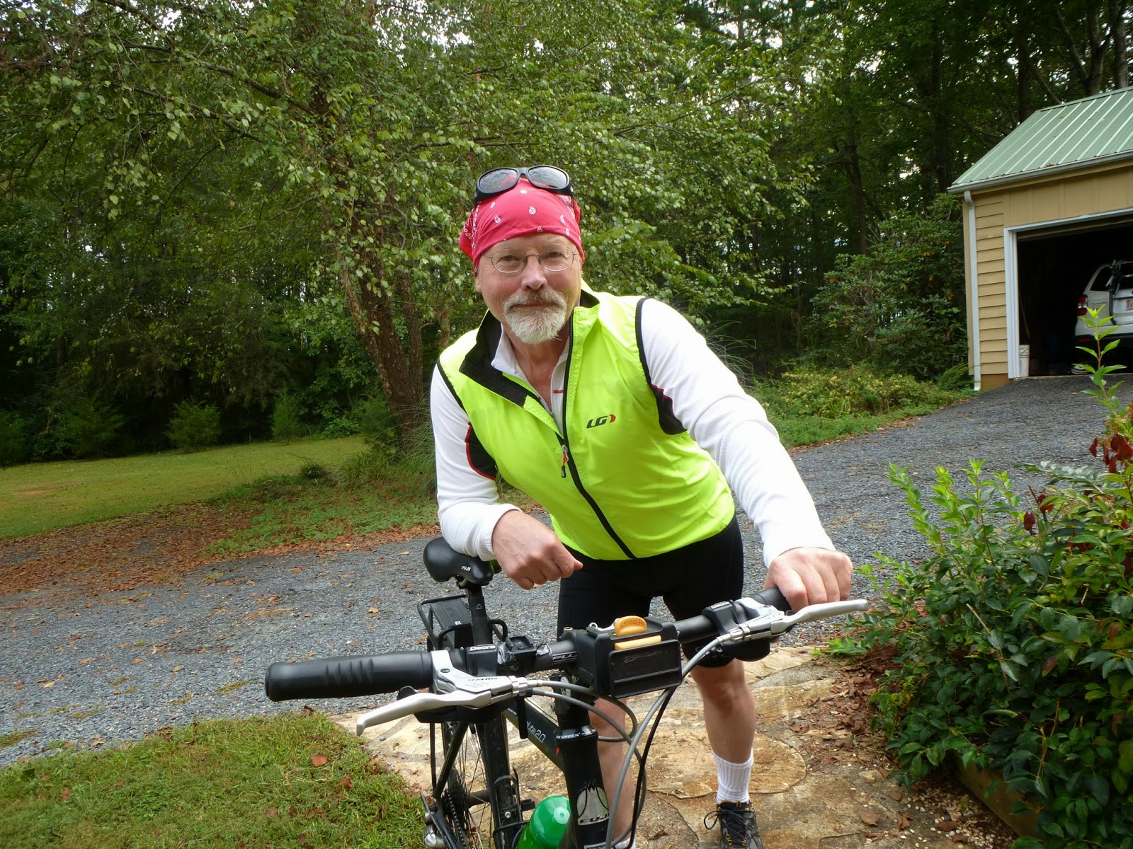
Today's PHOC hike in Linville Gorge is led by Ben Harris. There are 19 of us. The plan is simple, hike down Devils Hole Trail, cross the river, hike upriver on Linville River Trail, find somewhere to cross back over the river, scramble up a rocky spire, drop back down to the river, scramble up Henson Creek and then catch some great views from the ridge before finishing. Ben has thought of everything, excitement, danger and lunch with a view.

Nurse Debby nimbly crosses 

Ben leads us up from the road on an off trail short cut to Devils Hole trail, just to get things warmed up a bit. We make the descent on steep and rocky Devils Hole trail. At the bottom there is some confusion. Most folks do not attempt to cross the river here so the trail is not easy to follow. There are cairns in the river but they are of little use. You need to find the best way across and that is not readily apparent. We find a long piece of lumber and float it downriver to a point at which we can utilize it to cross a tricky spot. Kyle is absolutely catlike on the river rocks and bounds back and forth with ease. Ernest with his AT thru hiking experience is comfortable here as well. The rest of us sign onto the plan and make the crossing with their guidance. No major mishaps here, just some bumps and scrapes.

You are such a hot shot

This was an exciting crossing. We're all relieved to regroup on the other side, enjoy the scenery and roar of the river. It is just a short uphill climb to the Linville River Trail. There is a faint trail here leading up which indicates to me, this is not a river crossing often used. Current river flow is 62 cubic feet per second. Most of this spring and summer, this would have been a highly dangerous crossing.


We hike upriver along the river trail to a point, near a nice campsite, where some of our group has made previous crossings. Some of us rock hop upriver and some bushwhack riverside until we see a crossable spot. This crossing is deeper than the last but doesn't have the danger of swift water in tight channels that could really be problematic. I miscalculate my route across and end up having to be dragged up a rock by two companions. Of course I don't have photos of my ungracious river exit but I suspect some will surface on the PHOC website. Not only did I get skinned up getting pulled up the rock, I managed to get waist deep during the water crossing. Although, I had a full change of clothes, I never felt uncomfortable. 

From this point we head straight up in very steep terrain with a moderate amount of greenbrier. I was 5th in line when Bill (third in line) yells out. The first two scramblers have just passed right by a coiled rattlesnake. Everyone wants to get a photo but I head up, my eyes fixed on the ground. I saw the snake and am stunned at how camouflaged it is.

We manage to make it to a wall, then follow a trail alongside it until there is a 40 foot crack in the wall. Now we scramble up a very steep slope to the rocky spire above, our lunch stop. We are on the rocky spire which is just across the river from Babel Tower and Avatar. From here we can see a campsite on Babel and fellow hikers enjoying the view about a quarter mile away. To join them would be a herculean task.   


Hiking with Ben, assures me we'll always have lunch with a view. No restaurant can compete with this setting. I need the break, rest and refuel well. 


After the lunch break, we're back scrambling down the crack in the wall we came up. Then we pick up a faint trail at the base of the wall and continue until we're at the mouth of Henson Creek. Another break is in order. Some of our group head to the river for some river karma, I scout up Henson a bit. Once we regroup, Ben reviews the "rules" of hiking Henson Creek. "Stay together." 

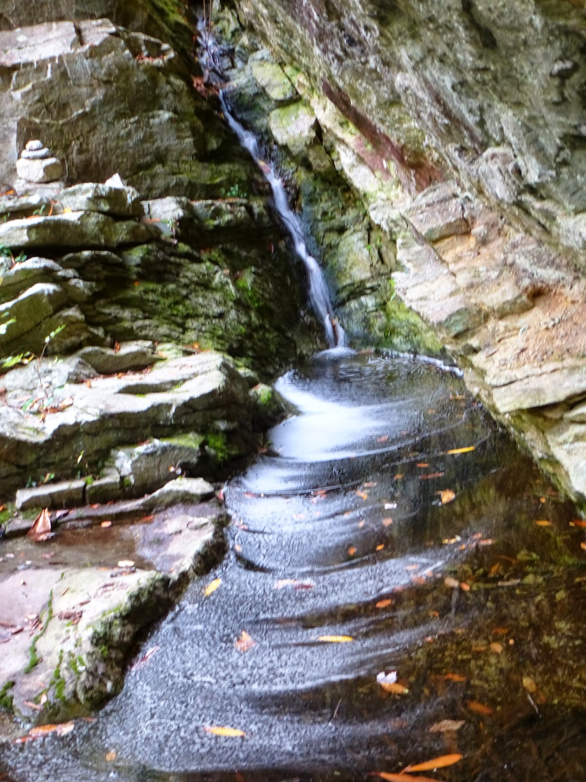
A side channel of Henson Creek near the mouth


The water level of the creek is very low. We'll be able to stay in the creek bed for most of the ascent. There are some tricky spots including one which only 4 of us attempt before we advise the others to find another way. It required a spot which I refer to as a "leap of faith". You have to make a move which you hope will hold. Bill made it up unaided, He helped me through it. In turn I dragged Dina and Gary up. That was it. We told the others to find another route.


Henson Creek is a steep stream bed bordered by rock walls. Large, sharp, jagged rocks fill the course. There are lots of leg scrapes and bruises associated with this scramble. Finally, it looked like we had reached an insurmountable headwall. Somehow, there was a route through it and we were back on trail. Here is where I expended most of my day's energy. For whatever reason, I pushed and pushed myself along this trail and then the never ending Red Trail and the so called "rabbit trail". When that finally leveled out, I was still second in line but spent. I was so glad, our point, Matt decided to wait for the others. 


While resting, I saw some Bottle gentian and took this photo. Linville Gorge offered up some great adventures today and finished off with this beautiful wildflower. 


The last landmark we pass on our hike today is Sitting Bear, a rock spire formation. Pretty odd, huh?

Friday, October 18, 2013

Oct 14 & 15 Greenbrier River Trail


Running alongside the Greenbrier River Trail is its namesake, the Greenbrier River, for the full 77 miles, North Caldwell to Cass WV. Last operated by the C&O in 1978, this trail and its corridor is owned and operated as a West Virginia State Park. Condition of the tread-way is excellent, crushed gravel and a 4 mile paved section through Marlinton.

I used Marlinton as my base for two days of riding. Marlinton is the largest community for some distance in all directions. Somehow it survived after the logging era ended. Prior to the railroad being built in the early 1900's, logs were floated down river to Roncerverte in the spring runoff. Once the railroad was built, logging could proceed on a much grander scale. Many small communities rose up along the tracks. many of these places are long gone today. A few remnants remain but you need to search for them.


Heading north out of Marlinton, the trail follows the east side of the river with mountains rising up right next to it. On the west side of the river is a long fertile valley, still in use as pastureland. Nine mile from Marlinton everything changes. The trail crosses the river and immediately into the 500 foot Sharps Tunnel, seen above.


Note the still standing, tell-tail to warn persons on top of the train to get down. I hope those trains were traveling slowly as there does not appear to be much warning. Once through the tunnel, the trail is on the west side and you are in a gorge. Mountains rise up on both sides. Scenery changes and weather changes. I've noted this transition before. Now there are many more maples and the fall colors are more vibrant.


Here is one of those whistlestop towns. Cloverlick is a tiny place with just a few homes but it does boast this beautiful train station.


I continued on to Cass which was a major base for a timber operation. The trail ends here but the railroad lives on with a tourist attraction train. The Cass train works its way up a mountain using switchbacks in which the entire train is pulled onto a spur at the apex of each swithback, then the track is switched, the steam engine reverses and the train slowly makes it way up or down.


The obligatory self portrait on my return ride to Marlinton. The ride today was about 47 miles in perfect fall weather as you may see from the photo background.


The last time I was here, this was a charred skeleton. Now rebuilt it looks as spiffy as ever.


The following day, I rode the opposite direction out of Marlinton. Above, in the former community of Watoga, is this bank vault trailside. You can see it from the trail but it is easy to miss. I understand it was part of the company store. The concrete vault is about the size of a large closet. It sports a steel door and frame. There are pieces of the foundation crumbling nearby but the vault was built to last.


There are a few houses along the trail. In Seebert there is a parallel road for about a mile, lined with small vacation homes. It seems every trail I've ridden in WV has a prison on it. This is no exception. Denmar Correctional Center is trailside. Originally a hospital for tuberculosis and later, other terminal diseases, it occupies such a bucolic setting. There is also a federal prison in Anthony a bit further south near the trail.


I didn't have the legs to make it all the way to the Droop tunnel, my original plan. I turned back at MP 33, stopped for lunch at Jack Horners Corner in Seebert and finished up just before 3pm having traveled 49 miles.

Oct 4 Pizza


My standard pizza, loaded with ground beef and chanterelles, sprinkled with spinach. We used the last of the frozen puttanesca sauce. However, I didn't make enough dough and didn't let it fully rise. Still this pizza was delicious despite the irregular shape. 

Sunday, October 6, 2013

Oct 5 Grandfather Mtn Profile to Swinging Bridge and Back


Rt 105 to the swinging bridge and back is one of my favorite hikes. Joining other PHOC members, we start up Profile Trail about 10 am. Although the distances aren't that great, the effort is. Profile Trail starts out relativity tame but eventually gets your attention. It is steep and rocky. I mean to emphasize "rocky".  There is a potable spring .4 mile from the end for those needing a drink. The trail ends at a "T" with either way headed to the two peaks of Grandfather Mountain, Calloway to the left and MacRae to the right. Today we're going to MacRae on our way to swinging bridge. 


The route to MacRae begins innocuously enough along a relatively flat and wooded trail but soon gives way to the first challenge. Negotiating up a boulder outcropping leaves 2 of our group unable to continue. Lyn with her broken arm sustained at Mt Sterling two weeks prior, knows this is her turn around spot. The other gal just wasn't prepared for this Grandfather obstacle. The views are wonderful as we hike along the ridgeline. Not long later we encounter the first ladder of the day. Immediately afterward is "the Chute" which earns this hike the moniker "chutes and ladders". Going up the chute may be a bit easier than going down but either way it is a slow process requiring accurate foot and hand holds. At the bottom is a pile of boulders you actually hike into through passageways underneath the jumble. There are 3 short ladders here. When you emerge you're at MacRae Gap and it is just a 2 ladder climb to the top. About 30 folks are sitting here but there is ample room for our group of 16 to settle in for lunch.


Lunch is over and we're on the move to swinging bridge via Grandfather Trail on the multiple ladder route. Photo above is the series of three ladders, always a bottleneck. Later in the day 2 rangers with walkie talkies were stationed here directing the up and down hikers like you'd see at a road construction site. Finally we make it to the parking area which is actually part of the "grandfather attraction" maintained by the heirs of Hugh Morton. It costs $18 per vehicle to enter and drive up. I'm pretty tired and want a little extra time walking back so I ask Debby our hike leader if I can return without the obligatory visit to the bridge, gift shop and restroom. I'm headed back at a much slower pace and decide to hike on the Underwood Trail, an alternate, more sheltered route back to MacRae Gap. This route turns out to be very rocky and very slow going. I make it back to the gap and wonder if I'm ahead of the group or now behind them. 


I feel my strength gone and am very tired. I know this feeling and know I can pace myself out but I am concerned I'm behind the group and will be MIA at their hike finish.

About 4 pm I'm slowly making my way down Profile and Matt comes up from behind and informs me he is ahead of 3 others who took the Underwood route but is unsure if the main group is ahead or behind. I enjoy our conversation for next couple miles on the slow descent. We arrive at the trailhead to find only Lyn and Diane, the gals who opted out early on hike at the first obstacle. We wait almost an hour before the remainder of our group arrive. Everyone is tired but quite satisfied with our day on the mountain.


Wednesday, October 2, 2013

October 2 Guest in the House


Someone told me, when you choose to live somewhere, you agree to live with the species already there.
So I am happy to share my home with this guy. I would prefer it not leave its skin lying around - that way I would not know of its presence and would be quite happier right now.


Sept 28 - Oct 1 Cycle North Carolina

 Ready for my ride

Cycle North Carolina is part of North Carolina Amateur Sports, a 501c3 organization promoting physical fitness, health and skill. I rode a SAG vehicle driven by Chuck Hobgood on day 1. Chuck is president of the organization. The mountains to the coast bicycle ride was conceived just over 15 years ago when the then director of NC tourism went to a conference at which his counterpart from Iowa was boasting of its bicycle tour. Not to be outdone by Iowa, the NC director immediately set in place such a ride for NC. The folks at NCAS picked up the idea and ran with it. Now in its 15th year, the annual ride from the mountains to the coast attracts over 1000 participants a year. I hadn't even contemplated a road ride 6 months ago, but somehow I got interested in this and here I am.
   
 Playing tourists

Nanci agreed to be my "personal SAG". She thought that stood for "some awesome gal". So we headed to the mountains and played tourists for a couple days. As the event drew nearer, we started seeing more bicycles and met other riders everywhere we went. We met two fellows loaded down on their touring bicycles on a BRP pulloff. They were camping along the way to cycle NC and were to ride it with touring bikes. The last night at the hotel, a Penske truck pulled up and unloaded an almost endless stream of bicycles. There were bicycle jams in the hallways that evening.

 No big deal. You can drive here.
 I can never remember the Black Mtn Crest peaks. Here they are.
 Late September Blackberries
 Cycle NC camp at Spruce Pine

We briefly made an appearance at camp Saturday night. The small town was overrun with us. We decided to eat in another town where the restaurants might not be as crowded. At Vance's Toe River Lodge with Blind Squirrel Brewery we found a neat country setting for supper. Hen of the Woods was on the menu. It was really Chicken of the Woods but I was thrilled nonetheless. 

 A chilly start.

It is in the high 40's when I start. The first descent is on Rt 226A out of Little Switzerland. Known by motorcyclists as the "Diamondback", it is a 9 mile route with just over 200 curves and 2000 feet of elevation loss. The ride down was spectacular. At 8 in the morning there was no traffic, none, except bicycles. I descended at dizzying speeds and was so glad I had my brakes worked on last week.

After the descent I met Gary, one of the fellows I rode along the coast with back in April. He helped me pump up a soft rear tire and rode into the first rest stop with me. I took advantage of the air pump there to make it nice and tight.  
 Cyclists roll into Marion 
 Mission Hospital's unique smoking cessation program.
 On the road

Rest stops are spaced every 10-20 miles, packed with lots of fluids, high energy foods, fruits and my favorite, PB&Js. Along the route we had a great view of Tablerock with Lake James in the foreground. As I descended another small hill about 12 miles from the finish, I blew my front tire for seemingly no reason. There was another fellow at the same spot with a flat. He had already called a SAG which was there. So I decided to ride in the back the final 12 miles rather than change a tire with my pitiful pump. As I stepped out of the van, there was my car with Nanci in it waiting. We gave a gal a ride to her hotel since she had to have a wheel replaced on her bike.

We had a great time roaming around Morganton. I found out later, we overwhelmed several of the downtown restaurants catching them short on staff and food. Tent city was walking distance to downtown and it was a short day. I recall it was only a 50 some mile day of which I rode only 38.

 Heading into the rest stop

Monday is a bit longer ride. It is 68 miles to Troutman just south of Statesville. Starting at 7:30 I was feeling real good. At about mile 14, a really steep climb took a lot out of me. About half the cyclists around me were walking it, as I did. 

 Rocket Man is disabled when a wheel fell off

Just outside of Newton, I passed Rocket Man in his fiberglass hull over a recumbent. Just 50 feet in front of him, I heard what sounded like fiberglass hitting pavement. Turning around I see his left wheel laying on the pavement and him sitting in the listing spaceship. After about 10 minutes of trying to figure out how to fix his wheel, a SAG pulls up and I hand the problem off to them, gladly.

The final 10 miles are a real struggle for me. I have to walk a couple hills in Lake Norman State Park. The road into Troutman is busy and drivers are impatient, passing us with oncoming traffic. I didn't like that especially when I was quite tired and not wishing to constantly be pushed onto a narrow shoulder. Traffic in Troutman is worse. It is stop and go with absolutely no shoulder. Several of us are not able to negotiate getting onto the road at one intersection. We final have to cut off a car and just get out as a group into the stop and go. I was glad when we arrived at tent city. Nanci was really aggravated at the traffic too. We decided we would not return that evening to Troutman. Instead we headed from our hotel to Statesville.
My average speed for the day was 12.4 mph and I finished at 2pm. It was a hard day for me and I did not look forward to Tuesday which would be 81.5 miles.

 We're in farm country

Tuesday I am off to another 7:30 start. There are lots of us on the road early due to the length of the day. I passed some beautiful countryside today. Things went smoothly to the first and second rest stops. Krispy Kreme made an appearance at the Salisbury rest stop. 

 Krispy Kreme smile

After rest stop three, about 5 miles to Denton there was trouble on the road. Someone has tossed a bunch of thumb tacks on the road. I went through without picking one up but saw 4 flats on the roadside right there and numerous more embedded in tires at the Denton rest stop. 

 Tacks in the road

Denton went all out for us. The elementary school emptied out onto the sidewalk to cheer us as we rolled through town. The rest stop they provided had sandwiches, chips, drinks, music and a very welcoming atmosphere. 
Denton welcomes Cycle NC

It is just 20 more miles to Asheboro. There is one final rest stop 7 miles out of Asheboro. The route in is on old NC 49. It is a never-ending series of rollers with no flat stretches to recover. It takes some out of me but when I get to Asheboro city limits, I'm revitalized. There is one final hill on Redding that is the steepest of my 3 days. After that it is all downhill. I roll into the Y at 2:15 and feel much better than the previous day's finish. My average speed today is 13.2 mph.

 Looks like I'm not last to arrive in Asheboro
Asheboro tent city

Nanci's wristband is cuter than mine

Cue sheets say I am home

I chose to do the 3 day option from Spruce Pine to Asheboro, so I am home as Tuesday's ride concludes. Perhaps next year I ride on.

Apr 20 Waterwall on Walker Creek

  Waterwalls redirect floodwater back into the creekbed. There is one very near the Uwharrie Trail on the Walker Creek section. This one is ...