Geared up
This 3 day ride on the Great Allegheny Passage and C&O Canal Towpath begins in Rockwood PA. My bicycle is geared up for the ride with essentials. The weather looks good and temperatures are cool. I'm excited to push off. The chilly morning air feels great. I'm wrapped up in layers and shed them one by one during the day. Trail conditions are great. Leaves cover the trail but I am confident, the crushed gravel underneath is a smooth surface.

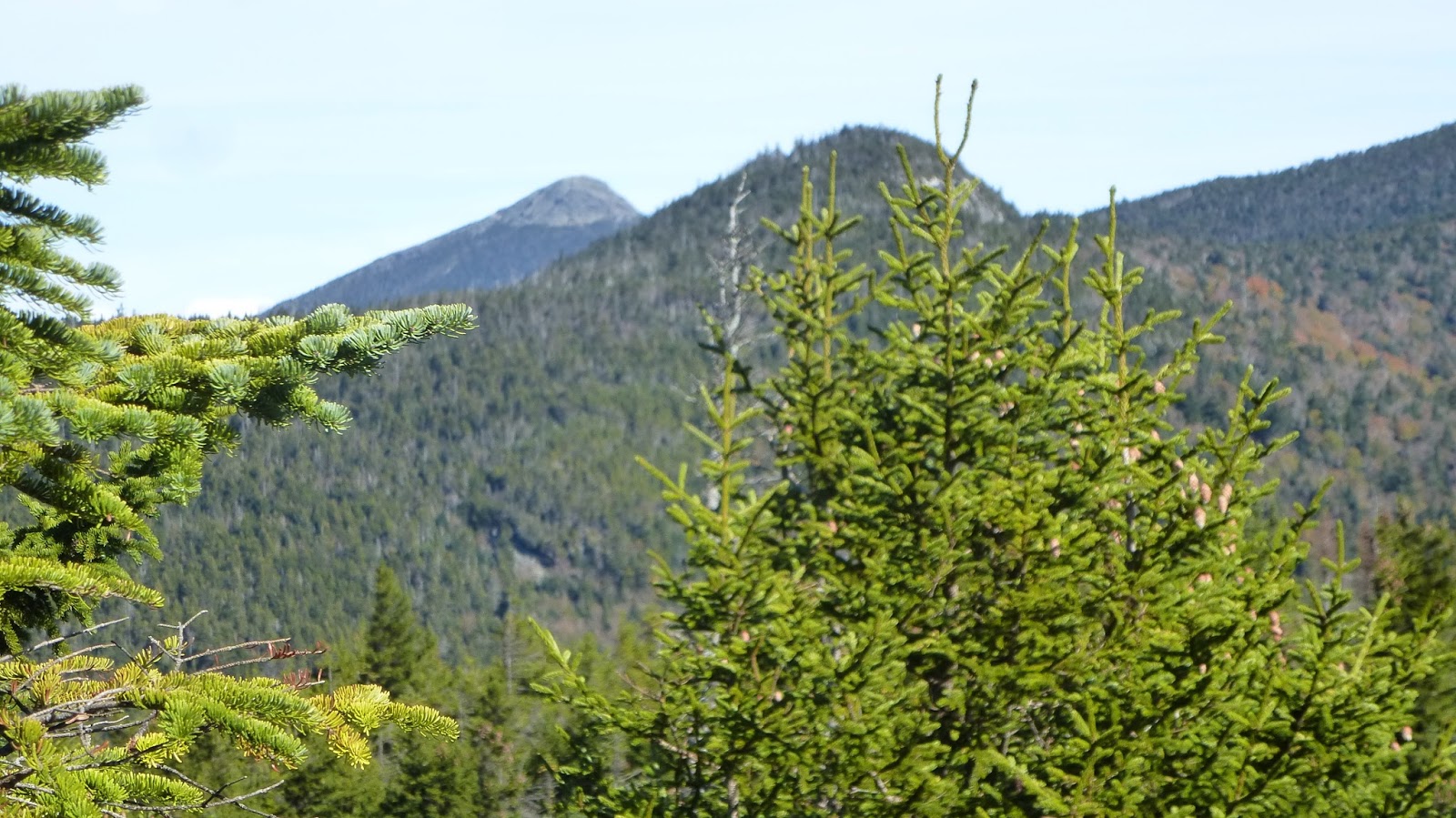
Fall colors
Here is the first major stop of the day. A small trailside cemetery attracts my attention. Many Meyers are laid to rest here as I approach Meyersdale. A small beaded cross hangs from the cemetery fence. Just beyond is the Salisbury Viaduct. At 1908 feet, this is the longest bridge on the trail. It crosses the Casselman River, Rt 219, Rt 219 Business and CSX railroad tracks, as well as a few cornfields.

The Viaduct
I watched a trail go underneath the viaduct. It appeared to be carrying scrap only. Nearby while in Meyersdale, my 30 minute stop was interrupted 3 times by passing trains.

Train under the Viaduct
The Meyersdale Station was quite friendly. Everyone had something nice to say. I enjoyed the train layout and museum of sorts they had on the premises.

Bollman Iron Bridge
Old steel bridges are commonplace on railroads. Before steel, there was iron. Wendell Bollman patented this truss design for an iron bridge. It may appear as if there is twisted wire cable, but it is long thin pieces of iron. The bridge was decommissioned early on and moved. Somehow it survived and was moved back to its initial position. A unique bridge!

Steel bridge
Yes, this is a sturdy steel bridge, part of the Keystone Viaduct. The bike trail is quite scenic here.

More colors
One hundred feet over the road and nearby brook, this bridge is one of my favorite spots. A wind generator can be seen above.

Highest point
This is the spot I have been looking for all day. The highest point on the trail. It is all downhill (literally) from here. The murals at this bridge are exceptional. You'll have to bicycle here to see them. I have too many other photos to post. Just inside the tunnel is a graphic showing the elevation of the trails between DC and Pittsburgh.

Looks like a fun ride ahead
Heading from here toward Cumberland is a dizzying ride. I was coasting at about 14 mph with an occasional pedal. It is roughly 25 miles downhill. Enjoy the ride.

the lighted Savage Tunnel
This is the best rail trail tunnel; the Big Savage Mountain Tunnel. Named for surveyor Thomas Savage who, along with the rest of his party, was stranded here in the winter of 1736. According to the legend, he offered himself up as food to save the rest of the party from starving. A rescue team showed up, saving Savage’s life. His companions were so grateful that they named the Savage River for him. The 3294 foot tunnel cost $13 million to refurbish. It is now lighted most of the riding year.

Heading into Dixie
Bizarre! The property dispute between the British families, Calvert (Maryland) and Penn (Pennsylvania) resulted in the Mason Dixon Line. The charters given each family by British royalty overlapped each other. They both claimed the same land. Finally in 1763, the families agreed to accept a British court ruling which established the boundary 15 miles south of the southernmost house in Philadelphia. Charles Mason and Jeremiah Dixon spent 4 years surveying the line. Much of it became moot for the families in the near future as their claims were nullified by the American Revolution. It was a little bumpy, but I crossed over the line in early afternoon. Nothing changed, it all looked the same to me.
It sprinkled a bit on the way into Cumberland. I was glad to ride into town. Cumberland is a large town with most all amenities one needs to re-provision on the trail. I enjoyed the C&O Visitor Center and museum, centered on the C&O Canal. Cumberland is the transition point between the two trails.
After a leisurely morning, I'm riding on the C&O toward my destination, Paw Paw, WV.

One of the Aqueducts
The very first difference noted is the trail surface. After the nice smooth surface of the GAP, I'm riding in mud puddles and two track of the C&O.
Above is one of the many aqueducts along the C&O. These were spots where a creek entered the Potomac, creating a gully or small gorge. The Canal was built over these creeks in aqueducts like the one above. I'm sure they leaked.

Green water
Although, there is still water in the canal, it is not flowing and thus, it is stagnant and full of algae. It looks like you can walk on water here.

Typical scene
The canal was abandoned after a 1924 flood damaged it. Much of the original canal still exists but trees have reclaimed the borders of the canal and towpath.

Narrow passage

Boltonia

Another aqueduct

Farm near Paw Paw
Late in the afternoon I near my stopping point, Paw Paw, WV. In the past year, the NPS spent $11 million building a side trail to Paw Paw. I passed this farm on the route to Paw Paw. You need to cross the Potomac into WV to the grand town of Paw Paw. Besides the Liberty gas station and the NAPA store, there are two lodging establishments. I'm staying in a simple room at the Wrenwood Inn. Hostess, Carol, makes a simple dinner of chili and salad. I buy a Yuengling at the gas station and drink it with host, Scott. He tells me about the group coming in this evening. They are two runner and two support people. Raising money for 9-11 families, they are running 344 miles in 6 days between Pittsburgh and DC. When they arrive, the runner check their blood pressure and weigh themselves. Then they recount their day, what they ate, drank, how they peed etc. I'm asleep by 9.
Next morning, the runner are off to an early start. I'm a bit later. It is a cold morning and the ride over the bridge is foggy. Within the first mile is the infamous Paw Paw Tunnel.

Exiting Paw Paw Tunnel
This 3118 foot tunnel was conceived during the planning of the C&O Canal. It replaced 6 miles of narrow gorge Potomac River. In 1836, it was estimated to take 2 years to complete. A former Methodist minister turned contractor was awarded the contract to build it. He seriously underestimated the difficulty and the ability of the foreign workers to get along. It seems the Irish workers clashed with everyone including themselves. Workers were not welcome in the area. So, they had to remain on company property. Instead of building a work town next to the river with easy access to water, they built on top on the mountain in which the canal tunnel and right of way was. This meant they had to trudge up and down the mountain each day on their way to and from work.Work stopped in 1841 and was not resumed until 1847. Another contractor completed the work in 2 years. By 1850 the tunnel was open but it virtually bankrupted the company and derailed plans to build beyond Cumberland.
Boats traveling down canal had priority. Traveling upriver, you could tell if a boat was coming down if the water level was 4 inches lower. This often did not stop captains from heading in anyway. One such standoff resulted in a several day delay as two boats refused to yield. Finally, someone started a fire on the upwind side of the tunnel and smoked the boats out.

Paw Paw Tunnel
I rode through the tunnel but it was loaded with potholes and puddles. A good light or two is needed.

Paw Paw Tunnel
It doesn't look like a big deal, but this tunnel is pitch dark once you are a couple hundred feet in.

Greenmon

Old cement kiln near Hancock
Thursday was a great day to end on. The weather was perfect for a nice ride.