Monday, May 29, 2023

May 26 Amadahy Falls & Rendezvous Mountain State Park


Rendezvous Mountain became a North Carolina State Park in 2022. It had been open to the public since 1984 as a North Carolina State Educational Forest. Prior to that it was operated as a NC State Forest since 1956. The real surprise to me was that it was donated to the state in 1926 to become the state's 3rd state park. The first two parks were Mt Mitchell 1915 and Fort Macon 1924. However, Rendezvous never opened as a state park. It was small and remote and its historical significance questionable. 


What about the name? I've read that Colonel Benjamin Cleveland, who lived on the slopes of the mountain, would climb to the top and blow an Ox horn to call the local militia men. It might have been in response to Indian raids and later during the Revolutionary War. Prior to the Battle of Kings Mountain in 1780, Cleveland gathered 300 local men and marched them on what is now the Overmountain Victory National Historic Trail. 


My hike is on the Amadahy Waterfalls Trail. It begins at the logging displays left from the educational forest era of the park. First on a gravel road and then on an overgrown woods road. I follow a ridge with steep slopes. Eventually, the trail heads down steeply. As it approaches Purlear Creek, vegetation replaces leaf litter. The trees get larger and finally we're at the creek. A lone picnic table has found its way here. 

Snakeskin Liverwort

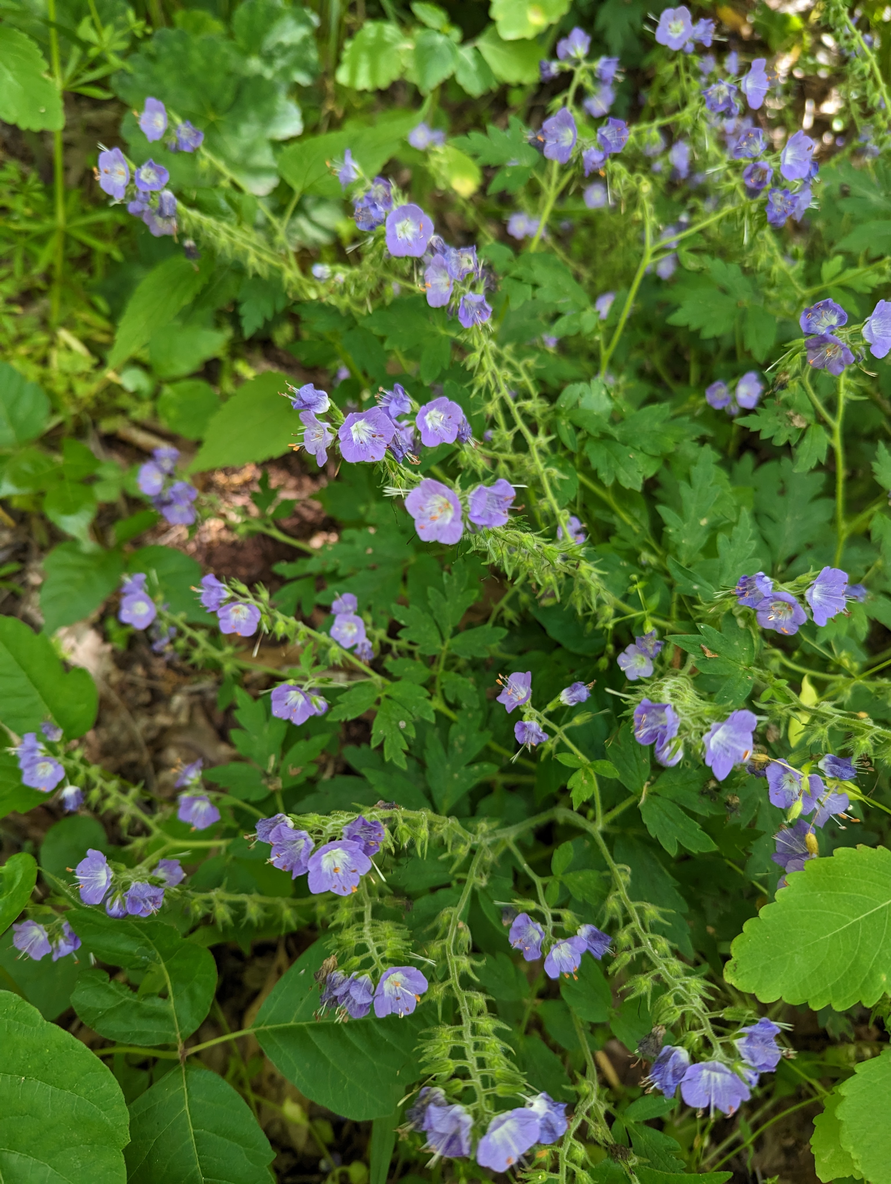
The trail hugs the Purlear Creek through a sea of New York Fern. It is a tight gorge and looks almost impossible to climb out of. There is lush and blooming vegetation for about a mile before the trail climbs up and away from the creek.

Wild Hydrangea 

Amadahy Falls

This is as close as I could get to the waterfall. The small creek puts on a big show here. Up close, the creek bed is loaded with glittering mica.

Broad Beech Fern

Sharpwing Monkey flower 


Drippy yellow blazes are standard fare, not that you could have gone anywhere else here. It was just too steep.

Wild Yam in full bloom

Galax

After leaving the creek and climbing out of the gorge, the remainder of the trail is on a gravel road closed to vehicles. 


This 1936 firetower was assembled by the CCC during their tenure here. They also build a cabin nearby which later served as the watchman's cabin. The tower is not open to the public although it looks like you could climb it. US Cellular has some equipment on it, so there may be some microwave exposure. 


Monday, May 22, 2023

May 20 Uwharrie Paddle - 109 to Dennis Rd


This PHOC paddle was arranged and led by Andrew White. There were 10 of us on the 7.4 mile float. A late morning start at 10:45am followed the 30 minute shuttle to Dennis Rd and back. The put in at the Rt 109 bridge has a nice slide for getting boats close to the water. The gauge was at 2.5, so a little low for this section.  


Leo was well behaved until the kayak got hung up and Leo jumped out. I think they have done this before.


The route has a series of small riffles and one class 1 rapid. Water velocity slows noticeably just before the splits and islands. Through here, the water speeds up again. 


We stopped on a pebble beach on river right for a quick lunch break. I saw Little Sweet Betsy Trillium here and at the put in. 


Just as I was pointing out a Prothonotary Warbler, this Barred Owl flew up from the riverside into a tree. Shortly thereafter a Bald Eagle launched from a tree limb. We chased a Great Blue Heron about halfway before it circled back.

Lunch on the rocks


We bounced on rocks all day. You had to pick your route carefully and read the water whenever we passed through a riffle. 


There were many folks out enjoying the river today. There appears to be many more private access points than I remember. There were two dredges operating. One was gas powered and the other by a car battery.


The final stretch has the class 1 rapid and very quickly, the buoy which advises power boats to not go further upriver, appears. From here it is just a short paddle to the take out.


Friday, May 19, 2023

May 17 Craggy Dome


Another 6000'+ peak. Last night, the weather was rocking and rolling in the mountains. In the morning it was foggy but not raining.  I got an early start, arriving at the trailhead (Craggy Gardens Picnic Area) at 8am. It is 48 degrees and overcast. There is water dripping off the trees and lots of wet vegetation overhanging the trail. I'm going to get wet and hopefully, not cold. 


The hike to the top of Craggy Dome and back is 6.7 miles, most of it on the MST. In the first half mile, I pass a gazebo with no view today and a large open air shelter. The trail is lined with Trillium Erectum. The ground is rich with vegetation. The trees are gnarly and large. 

Rose Twisted-Stalk

The trail is as rocky as it gets. Many flat rocks have been placed in the trail. That must have taken a lot of effort. Where there aren't rocks, there is mud. I slipped numerous times but never went down.


The sun never even made an attempt to break through. It was socked in all day until I finished hiking. Then it opened up into a sunny day. 


Meanwhile, I'm getting wet and footing is sloppy. The wildflowers didn't seem to mind the wetness. In addition to Erectum, I saw Painted and Yellow Trillium. 


The MST crossed the Blue Ridge Parkway and immediately after entering the woods, a side trail turned right. Alltrails lists this as the Reese Trail but there is no sign and it appears to be more of a manway than a trail. It headed up gradually and then steeply for .4 mile to the top. My pace slows to deal with the steepness and slippery footing. Toward the top, the trail turned into a cascading creek. Finally, I top out. It is completely socked in and there are no views. Once I found the highest point, I took no time to enjoy. I just turned around and started back. Coming down was painstakingly slow as I placed each footstep carefully. 

At the bottom, ready to the cross the parkway, I wonder if I'd be better off to hike the parkway back and not risk falling on slippery rocks. A quick look at my Alltrails map shows a tunnel along the road. So, that nixed that plan. Back into the woods I go.  

This looks like a yellow Erectum. Can that be?


On my return, I stopped in the large open air shelter to eat lunch. I'm back at the parking area by 1pm. Total hiking distance was 6.7 miles. 


May 16 Rattlesnake Lodge


In 1903 Dr  Chase Ambler from Asheville, began construction of his family retreat near Bull Gap. The photo above is the remains of the retreat's barn. 

During summer, the Doctor's wife and family of 5 children would spent summers at the compound. Dr Ambler would join them on the weekends, commuting from Asheville which is about 10 miles away. The family would take a carriage to Bull Gap where they had a carriage house. Then they would go by foot or horseback on a narrow trail to the lodge. This was done purposely to limit traffic to the family compound. 

 The name was given during construction. A number of snakes were spotted during construction and Dr Ambler offered a $5 per snake bounty. During that summer, 41 were killed. Their skins decorated the ceiling of the living room. 

In 1918, Dr Ambler's wife, Harriet died and he never returned to the lodge, selling it in 1920. A lightening strike in 1926 burned the building down. 


My hike was about a mile and a half walk in from Bull Gap, probably the same path the family took.  There was a very old locust split rail fencing along some of the path. About a mile in, there was a nice view looking southeast. The rest of the hike was in mature hardwood forest.


I passed a number of flowering plants and bushes. A number of Mock Orange bushes are along the trail. Purple Phacelias were in full bloom along with Wild Geranium, Spiderwort, Multi-flora Rose, Virginia Waterleaf, Flame Azalea, Stonecrop and Viburnum. 


Locust fencing along pathway


Above is the lodge's reservoir. It is located .2 mile up the mountain from the lodge. Water would collect here and be piped below. The reservoir would have been covered to keep wildlife out. 


Remains of the swimming pool, above. It would have been only a few feet deep. There were tennis courts too but I could not locate them. 

Another photo of the reservoir, looking at the inside.

The spring house was located close to the lodge remains. 

I think this may be the remains of the main lodge. 

      The lodge was two stories and had a balcony and footbridge which went over the roadway. 

During my hike, I met a group of 4 from Hendersonville. I ran into them several times. The finale time, I came up on them just after one of the gals had taken a spill and was scraped up on both elbows and one knee. She was shaky and lightheaded for a few minutes but after getting bandaged up, she was able to get on her feet. I walked out with them and gave the group a ride so they would not have to walk another 3 miles to another trailhead. 


Saturday, May 13, 2023

May 4 Green Swamp


The Nature Conservancy owns this 15,000+ acre preserve. We were in the area and I had hoped to see Venus Flytraps bloom. You may be wondering why an insectivore would have a bloom. Well, it needs to pollenate just like other plants but it also wants to consume insects. So the pollenating bloom is on a stem rising up and away from their clam shell trap. They were not blooming during our visit.


When a bug land on it, the trap begins to close but waits for a second contact within 20 seconds before closing all the way. They need a couple bugs a month to thrive but can live without insects, just at a slower rate.


This time of year, this is what to look for. The flower stems have a yellowish bud and are away from the base of the plant.


Pitcher plants occur here in great quantity. There are thousands. We saw a number of ants awaiting a fall into the digestive juice pitcher. The plant surface is slippery when wet, allowing ants and insects to fall into the pitcher. The insides are lined with downward facing hairs which make it more difficult to escape. 


And finally Sundew. It was everywhere.


Apr 20 Waterwall on Walker Creek

  Waterwalls redirect floodwater back into the creekbed. There is one very near the Uwharrie Trail on the Walker Creek section. This one is ...