Wednesday, January 31, 2024

Jan 29 Hannah Creek


It started out as just a hike to check out some trees reported across the trail. All four blowdowns were on the Birkhead Mountain Trail near the Hannah Creek crossing. After looking at the blowdowns, I proceeded to the creek to see how the trail looked south of there. 


Here is the creek crossing. Too much water to make a crossing on a cold day. Opting to see how the ford at Plantation Road looked, I hiked through the thicket in the floodplain. 


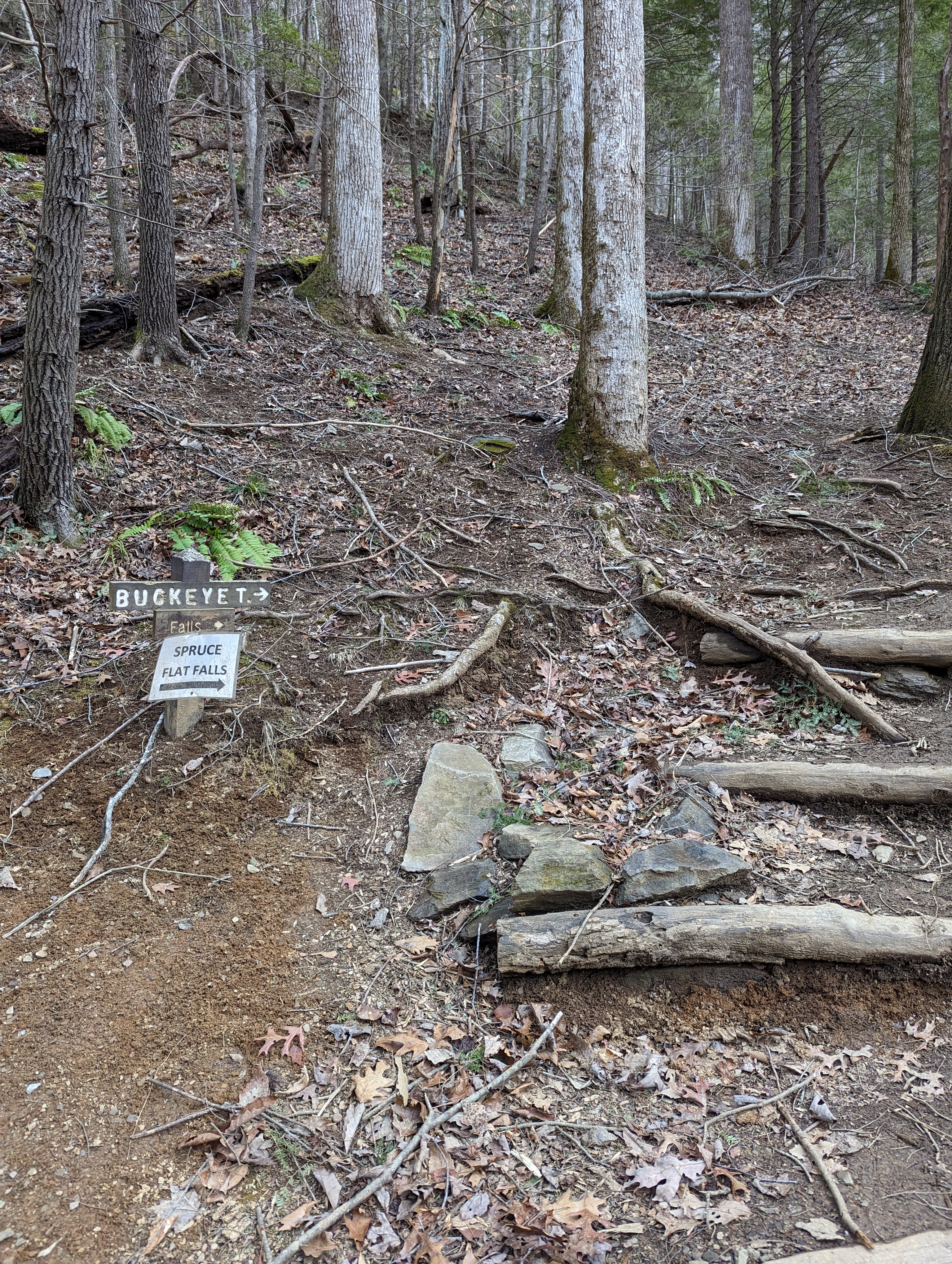
Here is the sign where the Uwharrie Trail used to cross the creek. The bridge is long gone and building a bridge so deep in the wilderness would be a monumental effort. Wilderness rules prohibit motor vehicles, battery tools, wheeled vehicles, chain saws, helicopter drops and so on.

Channel cut alongside the creek

Now, it became a challenge to cross the creek safely. The ford was too deep and the usually good spot to rock hop across next to the ford looked iffy. I continued to a bend in the creek. This spot pictured above, is a 600 foot long channel dug beside the creek. It is filled with standing water today. 

Large pile of rocks


There is a large pile of rocks upcreek where the channel begins. It does not look a dam, just a huge pile of rocks. It looks like there must have been a purpose for all this but it was not apparent to me. This area can be accessed off the trail to camp 6. Beyond Camp 6 is a manway that follows the creek for a quarter mile of so before petering out. 


Further upcreek where Plantation Road crosses the creek a second time, there is a dam. Joe Moffitt wrote that Kit Bingham had a gristmill here but this looks more like a detention dam than a grist mill dam. 

Breeched dam on a tributary 

Near the dam is another small dam on a tributary. This one looks to have impounded a large area. 


Joe Moffitt wrote that Christopher "Kit" Bingham established a plantation near here about 1780. Remnants of a home at the junction of Plantation Road and the Uwharrie Trail could be his place. Plantation Road heads downhill there for 1/2 mile to the creek and dam. 


Finally, I rock hopped across the creek to check out the dam on the other side, then headed upcreek. A sizeable tributary enters and the creek narrows and begins to have more declivity creating small drops and cascades. 


After leaving the creek and hiking offtrail in the expanse bordered by the creek, Camp 3 and Birkhead Mountain  trails, I came upon a chimney fall with a large rusting pipe like a large chimney pipe. No other signs of a home here, so perhaps it was a small cabin. Once I crossed the Birkhead Mountain trail between "Old Road" trail (as Don Childrey labels it) and Camp 5, I entered a wonderful weep of Christmas ferns and Running Cedar. I followed this weep until it ended near a tributary of Robbins Branch. It was a nice 8 mile circuit once I reached the Robbins Branch Trailhead. 


Monday, January 29, 2024

Jan 28 East Morris Homesite


This may be the largest standing chimney in the Uwharrie Forest. There appears to be a second chimney fall associated with the home. The footprint of this house was quite large. The remnants of the front steps is also evident.


The home overlooks a large flat area alongside Spencer Creek. The creek was rushing today and the flat area had a number of pools of standing water. There is a USFS food plot within site which may have been part of this home's farm.


The chimney's construction is similar to that of most I have seen in the area, stackable stones with a dirt/clay mix, no mortar. There were a few hand formed bricks in the lower part around the firebox.


About 150 yards from the home is this area of  Yucca, also know as Beargrass, Spanish bayonets, Adam's needle ans probably more. Many old homesites will have a Yucca nearby. Although, not native in the east, they have naturalized here. They are easy to grow in almost any soil, can tolerate droughts and the leaves can be stripped and used as cordage. I've read that the fibers were often used in smokehouses to tie and hang food for smoking. 


Daffodils are at almost every homesite I have seen. They pop up in January and will bloom in February as a sign that spring is near. The green stalks will disappear by summer but the bulbs will live on underground. 


After completing a tour of the old homesite, I walked a loop encompassing the UT, Barnes Overlook and Morris Mountain roads. 

Panther Branch UT crossing


Porcupine Mushroom

I know everyone calls them Hedgehogs, but I like Porcupine. They look somewhat like golden chanterelles on the ground but once you turn them over they are covered in structures resembling teeth. They are edible but I have never found more than one at a time so, I don't forage these. 


Friday, January 26, 2024

Jan 24 Spruce Flat Falls


Located on a rough trail from the Tremont Institute, this waterfall does not appear in most hiking guides (Ken Wise's 1996 guide does include). It is a spectacular cascade of falls and less than a mile from a parking area. I have visited it once before, in the summer as I recall. On that trip, I had to take off my boots and pants to cross Middle Prong River. Today, Middle Prong is swollen with snow melt. Crossing is not an option.


Not many folks know of this waterfall. It is well know by kids and adults that attend programs at the Tremont Institute. Parking is quite limited at the Institute. There is a Visitor Center operated by Great Smoky Mountain Association. A small weather station is located near the building entrance.


To hike, follow the gravel road up to the Institute dormitory building where the Lumber Ridge Trail begins. About 50 feet further is a trail junction and an old trail sign pointing right, signed "BUCKEYE T". The trail is rough and quite muddy today. The wind was active with several howls that send waves of leaves speeding by us. A couple bursts registered at "scary level". Pick your way through many exposed roots, rocks and stay high away from the unstable trail edge keeping you from tumbling down a steep drop. Look for an acute left turn just before the water tower. We missed that turn and had to backtrack to find it. 


Once you have climbed away from the water tower, Middle Prong will be present below on the right. It was a torrent today. About .7 mile from the start, you will see the waterfall. At first you can see the main and final drop as well as another upper drop, in photo below. 


However, as you approach further, only the bottom drop will be visible, photo at the top of this blog entry. Today, despite being 60 degrees, the left side of the waterfall was a column of ice. The temperature did not get above freezing for several days prior to today. 

I've read that there are four drops with only the last 2 viewable from the trail. To see the first two drops, one must climb up above to view them. There is also a manway from Lumber Ridge Trail that steeply leads down to them. The spray from the waterfall has created well iced rocks in the plunge pool vicinity. We were unable to get near the plunge pool today. 


Right below the falls are a series of smaller drops, photos above and below. Spruce Flat Branch shortly enters Middle Prong. In the photo below, you can see Middle Prong and just beyond it, the park road. The waterfall is not viewable from the road, though it is so close.


Tuesday, January 23, 2024

Jan 23 Baskin Creek Falls on Ice


It's the second day of 2024 Wilderness Wildlife Week in the Smokies. The weather has been cold and snow is on the ground. Our hike to Baskin Creek Falls is led by the delightful Keith Garnes. Keith's resume is impressive. He is involved with a friends group supporting a Tennessee state park, he's a hike leader, former LeConte Lodge winter caretaker and many more outdoor oriented activities. Today he is leading us on a short hike to the falls. But wait, the road is closed and we can still do the hike but we have to add 3 miles of a roadwalk in order to do it. Some folks drop out but I'm game for a 7 mile hike in the snow.


This short hike to Baskins Creek Falls, normally is just a 4 mile out and back on what isn't a difficult trail. However, there is snow and ice on the trail and this short section of trail was littered with downed trees. It is a high wind area and it certainly looks like it has seen some high winds this winter. There will need to be a concerted effort by trail maintainers to clear it.


It was a slip and slide down to Baskins Creek. The last 200 feet were very treacherous. Keith donned his microspikes and crossed the creek to get a few photos. The rest of us stayed on this side and had lunch.


After visiting the waterfall, we retraced our steps back. This time, the trail was more muddy than snow covered. It seemed there were more trees across the trail than on the hike in. 


One in our group had developed significant cramps. We had no option but to continue walking out and onto the closed road. She was in great pain by the time we finished. 


It is always a nice hike to Baskins Creek Falls. This was no exception. A great hike in the snow.


Monday, January 22, 2024

Jan 20 Hardaway Site


Here it is, National Historic Landmark - Hardaway Site. Every American archeologist knows of this place. I have known of this place for decades but it was off limits and still is. Three Rivers Land Trust arranged with Morrow Mountain State Park for a visit following a lecture by Randy Daniels of East Carolina University, at the 1913 Badin Inn. 

It was a packed house for the lecture. Travis Morehead, Executive Director of TRLT gave introductions followed by Randy Daniels lecture. Daniels, a university professor, gave an excellent account of the Native American historic presence in the area, the quarry and excavation sites nearby. 

Dr Randy Daniels

Besides Hardaway, two other significant archeological sites are nearby, Lowders Ferry, now under the parking lot at the Morrow Mountain boat launch, and Doerschuck, named for amateur archeologist Herbert Doerschuck. The points, tools and lithics from these sites came from stone quarried nearby. The majority of this stone came from Morrow Mountain. Other mountains in the area may also have contributed to the tool making going on. The stone from Morrow is Aphyric rhyolite which has a lava banding pattern (like a Zebra). From specimens in Hardaway, 68% are that type of stone. The second most numerous stone found is Porphyritic rhyolite, a speckled stone. These likely came from other nearby quarries. 

Daniels and Dr Bob Butler of UNC teamed up around 1990 to determine where the stone found at Hardaway came from. It was not obvious that Morrow Mountain was the source. There are no rhyolite outcrops on Morrow whereas nearby Stony and Biles Mountains are loaded with huge rhyolite outcrops. Eventually, Daniels and Butler realized it was Morrow and the reason there were no outcrops was because the Native Americans hammered the stone away. Although, the CCC and state park built a parking lot and picnic area on top of Morrow, there is much more up there. Daniels and Butler located debris from the quarry which was as much as 6 feet deep. If you walk the trail around the top of Morrow, you'll see stone debris everywhere. 

Daniels calls Hardaway a base camp associated with a quarry. It is thought, the native Americans hammered large chunks of rhyolite from outcrops and brought them to Hardaway and the other sites where they could be crafted into tools, primarily points and scrapers. Both Lowders Ferry and Doerschuck where in the flood plain of the Yadkin River. Hardaway was on top of a hill next to the river. When these sites were excavated, the strata from the two flood plain sites showed artifacts from Woodland, Paleoindian and Archaic cultures separated by strata of debris from floods. Hardaway had clean strata levels dating back to Archaic and possibly Clovis cultures. This makes the site at least 9000 years old and possibly older if the sites dates to Clovis. Lowders and Doerschuck were not dug as deep as Hardaway due to their closeness to the water and concern about the holes collapsing. 


Daniels explained that Hardaway was not continually occupied. Bands of people of those earlier cultures, likely traveled in circuits throughout the year accessing resources that would help them survive throughout the seasons. Possibly, the shad run was the time to be by the Yadkin where could also restock their toolkits and points. In order to know the range of these bands, Daniels traveled throughout the Carolinas and Georgia to visit local collections of scrapers and points. Morrow Mountain rhyolite was found in a large oval area extending into South Carolina and central North Carolina. The western boundary of this area was the Catawba/Wateree/Santee River.  Although Morrow Mountain stone does occur outside this area, it seems obvious that those that visited Morrow Mountain to make points and tools, traveled within this area and may have traded outside the area where fewer specimens were found in local collections. 


Hardaway is named for the Hardaway Construction Company from Georgia that was the lead contractor for the Badin Dam. Completed in 1917, the dam supplied electricity for the Carolina Aluminum Company. In the late 1920s, an employee mentioned the site to Herbert Doerschuck, a local electrical engineer, amateur archeologist and collector. Doerschuck probably dug some at the site before telling Joffre Coe, a UNC professor of archeology. Coe did not dig the site until 1948 and continued to 1980. Later digs were performed but nothing has taken place for more than 20 years. The site has been reclaimed by vegetation and time so much so that no one on this outing could find the location of the dig. Supposedly, Coe left a mark on a rock to locate the spot but we were unable to find that. 


After the lecture we traveled by vans to the Hardaway site. It is located within Morrow Mountain State Park. We traveled through a couple gates to get to the site. The park has video cameras in the area which alert park employees by cell phone when motion is detected. One employee told me that they do get photos of trespassers. There is occasional looting happening now but not like the looting that went on years ago. Much of the surface layer was ravaged by pot hunters after Coe published some early findings in a scientific journal. 

Even though we didn't find the site, it was a great experience to see the area and understand what has gone on there for over 10,000 years.


Thursday, January 18, 2024

Jan 3 Cedar Creek Dam


Cedar Creek near Asheboro is a tributary of Back Creek and eventually Uwharrie and Pee Dee Rivers. Waterways on the east side of Asheboro empty into Deep River which flows into the Cape Fear. 

Just downriver from this dam is a Carolina slate quarry which is likely the source of the stones used here. It appears the dam was built at a spot where river left sports a high bank anchored by a large rock outcrop. River right has a floodplain. The floodplain is about 200 feet before the terrain rises up. The stone portion of the dam is about 100 feet long and there is an earthen dam for another 100 feet. It's puzzling that there is an outlet, shown above. Behind the dam at this point is solid earth with trees. That leads me to wonder if that earth accumulated there after the dam was built. 

On river left where the dam joins the steep outcrop, there is a 6 foot opening. The creek no longer flows through it. It appears where the stone dam met the earthen dam, the creek breached the earthen dam. That is where the creek bed is now. 

Back of the dam 


Dam opening

Dam opening

The dam is offset here at the opening. My guess is that this is the original creek bed. I think this dam was built for water power and not like the Caraway Dams which controlled flooding and retained silt. 

Front of dam


This appears to be where the earthen dam was breached


Apr 20 Waterwall on Walker Creek

  Waterwalls redirect floodwater back into the creekbed. There is one very near the Uwharrie Trail on the Walker Creek section. This one is ...