Saturday, February 21, 2015

Feb 21 Cedar Rock Mtn & Betty McGee Creek


Today's hike was to be a coalition of 3 MeetUp groups and the Uwharrie Trailblazers, leaving from a Wildlife Resources Commission property to Cedar Rock Mountain with stops at Camp 3 and the Dowd Mines. As the week and forecast unfolded, it ended up being just 5 of the Trailblazers leaving from Tot Hill Trailhead. We had to forgo all but the Cedar Rock destination due to some time constraints for a couple of the hikers. So, our route was from Tot Hill on the Birkhead Trail to the trail to Camp 3 Trail. I'm sorry to not have a name for this trail. It has evolved this way without a name. About half a mile along this trail is an old road leading left with a berm across it. This is our route to Cedar Rock.

At the .7 mile mark on this trail, just after crossing a small creek, there is a chimney fall with foundation on the left. Among the debris here is an old iron kettle. This is also our spot to leave the old road and just head up Cedar Rock. It is a short climb. Today, it was icy and the two of us with Katoolah Microspikes had a definite advantage. Above is the scene from the top. It is quite different from any other Uwharrie spot. We could clearly see Mt Shepherd today. 


Our group of 5 parted ways here. Deb and I explored the area near the base of the mountain while the other 3 headed needed to retrace the route and head to Little Long Mountain for a scout project. I had previously seen many rock outcrops in the area and wanted to explore them more. We headed in the direction I remembered them to be. In the distance, what appeared to be a chimney, could be seen. Almost fully intact, this is a rare find in the Uwharries. It looked to have been a substantial home with a partial rock wall on one side.


We continued on, in the opposite direction in which I had intended. I wanted to see what else might be out here. We encountered a number of rock outcrops with piled rocks around them. Also, we spotted the two stone walls below which also were atop small rock outcrops. It is my guess, the area was cleared for pasture land.


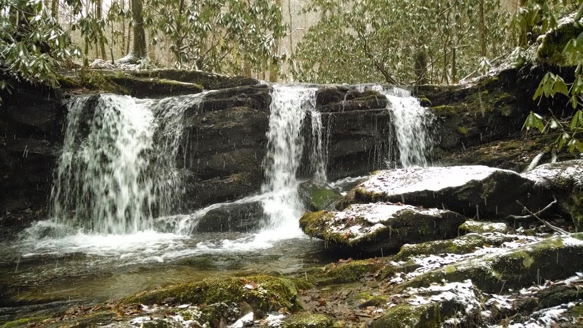
We followed a creek for quite some distance beyond the rocky area. Finally, I decided to take out my gps and see if I had Tot Hill as a waypoint. I did and we were only .9 mile away. The creek we had been following is Betty McGee Creek. We needed to hike over to the Talbot Branch drainage to get to my vehicle. This turned out to be a rather nice walk in mature forest. We did encounter an old road and walked on it until it ended at a spot very near the footbridge over Talbot Creek. We made our way down the hill to the trail and were back at the trailhead. Total miles were between 5 and 6.


Tuesday, February 3, 2015

Jan 28 Mt Cammerer in Snow


Our group of 9 is led by Tennessee State Park Ranger Marty Silver from Warrior's Path State Park. Marty has led many of my most memorable WWW hikes. Today is no exception. His first choice, Road Prong/Sugarland Mountain was inaccessible due to closed roads. That route would have involved a short scramble between Sugarland Mountain and Chimney Tops Trails which I was looking forward to but who can argue with closed roads and a hike up Mt Cammerer?


Low Gap Trail seems never ending today. The snow slows our progress some. Again, despite the frozen temperatures I am sweating and can't see through my foggy glasses for most of the climb. 


We are treated to spectacular rime ice on the trees. When the sun rises and pokes through the gap, the trees glisten in the sunlight. Everyone comments constantly about the scene. Marty stops at regular intervals to allow everyone to catch up. He points out various tracks in the snow. He spots, red squirrel, fox and mouse tracks. We see a few chickadees and juncos as well. 


Finally, we make it to the gap and the AT. I am looking forward to hiking on what I think will be easier terrain but the trail continues up for most of the 2 miles to the spur trail leading to the tower.


The 8-10 inch snow makes hiking difficult. I try to step in footprints to make it easier. We are treated to very nice westward views along the ridge. I am glad to see the spur trail. There is a bit of rock scrambling to do just before reaching the tower.


Inside the structure it feels as if it is heated. We are out of the wind and the sun has warmed it but there is still snow on the floor. Everyone huddles inside to eat lunch. We calculate our return hike and make the call for the pick up bus, only to find it is already en route. 


Views are tremendous in all directions. Sterling tower is clearly visible. I-40 disappears on its way toward Newport. Sunglasses would have been helpful as the snow reflected the brilliant sunlight today.


The hike back was about an hour quicker than going up. I stayed warm the entire way. However, there were a couple others suffering on the return.


I am so glad I was able to experience this mountain in these conditions. It was my last WWW hike this year. The event is moving to May in 2016, so we may not have these opportunities as often in the future.

Jan 27 Greenbrier Trails


Once again, not hiking with WWW today; just out with two friends. Our plan is to hike up Little Rhododendron Creek to the Grapeyard Ridge Trail. Then go off trail to a couple spots before continuing to Injun Creek Trail. 


We are treated to some very nice waterfalls along Little Rhododendron Creek. Today, the water is higher than normal but we manage the creek crossing which sometimes causes trouble. The lower part of the creek has an old roadbed along it. Once we get close to Grapeyard Ridge Trail, another old roadbed is alongside the creek but this one originates from above not below. 


Once we are hiking along "the Grape", I look for the manway leading to the "stone cube" (above). This structure may not have had any purpose other than as a repository for rocks cleared from a field or pasture.


Once back on the trail, I am now looking for the Dodgen-Rayfield cemetery. The guide says to look for a pile of rocks near the headwaters of the creek. Long before the headwaters of the creek, there are 3 white stones trailside. We stop and make note of this. Then I spot a cross carved in a tree. We follow the very faint manway, occasionally blazed with carved crosses in trees. It leads up up a steep old roadbed to a cemetery (above). After rereading the guide, I do not think this is the cemetery mentioned. We do spend some time here. The oldest graves date to just after 1900.


You can't pass this spot in the trail where an old steam engine has fallen in the creek, without noticing it. It is my understanding, this engine is the genesis for the creek's name, Injun Creek.

We hike the remaining 3 miles down Injun Creek Trail to the ranger residence to end our hike. Along here, we note it is odd that the park does not officially recognize this trail but maintains it with a number of log foot bridges. We also see a large group of Pine siskins along here. We encountered a smaller group earlier on Little Rhododendron Creek.

Jan 26 Ramsey Cascade


Today's hike up to Ramsey Cascade is led by Charles Maynard of Maryville. Ray Sellers is the sweep. We have 13 on this WWW hike including those two. We anticipate it will rain some today. Instead we have snow almost all day. The wind is blowing too. By the end of the day, there is 3 inches on the ground and another half inch went down the back of my neck. The first log bridge is one of the highest and longest in the park. It was a bit intimidating for a couple hikers. It is at this point, Ray decides to stop and wait for us on the return. At 87 and with only one functioning lung, I don't see why he decided to stop. The rest of us continue.


The second log bridge has an unusual design. It appears to be of newer construction. As we head to the waterfall, our group spreads out with about a 20 minute gap between first and last. There is one tricky little water crossing not far from the waterfall. In non-icy conditions, I wouldn't even notice it.


The rocks near the falls are covered in ice and snow so most of us eat lunch standing up. Even with the coldness, I have sweated most of the way up. The long rest here is quite nice. The waterfall is quite attractive in the snow.


On our return, we meet Ray at the long and high log bridge. Again we spread out with even greater gaps on the way down. I am cold and wet when we finish, but the waiting bus is toasty.


Jan 25 Lower Mt Cammerer


It is my first day at Wilderness Wildlife Week and I have chosen to hike by myself on a trail I've not been on before, Lower Mt Cammerer. The trail is about 7.5 miles long but doesn't start right at the Cosby parking area. You begin hiking on Low Gap Trail. I have already decided before hiking that I will not do the whole distance as it will require double the miles. My plan is to stop at a landmark so I'll be able to easily find that landmark while hiking from the other direction, thus hiking the entire trail over the course of two trips. 


Just outside of Cosby trailhead, is this spring by the side of the trail. It is obvious this area was lived in and farmed at some point in the past. For a few miles I'm hiking on an old roadbed. The first place of note, is Sutton Ridge overlook. The overlook is located up a short spur trail and has nice views toward Gabes Mountain. I can also see what appears to the Mt Cammerer firetower.


Continuing, the trail weaves in and out of coves, never deviating much in elevation. Certainly there are no landmarks here. It all seems to repeat itself. There is one set of footprints in the snow. When I arrive at campsite 35, there is a couple just leaving. They have been out for two nights in some rainy and snowy weather. Today is a fine day though. They tell me, they hiked up to the tower yesterday.


After leaving the campsite, I begin to look for a landmark to turn around at. Again, the trail seems to repeat itself with nothing standing out as something I'd recognize again. Finally, I come to the manway up Groundhog Ridge. It appears that the backpacking couple took this way up to the tower as there are two sets of prints going up and down. This is my turn around spot. I end up walking about 12 miles today.

Apr 8 Eclipse Party on Little Long

  April 8th on Little Long Mountain along the Uwharrie Trail. Thanks to Ciara and Wilder Uwharrie Trail Running for organizing such a fun ev...