Monday, December 21, 2015

Dec 20 Walker Creek


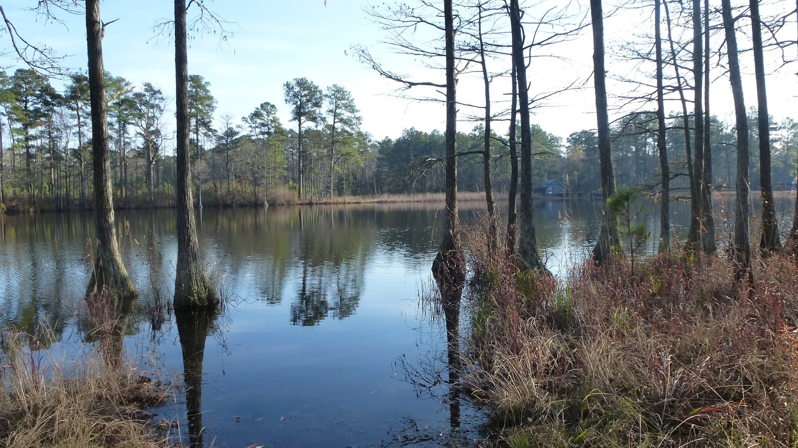
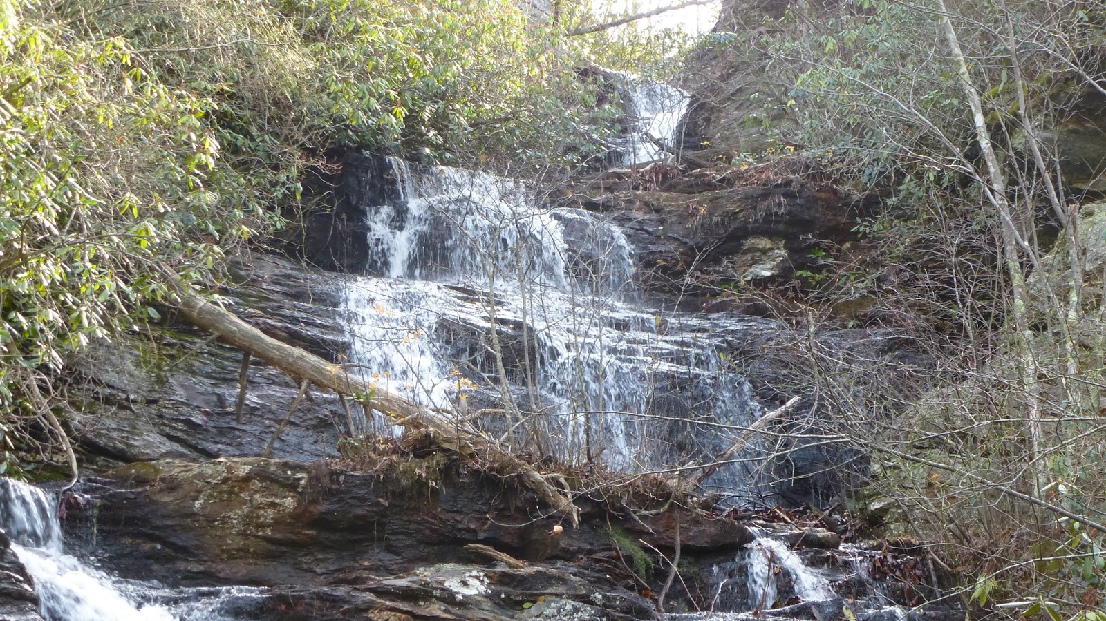
After doing some trail scouting in the Walker Creek area of the Uwharrie National Forest, I decided to try to walk the length of the creek in the National Forest. Beginning at one end, I walked along an area which looked as if it had been impounded once. Suddenly, the creek dropped several feet in a short area, as seen above. I watched an otter slide down the cascade for a moment. When it was out of view, I turned around. There facing me, not 40 feet away, was a waterwall. I understand these are referred to as detention dams, outside Randolph County. This one was only on  one side of the creek since the topography on the opposite side was steep. The purpose of the waterwall is to slow and redirect floods. Once these lands were fields and pastures and the rain runoff was much greater. I've been told they protect something downcreek from getting flooded.


This is a top view of the waterwall. Note the upcreek side is tapered. Both of the waterwalls I've seen on Walker Creek, had wide flat areas upcreek from them and narrow gorges downcreek.

I looked around the area to see if I could see anything else of interest. There were some pits and an old road but nothing else. Not too far from here is an almost fully intact chimney as well as a well defined old road which fords the creek at a low spot.

Walking upcreek from here, I switched back and forth from side to side looking for anything of interest.


This spot in the creek has a huge pile of rocks in the bed, forcing the water to one side.


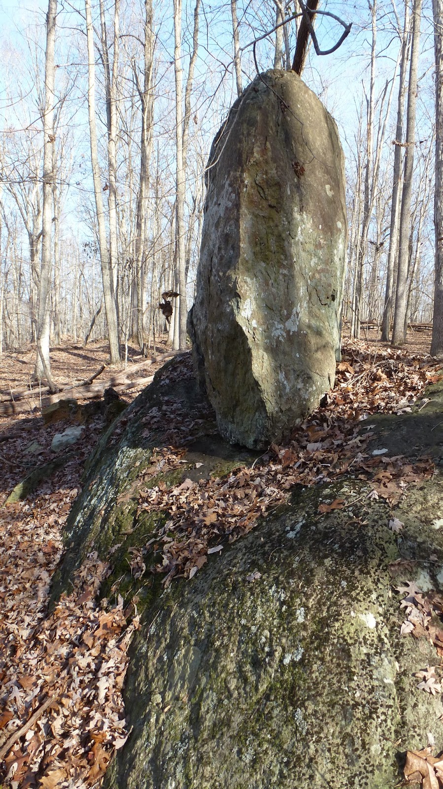
As the banks began to steepen on both sides and the laurel thickened, I had to climb up out of the gorge and walk in open forest on creek right. It is here, I located these outcrops of rhyolite which appear to have been worked, possibly by Native Americans.


Crossing over to river left, I came into an area recently occupied by beavers. They had gnawed this tree down and then gnawed shorter pieces. I looked up and down the creek for signs of a lodge but saw none. 


Some large rocks near the creek caught my attention. I followed them through the laurel to the creek. The rocks continued in the beyond the creek. They created a small island in this area. I was so enamored with this spot, I spent the better part of an hour here sipping on hot tea and eating lunch.


From there, I followed the mostly docile creek to the big waterwall. Knowing this is an archaeological site the Forest Service wants to protect, I wanted to find a trail route which would bypass this structure. A side creek enters Walkers Creek here. I followed it up and along a potential new route. I kept running into rock outcrops which appear to have been chipped away. For that reason and the fact I was so close to private property, prompted me to decide this was not a viable route. I'll be back again soon looking for that route.

Saturday, December 19, 2015

Dec 18 Hike up Pilot Mountain


My goal is to hike the new Mountain Trail which combined with the Grindstone Trail, encircles the base of the mountain for about 5.5 miles. The new trail starts out in beautiful mature hardwood forest. Some signs of disturbance are seen in the first mile. The land is relatively level and probably good crop or pasture land. After passing the junction with the Corridor Trail, I began thinking about all those stone steps on the Ledge Spring Trail. I wasn't sure how to get to the Ledge Spring Trail from the new Mountain. Suddenly, a large boulder caught me eye. I had to go investigate. It was the size of a small house. Pilot Knob loomed above. Not too far, I thought. So up I went.


It was steep but open forest. The only obstacles were downed trees. As I neared the base of the knob, it got steeper and strewn with fallen trees and rocks. The last 100 feet were slow. I slipped back a couple time during this Sysphean  scramble. 

Looks like Oyster Mushrooms

It is just a short distance to the Jomeokee Trail


After lunch, I headed down Grindstone. Realizing that there was no official trail connection here to the new Mountain  Trail, I headed down through the woods on an old road. When the road leveled out, I found a spot between laurel thickets and continued down until I popped out on the Mountain Trail.


Here is how the new trail looks. In this vicinity, the trail is also a fire break. In less than a mile, I was back on the Grindstone Trail and then in the campground. 

Dec 16 Morrow Mountain Hike

Debris field on Morrow

Beginning at the Visitor Center, I first ran into a maintenance employee. He let me in the refurbished hall. The floors had been sanded and it looked very nice. He then mentioned the various issues they were having with stone work. Mortar in the Carolina Blue Stone floors and walls, was coming loose. They were trying to keep up with the most obvious damage but there was so much more. The entire wall along the parking area on top of Morrow was falling apart. The stone patio in back of the VC was in need of repair as well.

I began my hike toward Morrow Mountain. The trail is gently rolling until you get to Morrow. Then it gets steep. I hiked up and then around on the top loop, staring at the ground. Here the debris field from the prehistoric quarry is all around and under the trail. After having a snack at the old picnic shelter, I headed down through the wood off trail until I ended on the road. About 3/4 of mile later I located the Sugarloaf Trail and hiked up to the top of Sugarloaf. Then down and back to the VC. 

Yadkin & Uwharrie form the Pee Dee

This map shows a fish weir in the Pee Dee about the spot where the Uwharrie and Yadkin conflow. That spot is now under Lake Tillery. While visiting this spot after hiking, I saw a Kingfisher, just like the one pictured. Also, at this spot is a lot of mistletoe. The one below was displaying some berries.

Mistletoe berries

The seeds are spread by birds which eat them. There is a sticky substance on the seed which adheres to wood. The seeds contain a slight root tissue which begins to grow into a host tree while the seed is stuck to it. The Mistletoe provides its own photosynthesis until the mistletoe has worked its way into the host's conductive tissue. Once this has occurred, the host provides the mistletoe water and nutrients. Occasionally, the parasitic mistletoe will kill a branch. 

One variation of the mistletoe tradition of kissing underneath it, goes that for each kiss a berry is picked. When all the berries are picked, the kisses stop.

Dec 12 Bird Island at Sunrise


Bird Island not Easter Island


Hundreds of birds are huddled on this sandbar right at the NC/SC border at the very southernmost point on Bird Island. I can see Ringbills and Laughing Gulls.


Dec 10 Carvers Creek State Park


Today's outing is at Carver's Creek State Park just outside Fayetteville NC. It is a new park, just having been transferred to the state by the Nature Conservancy in 2010 and opened to the public in 2013. About 1400 acres of the 4000 total acreage was the Colonial Revival winter estate of James Stillman Rockefeller and his wife Nancy Carnegie Rockefeller. James was the grandson of William Avery Rockefeller, co-founder of Standard Oil along with his brother John D. Rockefeller. Wife Nancy was granddaughter of Thomas Carnegie, brother of Andrew Carnegie. She grew up on Cumberland Island, Georgia where the Carnegies and Rockefellers both owned estates.

The property was acquired from the Rockefeller estate after his death in 2004. Some of the tenants were given lifetime leases to remain on the property. There is still one elderly couple residing in the park. 

It was difficult for me to understand the attraction of this land to Mr Rockefeller. It is part farmland and Long Leaf Pine plantation. The mill pond was created in 1850 and has a solid stand of Cypress trees. During our tour of the estate, we learned James was stationed at Fort Bragg in 1937. I'm guessing that barrack life didn't suit him.


Walking trails are limited in the park. There is one heading out to a pier along the mill pond. Cypress trees encircle this end of the mill pond. Besides jogging the short trail and park road, the main activity here is fishing. 


Tours of the estate are offered a few times throughout the year. I made prior arrangements to attend today's tour. Having arrived early, we walked the one short hiking trail along the pond. While waiting for the rest of the tour group to arrive, we annoyed resident fire ants. The small group of 5 arrives and is led by a local volunteer. Our tour begins, first with a warning about the peeling lead paint; "don't put any in your mouth". It sure looked tasty but I resisted.


Entering the house we are greeted with peeling paint, a vinyl floor which screams 1970s and Ceil Tex ceiling. Park staff had done work cleaning the panes of glass throughout the house, so they looked spiffy. First rooms were Miss Betty's quarters and the kitchen. Miss Betty seemed to run the household. She too, was given a lifetime lease to reside on the property. She has since passed. The kitchen looked like a typical 1970s era kitchen with dated appliances. Of course the Rockefellers rarely entered the kitchen and had little incentive to renovate, like they did in their living quarters. 


Other than the kitchen and bathrooms, wood floors were throughout. Wood or beamed ceilings are in those rooms as well. Every room had a fireplace. The room above is the dining room. Each corner of this room had a string cross the corners where Mr Rockefeller hung wishbones from chickens. Saving wishbones was a British custom which became popular here as well. However, saving them did not convey good luck. They have to be pulled apart after drying by 2 people, one on each side. The one with the larger piece of the wishbone after it is broken, gets his/her wish. Wishbones on good luck post cards were popular in the early 1900's.


Here is the back of the house. Although as you approach the house from the state park entrance, this is what you see. The other side faced the mill pond.


Now we are looking at the front of the house. Two artillery shells flank the front door. 

Our tour guides says the master plan for the park includes renovating the house, making it suitable for events and weddings. Where will that money come from? He doesn't know. Based on what I have seen, it appears very little has been done to the house in the last 25 years. The last renovation looks like it occurred in the 1970s. The fact that nothing has been done about the peeling lead paint, despite a dozen years of Nature Conservancy and State ownership, indicates even "band aid" repairs aren't being done. 


Thursday, December 10, 2015

Dec 6 Betty McGees Creek

Cut bridge over Betty McGees Creek

Beginning at Tot Hill, I had intended to hike to Cedar Rock Mountain and then follow Betty McGees Creek back to the Gray Owl area. However, starting out, I decided to reverse it, to see if I could locate the Gray Owl woods road from my direction. At the first campsite on Talbot Creek, I headed into the woods, crossed a tributary and then up steeply. At the top of this ridge, there was a campsite with much trash. In a minute or two, I had located the woods road I was looking for and followed it toward Gray Owl Road. I saw many reflector pins in trees along here. Nearing Betty McGees Creek, overgrown fields were on both sides of the woods road. There was one spot of large rocks here. At the creek, there was an old bridge made of telephone poles which had been cut and fallen into the creek. Thus, 4 wheelers would have a difficult time accessing this old woods road.

House beyond Gray Owl Rd

Just up from the creek is an old house. The only other time I have been here, maybe 12-15 years back, it was private property but no one was living in the house. Although the electric meter was still working. Since the occupants moved out, it appears the house was used as a deer hunting base. There are posters of deer on the inside walls. Also, the kitchen appears to be set up as if it were used by a group. 

Not all the windows are broken

In a large white oak about 40 feet from the house, is a large wooden deer stand with a tin roof. The latter going up to it is missing the first few rungs. Behind the house is a collapsed building. It had a partial basement but the tin roof is laying in the hole now. It is full of other appliances and junk.

Early Uwharrie decor

Welcome

Big rock you can climb up

After leaving the structure, I decided to follow Betty McGees Creek. Rather than retrace my path on the old woods road, I walked into the woods to cut an angle back to it. In doing so, I found an area of huge rocks with pits dug beside them. The pits were similar to pits seen in the Doud Mine area. One of the rocks had a handmade ladder on it. Most likely the ladder came from an old deer stand.

Toaster rock

And then there was this odd rock which looks like a piece of toast has just popped out of a toaster. Leading to the creek from this rock is a straight trough about 2 feet deep. I could not find any source of water here. Once at the creek, I headed upcreek. At one point I saw some trash but upon investigation it turned out to be a prospectors cache with shovel, scoops and pans for panning gold. Eventually, I entered the area I am familiar with. There are piles of rocks stacked up around rock outcroppings. there are neatly built stone walls about 20 feet long. Then there is the partial chimney and foundation wall. A very old road runs through this area. Not far from here you are at Cedar Rock Mountain. 

Cedar Rock Mtn homesite


Rather than walk back on trail, I decided to walk back along the Dassow property. I was surprised at the number of flagged routes I encountered here. This area is well on FS land. These seemed consistent with deer hunter flagged routes. Being so far from road access, it must be a good hunting area to make the long walk in and out worthwhile. Some of these routes crossed onto the Dassow property which was fairly nice hardwoods on top of the ridge but scrubby pine in the valley between me and Cooler Knob ridge. 

For the most part, my walk through here was most pleasant. I was on top of a ridge in nice forest with little undergrowth. It was quite easy walking for a mile or more. Once I got into the Gray Owl woods road area, I easily found the route back down to Talbots Creek.


Wednesday, December 2, 2015

Nov 29 Boone Cave


The outing today is a Davidson County Park, Boone Cave. Once a NC State Park, it got demoted when no evidence emerged linking the site to Daniel Boone. Boone did live in the area when he was a teenager. His parents owned property near the forks of the Yadkin and his journal says he briefly lived in a cave while they built a cabin. The forks of the Yadkin are about 5 miles downriver. There are some stories too. Supposedly, there was an arrow shaped rock found on the property with D. Boone carved into it. I didn't get to see this. There is no way to verify who carved it. 

However, I did get to visit the tallest Cottonwood tree east of the Mississippi. At 169 feet (maybe a bit lower now that a couple upper branches were blown off) it is a big tree. Right next to the Yadkin River too. Cottonwoods grow fast. They have deep grooves in the bark and branch early. So they look old but aren't as old as you'd think. It is an impressive tree.


The cave entrance on the right is the large one. You can crawl in and sit upright but not stand. There is a sizeable chamber, about as big as a single car garage but with a low ceiling. There is a passage leading back further but I understand it has been filled in to prevent folks from going in deeper.

The entrance on the left, is a narrow passage but I could see light about 20 feet in. 


The old stone steps are still there with a warning.


Nov 27 Cascade Creek Gorge

Eden Pool

Our scramble today begins at the end of Residence Road in Hanging Rock State Park. We began here because Cascade Creek enters a gorge just up-creek. Walking to the end of Residence Road and into the park's dump, we can see Cascade Creek just ahead. On a previous outing, I had gone here, crossed the creek and then moved well away from the creek before dropping back done to visit Eden Pool. Today we wanted follow the creek. That started out ok for the first 50 feet or so. We could see a choke point ahead where both sides steeply came to the creek among a thicket of Rhododendron. Actually, Rhodo was to be our menace all day. At this point, we decided to go up on creek left, heading up creek on our right. We roughly followed the route taken before by the Friends of Sauratown Mountains when visiting the pool. We dropped down and fought briers and rhodo until we were at the creek just below the pool. Crossing the creek, we found a nice flat spot at the base of a cliff to view the pool. 

Eden Pool from above

From here we could see a rock overhanging the creek which looked like it would give us a good view both up and down the creek. We managed to get to the overhang but our only view was the scene above. Same log across the pool as the last photo.

Now, we were hoping to follow the creek but once again rhodo got the best of us. Again we went high on creek left. Due to the steepness of the gorge here, we were not able to return to the creek for a couple hundred yards. When we did, we saw a water chute with about a 2 foot drop. We managed to follow the creek a short way but soon were climbing high on creek right this time. When it looked like we could get back to the creek, we did. This time we found this cool wall which almost looks like it was built. It is creekside with a flat walkway between it and creek. Here we were able to walk up creek a ways before forced to go high on creek right. 

Creekside wall near Middle Cascades

Overhang next to Creek

We had a real battle with Rhodo in this section. We managed to get back to the creek once in a nondescript section of creek. So back up we went. Again we tried to make it to creek level but it didn't look like it would be worth the effort. We were tired and soaked with sweat on this 70 degree humid day. I noticed on my GPS, there was a point of interest below Upper Cascades. Assuming this was Tise Cascade, we calculated where it would be by looking for a turn in the gorge ahead. Heading in this direction we could hear falling water. It sounded like it was both up creek and down creek. We aimed for the center. Popping out at the creek, we had a pool to cross. Our view up-creek was blocked by an overhanging rock. I was tired and just walked across the pool hoping my boots and gaiters would keep me dry. They did. 

Tise Cascade

When we crossed the pool, this is the scene we saw. Stunning. Tise is the highest falls in the park and was an attraction a century ago. I have seen pictures of an old post card of Tise.

Tise Cascade

We ate the rest of lunch here listening to the cascade. Right below us, the creek is forced through a spot between two rocks just 14 inches wide.

Tise Cascade

While sitting and enjoying lunch, I notice what looks like a trail heading out of the gorge, just above the pool. We exit on this manway and in less than 10 minutes are on regular park trail near the Visitor Center. So close and no one sees this stunning cascade. It was about a 4 hour scramble to go 1.5 miles.

Apr 20 Waterwall on Walker Creek

  Waterwalls redirect floodwater back into the creekbed. There is one very near the Uwharrie Trail on the Walker Creek section. This one is ...