At the put in, we receive instructions from one of our guides, Duane.
Three Sisters Swamp is part of the Black River, upriver from where it empties into the Cape Fear. The swamp overtakes the river, draining it into a 150 acre swamp and then reforming the river in 3 distinct channels. Thus the Three Sisters name. The NC Nature Conservancy owns 410 acres here. It has been purchasing surrounding land, now owning almost 16,000 acres nearby with easements on another 1000+. There is talk of a state park being formed here but strong local opposition is likely to win out.
First stop is a sandy boat launch on river left. This land is owned by Ben Cone of Greensboro. His property is known as Cone's Folly - a kindred spirit, perhaps.
Mileage today is 9 miles with the swamp being in the middle of the paddle. The Black River is flowing at a swift clip, much higher than my previous visit. As before, we exit the main part of the river on river right, into some channels that flow into a maze of trees and hammocks. Will has the spot on gps and it is exactly where he has exited the river on previous trips.

Research on the Cypress trees continues and is still evolving. Just 5 years ago when I first visited, the oldest core dated tree was one, tagged as BLK069 but affectionately called "Methuselah". Determined to be dated to 364 AD, it was declared the oldest tree east of the Rockies. Subsequent research, primarily by the University of Arkansas, has found older trees. The oldest being 2222 years old (in 2017) dating it to 205 BC. It is likely there are older ones but the primary method of dating a tree, known as dendrochronology, is not an exact science when you are dealing with hollow trees. Cypress trees develop heart rot, making a solid core sample impossible. So, core dating a tree must be done where there is solid wood, often well up a tree's trunk. That under counts the age of the tree. We saw several hollow trees. You could see through one. Yet, the living part of the tree, its outer shell, continued to supply upper branches with the ability to survive.


It was a fabulous day to be out paddling. Once in the swamp, we stopped at a relatively open area, to explore. It was easy to lose sight of everyone but still be close enough to hear voices. Many of the trees and knees were covered in poison ivy. It was almost impossible to avoid it. So many tight passages required that you grab something. Almost always it was poison ivy.
The function of Cypress knees is still debated. Since Cypress trees only occur in water or within a foot of so of water, my hypothesis is that the interconnected roots and knees, form a stabilizing base for the trees, which otherwise would topple in high winds. Other ideas include they are means of delivering nutrients, a territorial barrier and the most popular, they provide aeration of the root system. An enigma still.
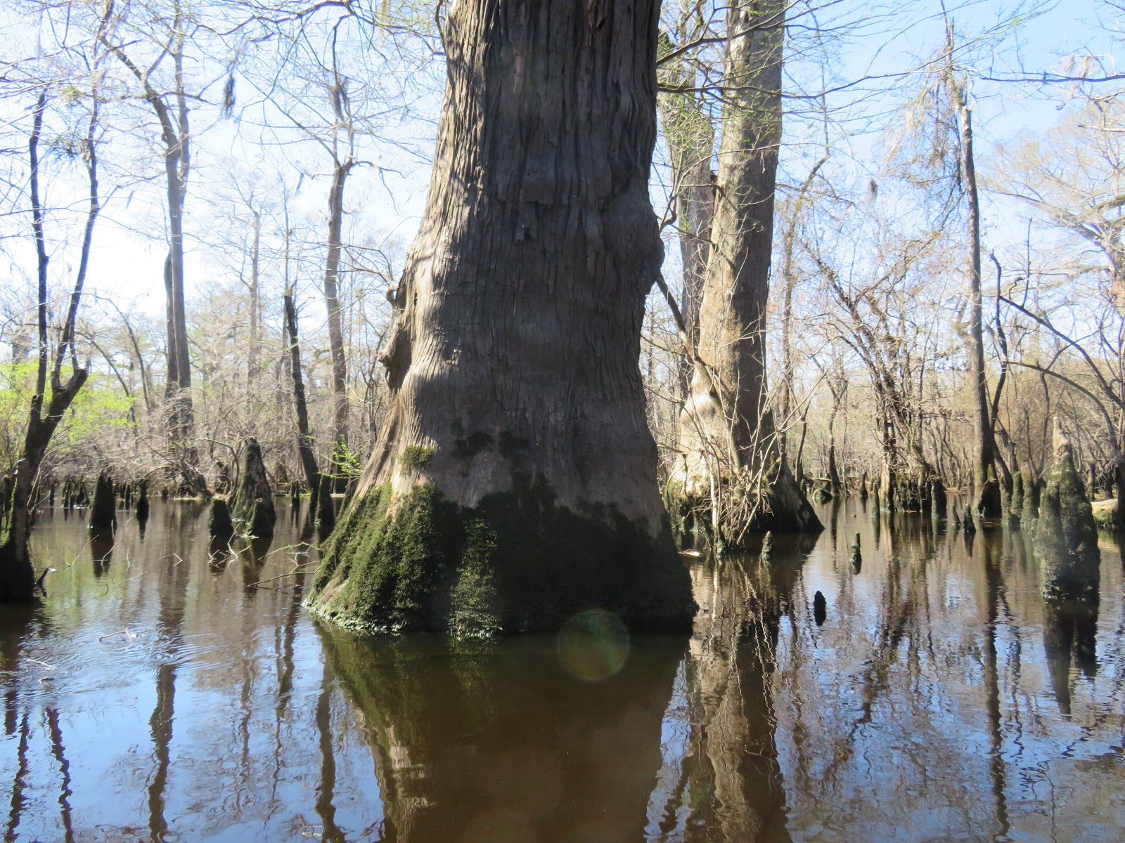
This tree dwarfs the kayak next to it. There were dozens of trees this size.
The larger Cypress trees often are "flat topped" meaning they have lost their upper branches, probably due to wind. Yet the tree lives on.
Toward the end of our paddle, this burl marks the end of the swamp. By far the biggest burl I've seen.