Sunday, January 26, 2020

Jan 23 Winter Hike Week - Courthouse Rock


Heading up Rt 441 (Newfound Gap Road), I was searching for the two car pulloff near the start of this offtrail adventure. Suddenly, we spotted a large group of colorful hikers working their way up a drainage. Eventually, I settled on a nearby pulloff and we began our hike. There is no trailhead and no official trail. I knew to look for an old section of road which got bypassed when the park improved Rt 441. Once on the old road, there is a faint and unmaintained trail. The trail heads up the drainage created by Road Turn Branch. It is here we ran into Bill Little, a senior hiker who decided the creek crossing was too precarious for him. He didn't seem the least bit concerned to have been left behind by his group.

Once we made the creek crossing, we came upon the cave pictured above. It is more substantial that it looks. The rock wall in front may have been larger at one time. This cave is called "Moonshine Cave". It sounded like there was running water within it but it may have been an echo from a nearby creek.  


The November 2016 Chimney Tops 2 fire impacted the area nearby. We saw some fire damage in our vicinity but nothing like the nearby mountains. Chimney Tops (not pictured here) was visible and quite noticeably barren. 


I assume Courthouse Rock gets its name because it is as large as a courthouse. It does appear to be quite large as you approach it. I'm told it is the largest free standing rock in the park. However, it is quite skinny as you can see in the photo second below. 

We finally caught up with the group we spotted climbing the drainage. The same group that left Bill Little behind. After a short conversation, I learn they are the Thursday Hikers from Knoxville. I ask if Gary Anderson is among them. And yes, he is standing just a few feet away. I first met Gary while hiking off trail in White Oak Sinks in the rain. We both were carrying umbrellas during this chance encounter. I learned he was from my hometown and now lived in Knoxville. We corresponded for years but lost touch until today. While getting reacquainted, one of their group came by and offered some candy from a small duffel bag. He introduced himself and let us know he was 90 years old.  

GA BARBER 1827

Its really is this skinny


Next stop is Road Turn Falls. Along the way, we ran into Bob and Tom, a couple former telephone guys. I had seen them getting out of their truck back when we started our hike. 


After we had our fill of the waterfall and the frozen icicles nearby, we retraced our steps back to our vehicle. On the way, we ran into Bill Little again. He was back at the creek crossing and suggested we look for his truck back on Rt 441. There were drinks and treats there and we should help ourselves. 

As we made our final turn to move away from the creek, I realized the old road made a very pronounced horseshoe turn with the creek bisecting the horseshoe. It dawned on me that this is how Road Turn Branch acquired its name. 

Jan 22 Winter Hike Week - Sugarlands Rockhouse


Another cold day at WHW. Our group of 12 began hiking on the Old Sugarlands Trail. The roar of the creek accompanied us. I don't know if it is called the Little Pigeon River here but that is what it becomes outside the park. 

About a mile in, we arrive at the former CCC camp 1458 and 1459. The structure above is what remains of the clock tower at the camp. Below there is a circular structure which may have been a fountain.


A little exploration of the surrounding area reveals one of the main camp structures. All that remains are the two massive chimneys and camp relics. We also located what appeared to be the camp dump. The dishes used were thick white china from West Virginia. Quite a few pieces were laying nearby.


We then continued on to the Burton-Ogle Cemetery where we stopped for a look around.


From the cemetery, we followed an old road and then an overgrown path through a forest of white oak and black locust. The bugaboo between us and the rockhouse is a creek - Big Branch. Sometimes you can rock hop and sometimes it is a bit too intimidating. Today its intimidating but there is a very strategically fallen tree allowing us to navigate the creek crossing without mishap. 


There has been some damage to the structure since the last time I was here. A tree has fallen and knocked over one side. 


This corner looks like it might not be here next time I visit.


The rockhouse does not appear on any early USGS topographical maps, including the 1931 map which I was using. However, it does show up on the 1942 USGS map, sparking speculation that the rockhouse was constructed by the CCC, surreptitiously in the park. It contains a number of metal bed frames. There were numerous quart conetop beer cans found nearby. This leads one to think it might have been a party spot, possibly for CCC officers.  

Crossing Big Branch


Jan 21 Winter Hike Week - House of the Fairies


One of the fanciest springhouses ever built now masquerades as the "House of the Fairies". The structure was built as part of the Louis Voorheis estate built around 1930. Voorheis incorporated waterworks on his 30 acres. With the twin creeks - Scratch Britches and LeConte, he had ample water and declivity to install fountains and small impoundments. His estate was deeded to the park in the late 1930s. Many of his original building still exist and are part of the GSMNP Twin Creeks Science and Resource Center. 

A man sits on a set of stone stairs, hand on his chin and facing away from the camera into trees
Louis Voorheis at the Springhouse
Photo from NPS


View from the top


Voorheis swimming pool is nearby as we made our way to the Fairy House

Photo below from NPS
Bathers gather at the edge of a pool of water, near a brick structure marking a spring

Jan 20 Winter hike Week Laurel Falls


Warning
Do not sign up for hikes led by Jim Plant


He has a broken rib and will be hiking at “broken rib” pace.
He is known to pick hikes that have unbridged creek
crossings, is prone to stop mid-hike to talk about
a dang fungus or fern.  All his hikes will be off trail.
Avoid at all costs. Hike with George, Rick or even Darcy,
before you sign up for one of Jim’s hikes


This is my WHW pre-hike. Laurel Falls is a 1.7 mile paved trail to a quite attractive waterfall. It is one of the most popular trails in the park. My most memorable hike here was in January 2013 when Wilderness Wildlife Week shut down for the day due to heavy rains. It was the same day a landslide covered up a portion of Newfound Gap Road and closed it for several months. Click this link to see it.

The hike and falls were much tamer on this trip. My rib appreciated the light hike.


Monday, January 13, 2020

Jan 11 Uwharrie Trailblazer Annual Meeting


The Uwharrie Trailblazers convened for our annual meeting in the community of Ophir. We began with a short commentary by hike leader, Jim Rich. The topic and subject of today's hike is the Russell Mine. Located just a few miles away, the Russell Mine operated from 1882 until about 1920. It produced about 16,000 ounces of gold. After the short introduction, our group car pooled for the short drive to Big Creek.


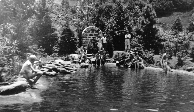
During the summer, there may not be any water in Big Creek but today there was a rock hop of mild proportions. A few wet feet but no casualties. Once on the opposite side, the "Big Cut" is right in front of you. Most of the ore processed at Russell Mine came from the Big Cut. The pit measures 300' x 150' and is 60' deep. Several shafts extend downward. I'm told they are as much as 200' deep. 


What remains of the mine today, just these rock walls. The photo below is from the operational days of the mine. Ore extracted from the Big Cut arrives via conveyor behind the building in the photo. Stampers in the building, crush the ore so it can be processed, separating gold. 

Russell Mine in the day

Spectrum 14 News joins in the fun


With such a large operation, many people were drawn to this area. Reports are that 40 people worked in shifts 24 hrs a day at the mine in its heyday. There was a general store, hotel and many homes in the vicinity. 

Big Creek flows into the Uwharrie less than a half mile from the Russell Mine. Just downriver from the confluence is a low "u" shaped rock wall across the river. When I first encountered this on a paddle trip, I was convinced it was a Native American fish weir. However, I have since been told it was a dam, impounding water up Big Creek, for use at the Russell Mine.


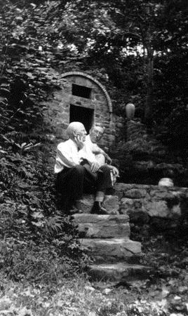
Our group poses by the Russell Mine foundation. There appear to be about 35 of us here. That is less than the mine employed at one time.


On the opposite side of Big Creek from the Big Cut, there is a ridge with this shaft and other pits. Russell Mine extracted ore from here as well. 


Back in Ophir, I spot this Redheaded Woodpecker busy extracting insects from this White Oak.


Ophir gets its name from a Biblical reference. King Solomon received gold and other commodities from Ophir. Gold from Ophir has other biblical references but its location is subject of speculation. The folks from this North Carolina community borrowed the name from the Bible since their community had such a strong gold connection. In 1832 gold was discovered nearby. A mine named "Steel Mine" operated on their side of the Uwharrie River, opposite that of the Russell Mine but very close as the Raven soars. It operated sporadically from 1832 to the 1880s.   


Note the push button controls on this ancient stove. Heating huge pots of chili on small burners is a challenge, even for Jedi culinary artists. 

The lunch spread was outstanding. The club provided chili and members brought covered dishes


How many Scoville units in that hot sauce?

Dr Gary Freeze of Catabwa College, lectures on the human history of the Uwharrie region. Using a North Carolina road map, Gary shows us how the colonial and modern day transportation routes create, almost a circle around the Uwharries. Population centers arc across North Carolina but avoid the Uwharries, and always have. The geology and topography make that so. To me, the most telling statistic was the percentage of land in agriculture in the late 1800's 

Guilford County - 62%
Caburrus County - 89%
Randolph County - 38%
Stanley County - 28%
Montgomery County - 14%


We just don't have good soil. Even on my tract of land, I can see that this is true. Along our road, there is good arable land but just away from the road, it turns. There are many patches of quartz, a subtle ridge of ryolite and rocky soil that only Chestnut Oaks can make a living on.

Gary spoke about the land and how it ran out of nutrients decades ago. That prompted the federal government to buy out the landowners during the Depression and those land purchases eventually led to the Uwharrie National Forest. As the population centers around us fill in, our future may be analogous to being the central park of a Manhattan. 


Next up, Mary Joan Pugh reviews our trail strategy. In conjunction with the Uwharrie National Forest, our group has worked to develop what we think is in the best interest of the hiking public. Topping our list is closing the gap in the southern Birkhead Wilderness. One parcel of property separates trail from the Birkhead Wilderness to Uwharrie National Recreation Trail, at High Pine Church Road. Also seen as a priority, making Camp 3 Trail official. It is an integral part of the Birkhead trail network but not recognized by the Forest Service. The SAWS crew which was contracted to clear Birkhead trails last September, was not able to work on the Camp 3 trail. As a result, we have 6-7 blowdown areas where "walk around trails" exist instead of clear trail. Another priority is creating a loop or trail system in the Walker Creek and King Mountain area with a new trailhead. Finally, we'd like to see a trail connecting Thornburg and Tot Hill, roughly following Betty McGee Creek. These last two items, we feel, are necessary to alleviate some of the pressure the Birkhead trails are experiencing. 

District Ranger, Mike Spisak, gave us an explanation on how the FS acquires property. Since our group has been involved with or supported several acquisitions destined to become National Forest, it is interesting to know the process. We not only compete with other NC areas for funding, but ultimately compete nationally. North Carolina has been quite successful in these funding battles. Understanding why properties sit and wait to be acquired is often difficult to comprehend. However, once they are public lands in perpetuity, makes it all worthwhile. As they say, forever is a long time. 

We recognized the trail building and maintain efforts of Stanley Siceloff, Steve Chase, Merritt Maness and Marcus West from our trail crews. I'd like to thank all the volunteers for their efforts. 

Joe White spoke about a new initiative, our trail adoption program. We are close to rolling this out and will be hashing out details this coming week. 

David Craft mentioned some changes on our steering committee. Karen Auman has had to step down. Karen always stepped up when something needed to be done. She coordinated the bus transportation for the thru hike, coordinated the annual meeting venue and food preparation, contributed to the trail crew, supported the thru hike in so many ways, even served as auctioneer at the Trail Celebration Days. We'll miss her but I suspect she'll be on the periphery ready to help again. David mentioned two additions to the committee, Kim Anderson and Abi Winegarden. We look forward to them being part of our forest family. 

Finally, in attendance was Mike Beck, one of our wonderful Forest Service friends whom we have worked closely with. Mike is leaving for a FS job in Michigan where he is from and still has family. We will miss Mike tremendously.  

Thursday, January 9, 2020

Jan 9 Northern Flicker - Yellow Shafted


I don't often see these guys but they are around. They are heard more than seen. This Northern Flicker spent quite some time in my yard. They feed on ants, so often they are on the ground rather than in a tree. 


The red crescent behind the neck makes this a colorful bird to see. Since this one was facing me, it took a while to see the red crescent. The Yellow Shafted subspecies has the red neck crescent.

Apr 20 Waterwall on Walker Creek

  Waterwalls redirect floodwater back into the creekbed. There is one very near the Uwharrie Trail on the Walker Creek section. This one is ...