Sunday, June 20, 2021

Jun 17 Roan Mountain Azaleas


The scene at Carvers Gap at noon was compounded by road construction. The parking areas were almost full - still some room in the overflow but with all the confusion, most folks tried to get in the others and blocked traffic as they tried. One woman drove her car off the side into a nosedive ditch. She was ok but seemed overwhelmed by her predicament. 


We are finally on the trail and looking at the big balds that we'll climb. There are lots of people out including about 40 Governors School students. The air is breezy and cool for late June. 


Distant mountains surrounded us. I could see the Smokies, the Blacks, Grayson Highlands, Linville Gorge mountains, Grandfather, Beech and Sugar (hard to miss with that ugly condo cube on top. 


Most folks are out here today to see the Flame Azalea. That includes me. It appears to all be same species but some slight color variations. There was one which was distinctly yellow. My photo of it had a bit too much sunlight, so it is not pictured here, 


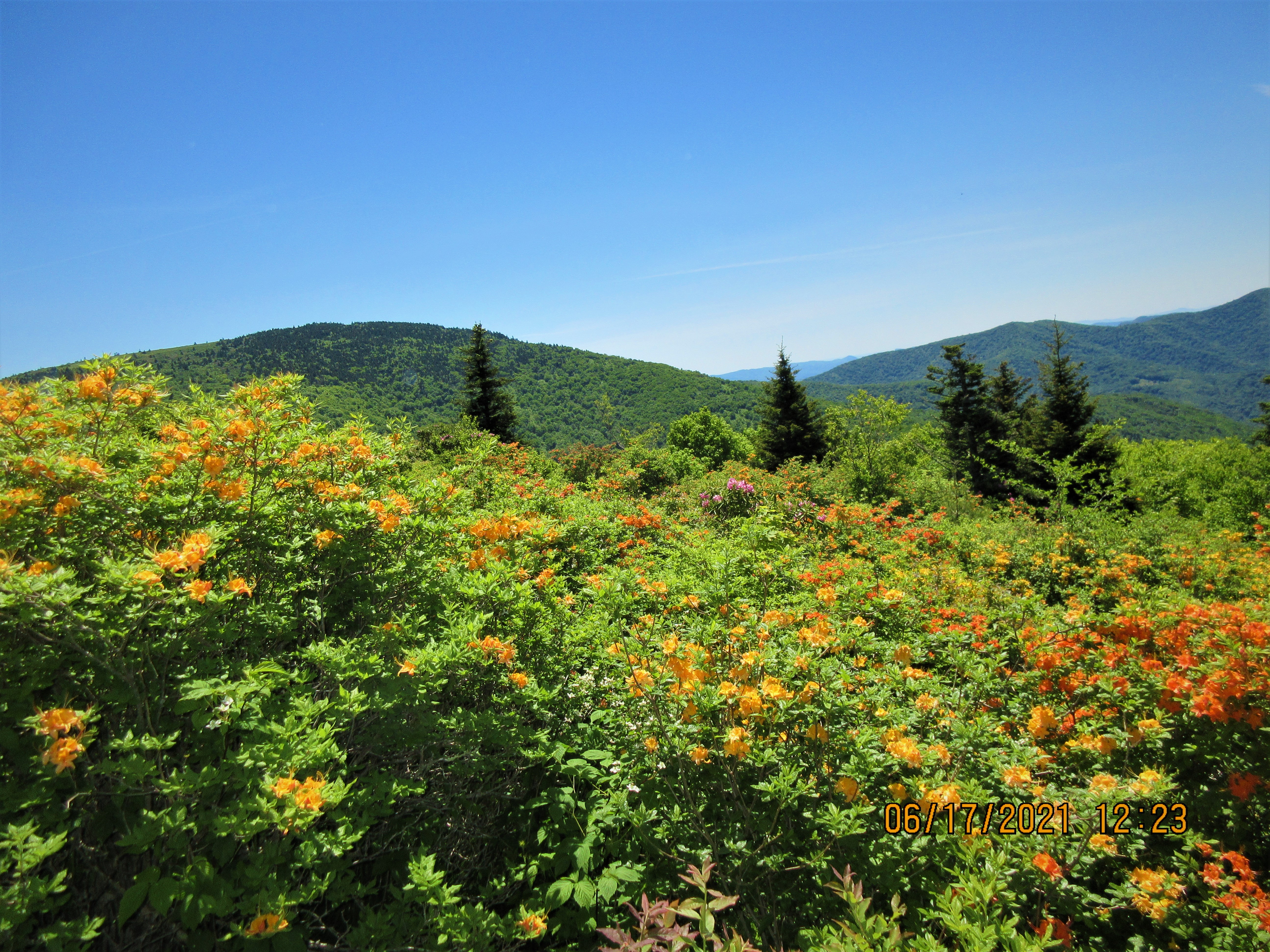
These photos were all taken in one area, less than an acre in size.


Catawba Rhododendron was also blooming. The word is that it is not blooming up in Cloudland. There are two Rhododendron festivals scheduled for this weekend. They might get a glimpse of the bloom up above but I suspect the prime bloom will occur in a week.   


Stan Murray Shelter has a cool looking mouse proof food bag hanger. 


Our hike ended at Roaring Brook parking area on the Overmountain Victory Trail. 


Jun 14 Caraway Creek Preserve Trailbuilding


Uwharrie Trailblazers had the leaf blowers, chain saws, weedwhackers and lots of hand tools going at it this morning. Within 2 hours there was a trail. Thanks to Piedmont Land Conservancy for the land and the planning, Randolph County is going to have a great trail system on a beautiful piece of property with early American and Native American heritage sites. 

Not to mention a huge Short Leaf Pine

It is solidly built


The property has a beautifully constructed check dam. This dam was designed to control sedimentation downstream and redirect water flow into the creek bed during flooding. 


Jun 12 Damage to Betty McGee Bridge


On Jun 10 the Thornburg area of the Birkhead Wilderness had over 4 inches of rain during a very short period of time. The brand new bridge over Betty McGee Creek took a beating and barely survived. The creek rose up about 7 feet higher than the grade level of the bridge. The fill dirt by the river left footing was completely washed away allowing the water to lift the bridge and push it downstream about 8 feet until a Sycamore secured it from further movement. 


Damage to the wood structure was minimal but now both sides are off their footings. 


The Forest service had their engineering staff investigate. Their initial plan to remedy the situation is to raise the bridge to the highest level of the bank and add 15 feet of length. Meanwhile, the bridge will continue to serve as a crossing but with a caution warning. 


Apr 20 Waterwall on Walker Creek

  Waterwalls redirect floodwater back into the creekbed. There is one very near the Uwharrie Trail on the Walker Creek section. This one is ...