Sunday, August 20, 2023

Aug 13 Macrae Peak at Grandfather Mtn


Beginning at the lower (hiking) parking lot for the swinging bridge, we started our hike early afternoon on a sunny day.  Climbing steadily on the Grandfather Extension Trail, we reach the Grandfather Trail to Macrae peak. Here we level out for a while passing through lovely small meadows. 


When the ladders begin, we end up waiting about 10 minutes for a couple groups descending. Several were military guys with the heaviest looking packs you can imagine. The first fellow down had a difficult time just getting on the ladder. That was the only major traffic jam we encountered.


There is no shortage of views out there. In every direction you get stunning views.


We made it to Macrae. There were just a few folks up on the rock enjoying the views. 


We returned via the Underwood Trail which is longer and rockier. There is one ladder on Underwood and a very difficult cable on the short distance we hiked on the Grandfather Trail to get to Underwood. Underwood is less exposed too, in case you need to get out of the wind or storms. 


I think we did less than 2.5 miles of trail. That would make this about the most difficult 2.5 mile hike I have done.


Aug 11 Pond Mountain


Finally, I made it to Pond Mountain. Don't confuse this is with Pond Mountain Wilderness or other Pond Mountains. This is a Blue Ridge Conservancy property. They partnered with NC Wildlife Resources Commission in 2008 to create the 2900 acre Pond Mountain Gamelands. 


To get here is part of the journey. Input "Pond Mountain Game Lands Creston" on your route navigation. Be prepared for narrow, winding dirt roads. The entrance is on Rock Fence Road. There is a parking area and kiosk. If you are driving a 4WD pick up, you can continue another 1.6 miles on a gravel road to another parking area and gate - photo above. If you are driving a sedan, stay at the lower parking area just off Rock Fence Road. You'll have to add 3.2 miles to your hike making it 9 instead of 6 miles (out and back total). The first 1/2 mile of the road to the upper parking area is the worst part. It is steep and winding with loose gravel and not wide enough to pass oncoming traffic. I could see a vehicle coming toward me and was able to pull in a field road. Otherwise, someone is backing up for a ways.

Pond on Pond Mtn

From the second parking area, the road continues past a locked gate. I think this gate may be open during hunting season. The road is still gravel but transitions to a dirt 2 track. The entire hike is on a 2 track.

One of the first things I see is a very small pond. I understand Peter Jefferson (Thomas Jefferson's father) named it Pond Mountain due to the small ponds. Jefferson was here to survey the boundary between NC and Virginia.


The meadows are dotted with the colors of wildflowers in every direction. On my way out of this 6 mile out and back, I had no views. Clouds and morning mist hid the views. On the way back, every direction was loaded with tree covered mountains views. 


Most of the hike is in open meadows. There are a few trees her and there, as well as some leftover Christmas trees from the property's former life as a Christmas tree farm. About midway, there is a very steep hill through a wooded area. It's short but was the most difficult part of the hike. Just after cresting the top on that steep rocky road, you enter an open area with terrific views and an abandoned house. Water penetration is destroying it. The floor is rotten as is almost everything else. I found a door laying in a meadow about 200 yards downhill. I thought the wind might have blown it there. The trail passes right by the house and continues downhill on what was the home's driveway. It is quite eroded now.


Following the eroded road downhill for about 1/2 mile, you'll arrive at this disc marking the spot NC, Virginia and Tennessee come to a point. Note the triangle in the disc. If you were to walk the North Carolina line for 3 miles, you'd reach the Virginia Creeper trail where it leaves Virginia near Whitetop. 

The disc is in the rock on the right side.


At the boundary marker, I retraced my steps back to my truck. So much of the 2 track trail is grass, my boots were soaked. Wear waterproof boots and gaiters to hike this trail when the grass might be wet. 


The views were fabulous on the return. Some clouds lingered but there was no threat of rain. A thunderstorm would not be fun out there in the open.

August wildflowers thrive


Aug 9 MST to Mt Hardy


I know it says Black Mt but we're on Mt Hardy, I'm certain. It may have been Black Mt in 1933 or someone thought they were on nearby Black Mt.

Dodder Vine or Love Knot

Today's hike is on the MST. Our trailhead is on Rt 215 just off the Blue Ridge Parkway. Once we step off the road, we are in Middle Prong Wilderness. Due to wilderness regulations, there are no MST blazes nor trail signs. We're on our own. The first quarter mile is up and down with large of rock. Then things level out and we are on a railroad grade. We follow the railroad grade all the way to the Mt Hardy turnoff.

First (and only) glimpse of  Mt Hardy

The railroad would have been for logging. So, once the logging was finished, the tracks and structures were removed. We saw twisted wire cable in several places and even a length of rail, discarded for some reason. There were open areas slowly being reclaimed by forest. These may have been loading decks or possibly a shantytown. 

A nurse stump tree

We walked through some wonderful boggy areas. The bedrock in some of these spots is only 18 inches below. Sometimes, these places don't have anywhere for the rainwater to drain away, thus retaining the moisture to form a bog.

Mosses love bogs

Although, the 3 mile trek to the top is 1000' in elevation gain, the first 700' are evenly spread over the first 2.5 miles. The route to the top leaves the MST for a 1/2 mile track up. It starts out like a real trail but becomes overgrown quickly. Using Alltrails navigation to see the route helped much. 

Cool club moss

Another cool club moss


When we reached the USGS disc, the trail seemed to continue and we were not convinced we were on the highest point. Will used his Avenza app to measure the elevation. after a good 20 minutes of walking from one spot to another, we concluded that the disc was very near the highest point. Here we sat for a nice lunch break.


On our retreat back to the car, we passed several hiking groups and a fellow from Winston-Salem looking for waterfalls. He told us of one he had just bushwhacked to nearby. Near the trailhead we passed a couple with a ferocious poodle dog. They were hoping their favorite waterfall campsite would be available. It is located on the trail to Green Knob very near the spot we left the MST to access the Mt Hardy track. A different waterfall than the other guy had visited.


Saturday, August 19, 2023

Aug 8 MST to Blackstock Mountain


Blackstock is another 6000'+  peak in the Black Mountain vicinity. It's right on the MSP. My route began at a small parking area about 1/2 mile from the beginning of the Mt Mitchell approach road from the BRP. The first thing I saw on the trail were the steps pictured above. Yesterday's storms left the vegetation dripping and the rocks slick. The first 3/4 mile of this trail is, in many spots, a rock to rock to rock hike. Many small slips made me very cautious. 


Then it turned into an easier trail to hike. The wet vegetation and humidity left me soaked. Blackstock is 3 miles in and almost constant uphill  with the last 1/4 mile being steep. 


Ferns, mosses and club mosses made for a very pretty and interesting hike. Mushrooms were brilliantly colorful after soaking up the moisture from recent rains. 


On a map it looks as if you are walking beside the BRP, but here there is little traffic noise. 


I'm on top finally. There is a tree which has fallen across the trail near the top. I look around to see where the highest point is located. It looks like I'm standing on it. Just a couple minutes after beginning the return trip, several hikers come through. They are doing a longer shuttle hike. They tell me there are two more of them right behind. Twenty minutes later I see the other 2 fellows. 


About the midway point I had seen some flagging and what appeared to be a recently roughed out trail. On the way down, I stopped to check it out. I walked on it a few minutes before turning around. Where it goes, I don't know. It is right at the spot I began seeing state park boundary signs. That is something to do next time.


The return was so much quicker than the way up. I am soaked after this hike and glad to change shoes and shirt, 


Wednesday, August 16, 2023

Aug 7 & 14 Grassy Ridge Bald


Back to back Mondays on Grassy Ridge Bald on the Roan mastiff. The August 7 hike is with Carl Fritz of Tennessee Eastman. I am the only one who showed up for the hike. It was a relatively early start at Carver's Gap and the weather was nice but the forecast was not. That is likely why no one else showed up. The parking area was at about 2/3 capacity.  

Silver Rod

Carl has for 20 years been in charge of maintenance on Roan and 130 miles of AT. It was fascinating to hear his stories of 20 years experience on the mountain. Virtually all his work there involves the impact of hikers on the mountain. He feels the impact up until 2014 was manageable but now, it is a losing battle. What was once a 3 foot wide trail has grown to a 3 lane highway. The club, Tennessee Eastman put down ground cloth and another strong plastic sheet with holes designed to hold gravel in place on steep sections. The initial work began in 2001 and a major replenishing was done about 2014. They were able to get tons of gravel up on Round Bald using a track vehicle and then bucket brigades to get gravel beyond where the vehicle could go. They harvested over 100 Black Locust trees on a nearby property that needed to be cleared thus using local wood rather than bring in wood from an area which might have non-local bugs in it. The wood was used as steps and water diversions.  


A more recent project was to install 2 peak finding signs on the top of Round Bald with wood and wire raised walkways to them but few people walk on the walkways, preferring to walk on the ground next to them. Although the metal interpretive signs have been there less than a year, they are scratched up. 


So, how do you deal with the current situation? Parking is out of hand. The state has put up cones to keep people from parking at roadsides. The last time I visited Carvers Gap, a woman parked her car on the roadside right by the parking lot entrance and went into a ditch. The car had one wheel in the air and was at a 45 degree angle. To accommodate vehicles, the plan is to build another lot slightly down the hill on the Tennessee side. I saw that spot and it will help but won't be very large. They also have a tentative plan to pave the trail from Carvers Gap to the top of Round Bald. The majority of people visiting don't go beyond that spot. Carl knew roughly the tonnage of materials that would be needed. I don't remember the number but it was staggering. And, there are plans to re-route the AT also. As you go up Round Bald, you're in a bald as you start and then enter woods, then back in the bald to the top. The AT will will go into the wood and stay there, bypassing the top and joining back near the gap between Round and Jane Balds. I saw flagging in this area on my second hike. Morgan Summerville with ATC was coming the next day to review some of these plans and may have flagged the route.  


Getting back to my hike description, we topped Round Bald, then Jane Bald. At Jane, Carl told me how it got its name. Over a century ago, a local gal, Jane, tended cattle in the area. She was searching for a lost cow, got caught in a storm and died of exposure on the bald now named for her. However, on my second hike I got a different story from my hiking buddy, Russ. It starts out the same, Jane is tending cattle. The cows eat the vegetation with includes White Snakeroot. It is mildly poisonous to cows but deadly poisonous to humans. Jane drank some cow's milk and died on the bald. I like that story better so I'm sticking with it.


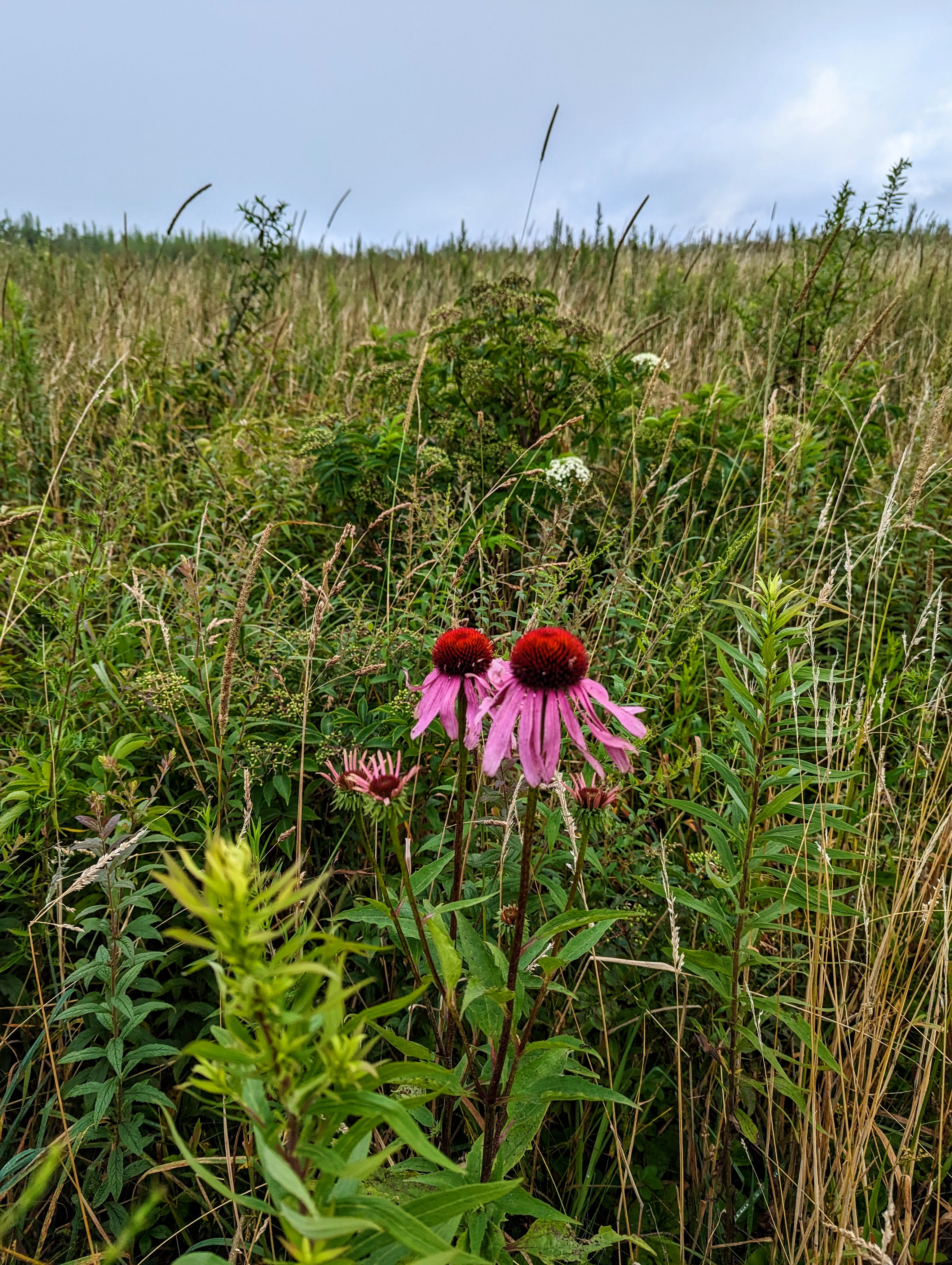
After Jane Bald, there is a gap but not a deep one, before heading up Grassy Ridge. There is a trail split with Grassy straight and AT veering left. I wonder how many AT hikers miss the sign and continue straight. We made it to the large rock with the plaque and turned back. Volunteers with the Southern Appalachian Highlands Conservancy were weed whacking acres of blackberry near the top.


My second hike was with hiking friends, Will and Russ. Once again the threat of rain was with us. We started out in good conditions and had a lively conversation going on the hike. We did the same hike to the rock with the plaque but decided to go on further. 


Starting out on a well worn path, we entered some scrubby forest where folks often camp. Once out of that area, we re-entered a bald on a fainter trail. We got to an open spot where trail volunteers often camp. Beyond there, we were following a faint trail which had tall vegetation overtaking it. I used my poles to spread out the vegetation so I could see where I was stepping. This continued about 1/4 mile until the faint manway ended. We had lunch on the rocks here with the view pictured below.


As the photo indicates, there are some clouds heading our way. Just after starting back, the clouds obscured Roan High Bluffs and Roan High Peak. Seconds later, the wind picked up and without warning, rain pelted us. We struggled to get into raingear and covers on our packs. The rest of the hike we were in and out of rain. The wind on top of Round Bald made us look like a few drunks trying to walk straight. Once at the vehicles, we were able to get into dry clothes and head out.


Apr 20 Waterwall on Walker Creek

  Waterwalls redirect floodwater back into the creekbed. There is one very near the Uwharrie Trail on the Walker Creek section. This one is ...