
Finally, I made it to Pond Mountain. Don't confuse this is with Pond Mountain Wilderness or other Pond Mountains. This is a Blue Ridge Conservancy property. They partnered with NC Wildlife Resources Commission in 2008 to create the 2900 acre Pond Mountain Gamelands.

To get here is part of the journey. Input "Pond Mountain Game Lands Creston" on your route navigation. Be prepared for narrow, winding dirt roads. The entrance is on Rock Fence Road. There is a parking area and kiosk. If you are driving a 4WD pick up, you can continue another 1.6 miles on a gravel road to another parking area and gate - photo above. If you are driving a sedan, stay at the lower parking area just off Rock Fence Road. You'll have to add 3.2 miles to your hike making it 9 instead of 6 miles (out and back total). The first 1/2 mile of the road to the upper parking area is the worst part. It is steep and winding with loose gravel and not wide enough to pass oncoming traffic. I could see a vehicle coming toward me and was able to pull in a field road. Otherwise, someone is backing up for a ways.

Pond on Pond Mtn
From the second parking area, the road continues past a locked gate. I think this gate may be open during hunting season. The road is still gravel but transitions to a dirt 2 track. The entire hike is on a 2 track.
One of the first things I see is a very small pond. I understand Peter Jefferson (Thomas Jefferson's father) named it Pond Mountain due to the small ponds. Jefferson was here to survey the boundary between NC and Virginia.
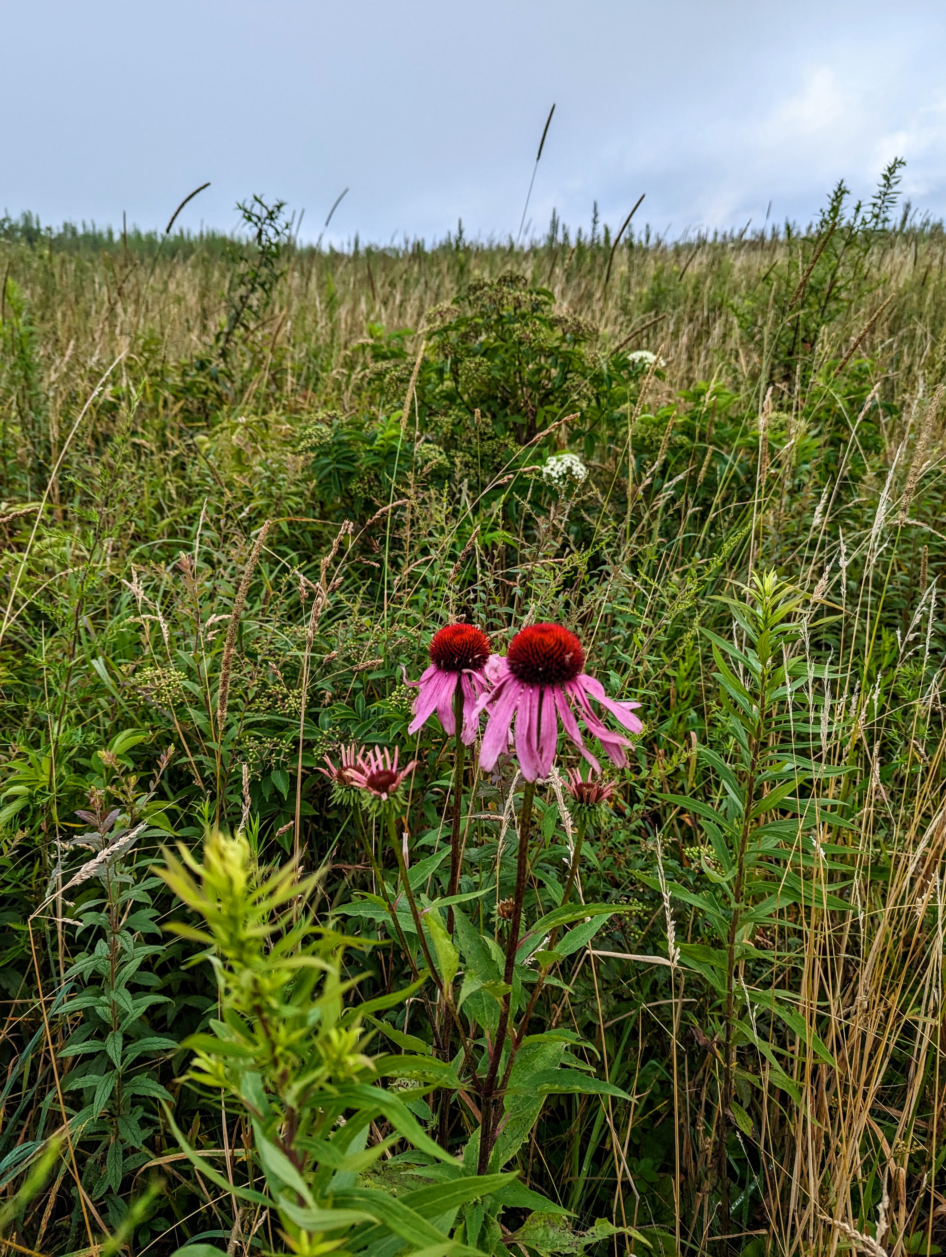
The meadows are dotted with the colors of wildflowers in every direction. On my way out of this 6 mile out and back, I had no views. Clouds and morning mist hid the views. On the way back, every direction was loaded with tree covered mountains views.

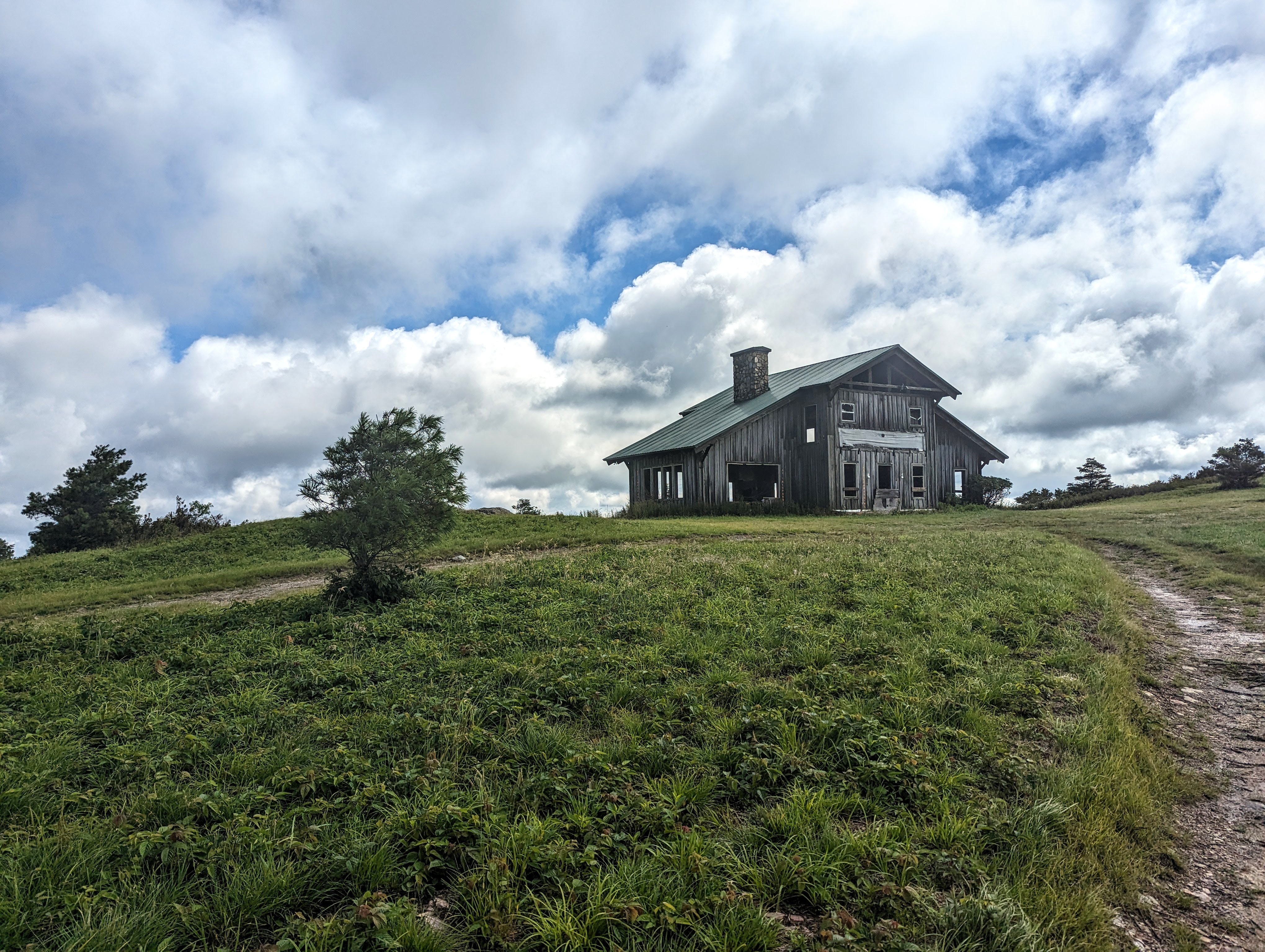
Most of the hike is in open meadows. There are a few trees her and there, as well as some leftover Christmas trees from the property's former life as a Christmas tree farm. About midway, there is a very steep hill through a wooded area. It's short but was the most difficult part of the hike. Just after cresting the top on that steep rocky road, you enter an open area with terrific views and an abandoned house. Water penetration is destroying it. The floor is rotten as is almost everything else. I found a door laying in a meadow about 200 yards downhill. I thought the wind might have blown it there. The trail passes right by the house and continues downhill on what was the home's driveway. It is quite eroded now.


Following the eroded road downhill for about 1/2 mile, you'll arrive at this disc marking the spot NC, Virginia and Tennessee come to a point. Note the triangle in the disc. If you were to walk the North Carolina line for 3 miles, you'd reach the Virginia Creeper trail where it leaves Virginia near Whitetop.

The disc is in the rock on the right side.

At the boundary marker, I retraced my steps back to my truck. So much of the 2 track trail is grass, my boots were soaked. Wear waterproof boots and gaiters to hike this trail when the grass might be wet.

The views were fabulous on the return. Some clouds lingered but there was no threat of rain. A thunderstorm would not be fun out there in the open.

August wildflowers thrive


No comments:
Post a Comment