Blackstock is another 6000'+ peak in the Black Mountain vicinity. It's right on the MSP. My route began at a small parking area about 1/2 mile from the beginning of the Mt Mitchell approach road from the BRP. The first thing I saw on the trail were the steps pictured above. Yesterday's storms left the vegetation dripping and the rocks slick. The first 3/4 mile of this trail is, in many spots, a rock to rock to rock hike. Many small slips made me very cautious.
Then it turned into an easier trail to hike. The wet vegetation and humidity left me soaked. Blackstock is 3 miles in and almost constant uphill with the last 1/4 mile being steep.
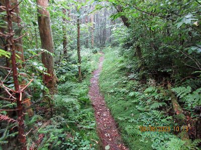
Ferns, mosses and club mosses made for a very pretty and interesting hike. Mushrooms were brilliantly colorful after soaking up the moisture from recent rains.
On a map it looks as if you are walking beside the BRP, but here there is little traffic noise.
I'm on top finally. There is a tree which has fallen across the trail near the top. I look around to see where the highest point is located. It looks like I'm standing on it. Just a couple minutes after beginning the return trip, several hikers come through. They are doing a longer shuttle hike. They tell me there are two more of them right behind. Twenty minutes later I see the other 2 fellows.
About the midway point I had seen some flagging and what appeared to be a recently roughed out trail. On the way down, I stopped to check it out. I walked on it a few minutes before turning around. Where it goes, I don't know. It is right at the spot I began seeing state park boundary signs. That is something to do next time.
The return was so much quicker than the way up. I am soaked after this hike and glad to change shoes and shirt,


No comments:
Post a Comment