Tuesday, January 31, 2017

Jan 31 Prickly Pear on Little Long Mountain


By Vectorisation by Alex Covarrubias.Based on the arms by: Juan Gabino. - Vectorised from File:Mexico coat of arms.png by Alex Covarrubias., Public Domain, https://commons.wikimedia.org/w/index.php?curid=2638888


On top of Little Long Mountain, within sight of the shelter, is a huge colony of Prickly Pear Cacti. Although native to this area, this is the only spot I have seen it growing. 


Found in abundance in Mexico, the Mexican coat of Arms depicts an eagle eating a Diamondback Rattlesnake while perched on son Prickly Pear growing on a rock submerged in a lake. When the Aztecs saw this scene occurring, they built their capital Tenochtitlan, according to legend of course.


After peeling and removing all the little prickly things, the pad is edible. It is called "tuna" in Spanish but that has nothing to do with fish. That is just the way it is translated. How about "Tuna of the Uwharries"?


Sunday, January 29, 2017

Jan 29 Tadlock Graves in Birkhead Wilderness

Betty McGee Creek

Les III showed me a photo of this Tadlock grave and mentioned it was out in the woods by Betty McGee Creek. I knew right away I would have to find this place. On Randolph County GIS, it show up as .1 acre in the middle of the Birkhead Wilderness, belonging to Lillie Vuncannon Cemetery. Using GIS and Jared Byrd's Birkhead map, I carefully positioned the cemetery on the map and headed out there. That was all well and good but when I arrived at Thornburg trailhead, I had no map. Of course my well intentioned plans were for me to find it on my own. 

Beavers at work

Off I go. Following Betty McGee Creek for a ways, then just heading in the direction I thought I needed to go. I found an old road with corrugated metal culverts, piles of rocks and eventually ended up on the gravel road used for owners of inholdings. At about this time, I began to think, this may not work out. I have walked a couple hours and only had a vague idea of where I had placed the "+" on the paper map. I did remember the terrain but looking about, it wasn't connecting for me. 

More pits

Alas, I had technology in my pocket. Wilderness Navigator on my phone, a gps and with a slight cellular signal, I had internet access to GIS. Putting it all together, I figured I just have to head in the best direction I could determine and hope for the best. I walked up and down and and finally decided, I needed to head back to Thornburg. At that moment, the grave appeared.


The Tadlock grave

Two Tadlocks buried here

Mother and Father are buried here. There are two footstones (one under the fallen log).

Old Road washout

Walking back was a bit easier. I located an old road and followed it about 1/3 of the way. It was washed out, above, on a McGee tributary. 

Jan 28 Cascades of Cascade Creek


Today is the big event at Vade Mecum. I knew my afternoon would be spent behind a table in Tise Hall, talking up Friends of Sauratown Mountains. So, my morning would be spent visiting waterfalls in Hanging Rock State Park. I decided to see all three of the major cascades on Cascade Creek. Above, we have Tise falls which is actually just downcreek from Upper Cascade but a very difficult scramble in slick and icy terrain.


Next up on the agenda is Upper Cascade. There is a well built wood viewing area and staircase to bring you right down to the plunge pool.


And finally, Lower Cascade, accessible from a trailhead on Hall Rd with a short .4 mile walk and many steps down.


Jan 22 Henwallow Falls


This short 4 mile hike to Henwallow Falls passed and crossed several pretty creeks. One bridge has been relocated due to a washout. The first creek crossing is Crying Creek, so named for a man mourning his brother, whom he  accidentally shot while bear hunting here.


Henwallow Falls. How did that waterfall come by that name. I've read it was an act of rhetorical revenge. The folks in the area called another community "Roostertown" because a family bought 100 chicks, hoping to raise laying hens. All but 5 turned out to be roosters. In an act of rhetorical revenge, Roostertown began calling the other community "Henwallow". Makes perfect sense.


Ninety feet high and just a few feet wide. It still makes for a great display.

Jan 20 Mt Cammerer


It was a gorgeous day until we got up on the AT ridge. Forecast was was rain but today we saw just a drop or two. This 12+ mile hike involves a 3000' elevation climb. Most of it in the first few miles on Low Gap Trail. Our group stayed together for most of the climb but in the last 1/2 mile, we spread out. Then regrouped at the gap. That is when the cloud moved over us and stayed for a good while.


Visibility was down to 150 feet at times. Near the lookout shelter, the terrain gets very rocky.


Mt Cammerer Tower was refurbished in the 1990's but it is looking old and shabby again. The door does not properly close, so water gets inside on a regular basis. A couple floor boards are rotting. 


About 30 minutes after leaving the tower, the cloud moved on and the valley below was visible again. We just missed spectacular views.

All 5 of us managed to have a fine time on the mountain.

Jan 18 Gatlinburg Fire - Baskins Creek


Late in the afternoon, Nov 23, a fire was started along the Chimney Tops trail in the general vicinity where another fire was started a week earlier. The first fire was extinguished. The second, now known as Chimney Tops 2, was contained to a same area for 4 days. National Park firefighters did not actively try to contain the fire during this period, relying on national boundaries which, in normal conditions, would contain the fire.

On Nov 27, water was dropped on the fire via 3 helicopters, loading up with water from Fontana Lake, 8 miles away. This helped to suppress the fire but not extinguish it. The fire had grown to about a 35 acre area by evening. Drastic weather changes were to come that night. Very low humidity, less than 20% and winds, began to spread the fire. 

November 28 did not go well. Wind picked up during the day, expanding the fire and causing it to jump Newfound Gap Rd (Rt 441) and other natural boundaries. Cove Mountain weather station reported a wind gust at 87 mph just before it lost power. A voluntary and then mandatory evacuation of Gatlinburg was ordered. High winds carrying huge embers, spread the fire miles in a very short period. By evening, the fire roared through Gatlinburg in about 30 minutes. A separate fire started at nearby Cobbly Knob caused by a downed power line. Several spots near Pigeon Forge and along Middle Creek burned as well as spots to the west near Wears Valley.

When rain finally dampened the spread of the fire, damage assessments were made:
14 dead
2460 buildings damaged or destroyed including 2000 homes
$500,000,000 damage
1794 acres
Cost to fight, about $9m
Amount raised by Dolly Parton to help those who lost homes - $9+ million


I knew the Baskins Creek area of Gatlinburg had been hit very hard. The only hike I wanted to do today was to Baskins Creek Falls. I had spread my fathers ashes here several years ago and was interested to see what it looked like now. Beginning in downtown Gatlinburg, I walked up Baskins Creek Road. About 1/4 mile from the main street, I began to see fire damage, leveled building and burnt out vehicles


On Dec 7, residents were allowed back in the area to search through their homes. Several of the homes I saw, had trinkets displayed, obviously fished from the ashes. A few places had them lined up on a mantle or rock wall which had survived. One collection of items included the ceramic houses that folks dress up in a holiday village during Christmastime. They had all turned white but did not melt. Some of things I did see melted were piles of aluminum and vinyl siding still clinging to home which remained standing. A few places, which were now leveled, had completely intact structures just feet from the rubble. I saw a wood swing still standing and a number of garden or lawn items still standing.


Demolition of what was left was ongoing this morning. Rubble was being separated into piles of metal and piles of stone. Then those piles were being loaded into containers or on trailers and hauled off. 


 At the end of the road, where the National Park begins, I was surprised to see several homes which had survived and were currently being occupied. How unsettling it must be to drive by total devastation to your unscathed home.


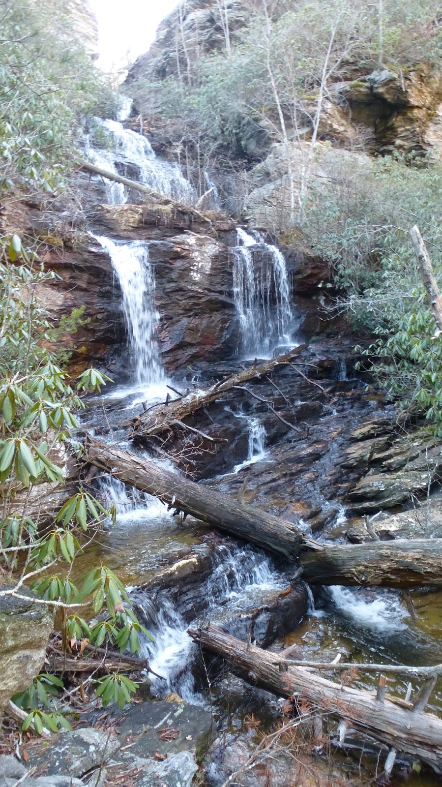
 My hike in the burnt woods began at the end of the road on a social trail which leads about a mile to Baskins Creek Falls. The trail was passable and still in fine shape for an "unofficial" trail.

The waterfall and immediate surrounding area was not burned, but almost everything else here did.


Most areas I walked through, were burned only at ground level. Fire scars on trees rarely were higher 6 feet. Laurel and Rhododendron burned up but in many cases the leaves just turned yellow and lay on the burnt ground. Leaf litter was quite thick in spots, maybe as much as a foot thick of, now, burnt leaf litter.


There is a small cemetery near the waterfall. I visited it and continued walking up toward Cherokee Orchard Road. Here, the fire produced some eerie sights.After leaving the trail, I walked 4 miles on the roadway back to Gatlinburg. Most of this area burned, exposing bottles and cans which had been thrown from car windows for years. 

At the outskirts of town, I saw another 4 houses gone. Many folks were out in the yard tidying up, spreading mulch and trying to make home a home again.


Saturday, January 28, 2017

Dec 22 Pilot Creek Trail


A recent acquisition for Pilot Mountain State Park, offers a perfect opportunity for a new trail. The park has a huge parking problem. Visitation numbers continue to climb but parking is out of the question for many visitors due to limited spaces. This new addition allows hiking access without driving into and parking with the crowds that occupy the office and summit parking areas. The new, still not completed, Pilot Creek Trail is accessed off a dead end road. The property comes with a ready made parking area with lots of room to expand if needed. Hikers, trailrunners, and nature lovers will be able enjoy the park from this new access without impacting the main road to the office and summit.


The trail is just over 3 miles and connects the access on Boyd Nelson Road to the park's campground. There is a connection to other trails for those wishing a longer hike.


The Friends of Sauratown Mountains provided the labor and equipment to build this trail is just a few months. Huge thanks to Harry Wilson, Richard Nifong and Don Bergey for their efforts. 


I very much enjoyed hiking through several very distinctly different forest types on this trail. On the slops of Pilot Mountain are mature hardwoods. Rocky areas support many Chestnut Oaks. A White Pine plantation is crossed. This old structure is made from hand hewn logs. Remnants from an old wagon are seen near the campground. And a delightful flirtation with Pilot Creek greets the hiker as well.


The trail becomes Official at its grand opening, Earth Day, April 22. There is will a dedication. Again big thanks to the volunteers who made this possible.

Dec 10 Dark Mountain Quarry


Dark Mountain lies partly on private property and partly in Uwharrie National Forest. The ryolite found here, appears to be of high quality for making stone tools. There is a section of Uwharrie Trail which goes through a very rocky spot. I believe this is a debris field from a prehistoric quarry. Many of the rocks have sharp fractures. The outcroppings appear to have been chipped away.


The highest point of Dark Mountain is on privately owned land. You can see very large outcropping there. The trail ascends to nearby summit which may not be named. Again, here, rock chips are everywhere for the entire length of its ridge. 


Mar 26 Check Dam on Taylor Creek

  Another dam in the Caraway Creek drainage is one that many people have seen as it is visible from Lassiter Mill Rd. The owners on creek ri...