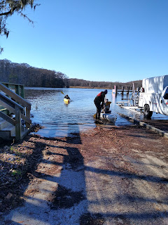
Today's paddle is with Black River Outfitters on the Waccamaw River in Murrells Inlet. Our guide is Mike Eady, a charter captain who grew up in Pawleys Island. His knowledge of the rivers here, goes back to his youth which was spent fishing and exploring this wild area.
Beginning at the Wacca Wache Marina right on the Waccamaw. We paddle upriver for a few minutes and then head into a creek. The waterway is really just a channel of the Waccamaw but is is given a name, Vaux Creek. On one side is Vaux island, a very small island. The other side is Sandy Island, the largest inland island in the eastern US. At 6 by 8 miles it would be over 30,000 acres.
The southern tip of the island is inhabited with about 50 residences. The only access is via boat. The state has provided school transportation via a school boat. Is is said the residents are almost all related to Phillip Washington who purchased several hundred acres after being freed from slavery at conclusion of the civil war. Rice plantations were numerous in this area. One of those plantations was Brookgreen. There is a road which runs the length of the island - Brookgreen Road. We walked on it for a short distance. All roads here are sand.
We passed a spooky looking place on Vaux Creek. A fishing camp, we guessed. I must have been too spooked to get a photo of it.
Mike gave great commentary, some based on his experiences in the area. He pointed out birds as we saw them. Along Vaux, I saw a couple Bald Eagles, a Kite and lots of Red Winged Blackbirds.
The northen part of the island is owned by The Nature Conservancy. They maintain a dock and cabin for research.
From the Nature Conservancy website:
1993
THE THREAT
Businessmen Roger Milliken and E. Craig Wall, Jr. file for a permit to build a bridge from the north end of Sandy Island, where they own more than 9,000 acres, to the mainland. Their stated goal is to harvest timber, but the proposal quickly raises concerns about future development.
Objections from residents and conservation groups lead the state to issue a conditional permit, contingent on a study of the bridge’s environmental impact on the island’s endangered red-cockaded woodpeckers. The delay opens a short window for advocates to find a way to protect the island.
1995
Public opinion turns against the bridge, thanks in part to coverage from The New York Times, The Los Angeles Times, The Washington Post and local news outlets.
An updated application still fails to address the bridge’s full impact on the woodpeckers. The permit is denied by the U.S. Fish and Wildlife Service and the state Office of Ocean and Coastal Resource Management.
1996
SUCCESS
After nearly three years of meetings between Milliken, Webel, Beach and then-Conservancy State Director Pat Morgan, Sandy Island Preserve is officially protected for $11 million.
The South Carolina Department of Transportation (SC-DOT) contributes $10 million, creating a mitigation “bank” to offset the environmental impact of future road construction.
The Conservancy contributes $1 million, agreeing to steward the land and take full ownership once SC-DOT uses up its bank credits.
Milliken and Wall agree to forego $1 million of the $12 million appraised value.
2000
The $3-million Winyah Bay Bioreserve Endowment is created with a spectacular $1.2-million closing gift from Diane Terni and The Diebold Foundation, in honor of Dorothy R. Diebold. The endowment funds a full-time land steward for Sandy Island and a project director for Winyah Bay.
2011
The South Carolina Department of Transportation officially transfers Sandy Island Preserve to The Nature Conservancy.


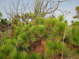
We dock out kayaks at the Nature Conservancy's dock and begin a hike through the Long Leaf Pine forest.
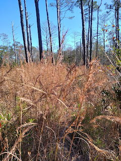
Among the Long Leaf Pine, we spot a couple Red Cockaded Woodpeckers and a Piliated Woodpecker. The Red Cockaded Woodpeckers nest in cavities of dead Long Leaf Pine. Researcher have identified the nesting trees by painting the base white.
We also learn Pitcher Plants, Sundew and Venus Fly Traps occupy a boggy area in the vicinity. Feral hogs in the area, pose a menace by rooting through the landscape like rototillers.
Our island tour is a slow jaunt in a loop of about a mile. We end up back at the dock. Shove our kayaks off and paddle back out Vaux Creek to the Waccamaw.
The long paddle across the Waccamaw is pleasant and considerably more comfortable than our first crossing which was in 38 degrees temperature. Our destination is Collins Creek. This creek is wide as we start up it but it closes up rather quickly. There are a couple private boat launches along here.
Mike guides us into the Cypress swamp in a narrow channel. We have to maneuver around Cypress knees. Finally, at a dead end, we have to turn the boats and head out. It is a short paddle back to the marina.