In 1983 a Cessna airplane crashed into the side of Browning Knob near Waterrock Knob. Thus, now it is a popular hiking destination from the Waterrock Knob parking area. It was of little interest to us. Our plan was to hike Yellow Face (6032'), Waterrock Knob (6292'), Mt Lyn Lowery (6240') and Plott Balsam (6088'). In the process we would go over Browning Knob (6195') as well. Foggy in the valley this morning but it was a gorgeous day above.
After parking for the day, we hiked back down the approach road, crossed the BRP and walked 1.6 miles to the top of Yellow Face and back. There were no views on top and just a thicket of blackberry to make finding the highest point difficult. We settled on a rock to the right of the trail as the highest point.
Yellow Face from the top of Waterrock Knob.
Continuing, we retraced to the parking area and headed up the tourist trail to the top of Waterrock. After a brief stop to enjoy the view, it was on to Browning Knob. The trail drops steeply, levels out and then rises steeply, back to almost the same elevation as the last peak. There are many roots and slick spots along the way. The top of Browning Knob is where most everyone, heads left, down the side to the plane wreck. We kept straight on an unmaintained path. We dropped very steeply this time and followed an undulating route along a narrow ridge for about a mile and a half. We passed two very large boulders along the trail and headed up to Mt Lyn Lowry. Near the top, we came to a fork with the right identified as private property and video surveillance would be watching us. We took the hiking trail to the left and soon saw that this was hardly a trail. It appeared to have been recently cleared. The soft pine needle litter had not had time to erode away. This path was a series of obstacles and required good foot placement. There was a handmade sign on a tree indicating distances to Lyn Lowry and Plott Balsam.
This short bypass path took a lot of energy out of us. When we climbed back out at the other side of the private property, I was winded and we were pretty sure that we would not have the energy to make it to Plott Balsam. From here to Lyn Lowery, the going got easier and eventually, we were on a road. The road ended at the huge cross erected in 1964 in memory of Lynn Lowery. Lynn died just days after her 15th birthday in 1962. Her parents funded the 60' steel cross. A plague indicates it was built by Eugene B Miller in 1964.
The cross was lighted for years. In 2011, the lights went out due to a malfunction. Although, repairs may have fixed that, the mercury vapor bulbs used are no longer available and newer bulbs don't have the wattage needed. The color or shade of color given off by newer bulbs is less desirable. The Lowery family foundation has maintained the cross for almost 60 years and it still look quite structurally sound. The road leading to it does not look like it has seen any vehicle traffic in quite some time.
It was such a pleasant time in the shadow of the cross. It was 12:30 and the round trip to Plott Balsam would take over 2 hours. We had decided not to attempt to go any further, so this was to be our turn around spot. We ate a leisurely lunch and enjoyed the views in all directions.
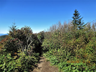
Returning the way we came, Will decided to do some maintenance in the overgrown areas. Can you spot him in the photo above?


No comments:
Post a Comment