Wednesday, March 10, 2021

Mar 6 TRLT Hike


Travis welcomes everyone

This is the inaugural hike of the TRLT (Three Rivers Land Trust) Hike Club. The Hike Club will have one hike a month on TRLT properties. Today we are on a large tract of land near the Uwharrie River. There are conservation easements on this properties so it can not be transferred to the National Forest Service. Currently, TRLT has divided this land into hunting blocks and it is in their hunting program. Thus it is not open to the public.

TRLT Clubhouse

The property came with this deer hunting lodge, adorned with many skulls. Several other building are in various states of disrepair. 

Crystal leads the way

Cotton Family Cemetery

First stop is the Cotton Family Cemetery. There is a stone enclosure but most of the graves lie outside of it. There is one which intrigues us. "Letha consort of Thos Cotton". We speculate on this. I later saw on various grave and ancestry websites that Letha Coggin was married to Thomas Cotton and had 3 children. Why she was listed without a last name and as "consort" remains unexplained but I suspect it all made sense back in the 1870s.  


This structure is alongside the Uwharrie River and has a concrete slab inside. It must have supported a heavy piece of machinery at some time.

State Champ

Right alongside the Uwharrie, is this State Champion Short Leaf Pine. Crystal explained that it is a co-champion. Trees are measured in several ways and scored. If trees are within 10 points of one another, they are given co-champion status. 


Down by the river these daffodils grow. That usually means a homesite was there. These have an unusual look with a green tint within the flower. Someone called them Yellow and Green Eggs. 
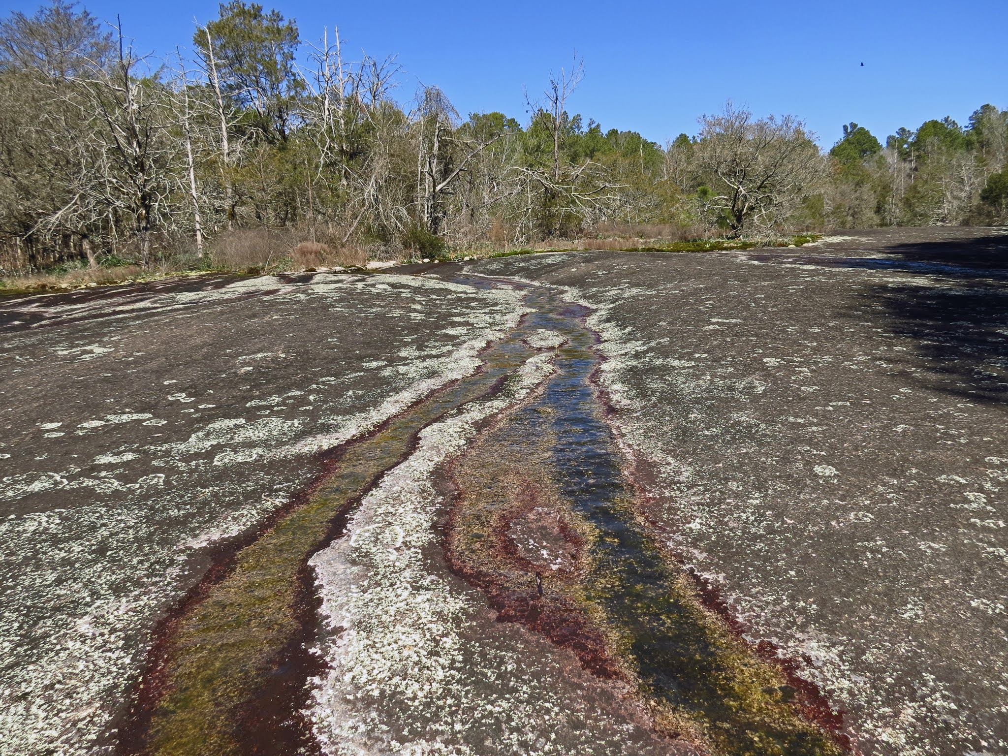

Horse Pasture Creek

Historic Deer stand


Mar 4 Forty Acre Rock


It is a stunningly beautiful day and we are headed to Forty Acre Rock near Kershaw SC. Will and I have made two previous trip and are bringing good friend Rick along for this tour. Rick is showing off his camera above. I have used a number of his photos in this post. You should be able to see the difference.


We began hiking from the lower parking area, heading for Naked Falls first. The area around the waterfall was sporting a carpet of Trout Lilies. Will said his SEEK app identified them as Fern Lilies. We climbed the trail next to waterfall. Rick is taking a photo from the waterfall top. The water just glides over the smooth rock here.


We are on the main rock. It is evident the pandemic year of 2020 has left a fresh compliment of graffiti. We spend some time walking around the rock, looking for other trails and inspecting all the pools. There are a few other folks roaming around too.


After a grand tour of the main rock, we slip down a slight drainage to get onto the other rock areas. Before touring them, we drop down to see another waterfall and the cave beside it. The cave has been painted so many times during the past year, I'm calling it the Covid Cave. 

Elf Orpine

We explore the smaller rock areas and sit for lunch at a very nice spot. Water trickles along these rocks more than the main rock. The waterways and pools fill with Elf Orpine and other succulents. Mosses and Reindeer lichen enhance the rock gardens. 


On google earth, I spotted a rock we had not visited before. We had to go through a wooded area using a privately owned field as a guide to lead the way. And there it was. Each rock seems to have a different dynamic going on. This one was a bit drier but a beauty, just like the others. Other hikers have been here before but this is undoubtedly the most remote and least visited. 


Slipping down into a gulley, we try to stay in the woods, making our way to the next area of exploration. When we get to a powerline, we decide to head out to the road and walk along it. Our target is a creek on the other side of Nature Preserve Road. The spot to turn into the woods is a flat area of road with a one car pull in spot. Here we head into the woods, passing an old farm or timbering dump. The old road leads to a small waterfall and creek.


It is a small waterfall but quite scenic. Just downstream from here, the creek disappears under a rock jumble. You can get inside the jumble and climb around, listening to the creek crashing down rocks below you but out of sight.

Rock jumble with underground creek

Will's plan all along, has been to walk up a side drainage here. We do that and see large rock outcropping and erratically placed boulders. As we walk around here, we keep seeing interesting boulders and keep walking. 


We are amazed to see so many and that they are solitary and so oddly placed. This goes on for a good 1/4 mile. We are roughly walking downstream but just out of sight and sound of the creek. 


We are not able to cross the creek, so we walk alongside it until we reach old 601. The road is overgrown but there is a bridge over the creek and we make our way back toward the parking area. But wait. there is one more stop. I had seen on GIS a cemetery across Rt 601. We walk over to it. It is on a gated road a couple hundred yards back in the woods.


Tuesday, March 9, 2021

Feb 25 Cades Cove Hikes


It is a nice day and Cades Cove is always a popular place, so our plan is to drive the 11 mile loop and do short walks off the beaten path, so to speak. This spot is quite scenic, a few large trees in the middle of a pasture, with Rich Mountain in the background. If you walk up to this spot, you'll see it is a cemetery.


Unmarked stones have been getting pushed around by the tree roots for years. This is the Ike Lequire Cemetery. There are 16 unmarked graves. 


Now we are at the Lawson Cemetery, hidden on a wooden knoll near the Dan Lawson homesite. It has 25 graves. Dan and his wife are buried here. This is the famous cemetery which never became part of the park property since it was titled to "God Almighty". 


As you leave the Cable Mill Visitor Center continuing to drive around the loop, this pond is always visible in the forest on the left. Finally, I made the short walk to it. There were 3 men wading in it, engrossed in some aquatic study.   


Above are 3 large Dogwood trees alongside the Cable Cemetery. We walked back in the wood here and saw several deer. They didn't mind our presence a bit.


Just opposite the Missionary Baptist Church, is this stone circle. No one knows what the purpose of this was. It is associated with a former CCC camp. It could have been a flower bed, fountain or flagpole base. It had become obscured with vegetation over the years. The Cades Cove Preservation Society had a workday dedicated to reviving it and intriguing people like me with it.  


On the path to Gregory Cave, we passed an old homesite and saw this massive Cypress tree. There were a number of  them nearby too.


I have always thought this is the entrance to Gregory Cave, but I'm not certain. It was once a commercially operated show cave by the Gregory family. The nearby Missionary Baptist Church held some services in the main room back in 1954. It was prepared as a bomb shelter with 1000 person capacity. There are some rotting picnic tables nearby which were used by the NPS for group presentations. It looks like you could slither in there but not today. 

The sinks

Feb 24 Visiting Old Friends at Albright Grove


Cemetery on Old Settlers Trail

It's been a few years since I have made the trek up Maddron Bald Trail to the Albright Grove. I'm excited to visit my old friends in the grove. Champion Fiber Co owned the area and planned to log it. The National Park Service condemned the property and after a suit, the property reverted to them. It is named for Horace Albright the second director of the National Park Service.


We start our hike on the tiny and obscure parking spot and walk up an old road, still paved. A park employee passes us in his vehicle, on the way to work on Old Settlers Trail. We stop at the Baxter cabin to glance around. Behind the cabin is a spring and probably a springhouse existed here also. 

Tulip top missing

The hike to the grove has 3 distinct sections. The first being a gated but drivable road up to the junction with Old Settlers Trail. Then an older road which eventually ends in a loop. That was probably where early tourists drove to and turned back. Then an older track continues to a crossing over Indian Camp Creek on a spectacular footlog bridge.


We walked the Albright Loop in a clockwise direction. There are always new trees down on this trail and today was no exception. Some had been recent and had barely even been walked around. We took our time walking, noting what tree species we were seeing. The Big hemlock are all dead or dying. The poplars have taken over as the giants of the grove. They are being challenged next by some big oaks. The giant Silverbells, Maples and Fraser Magnolias are wonderful to see so large. Upper branches are covered in resurrection fern and other small bushes and even trees. many tops have been lost to lightening and wind.

Fraser Sedge

Silverbell burl

Lunch was simply peanut butter and strawberry rhubarb sandwiches but the spot made it a grand occasion. 


Fallen Hemlock

I estimate the diameter of this Hemlock to be about 40 inches. It fell right across the trail. You could still smell the sap.

Indian Camp Creek bridge


Tree which grew on a nurse log

Hemlock adelgid 


Apr 8 Roy J Maness Nature Park

  This Troy park is a great place to fish, picnic and smoke weed. That is what I see every time I visit. I never thought of what wildflowers...