Thursday, October 24, 2024

Oct 22 Cliffs of the Neuse


Located in the coastal plain, Cliffs of the Neuse is a small NC State Park at under 900 acres. I began my visit at the Visitor Center. The building has some interesting displays which touch on the human history of the park as well as the geology. Tuscarora and Saponi Indians have occupied the area and used it for ceremonial hunts. The sand cliff rises as much as 90' up from the river and runs about 600 yards along the river.


Mountain galax is found on the Galax Trail. I doubt you can find it many other spots in the coastal plain. Here, the galax meets Spanish moss.  I heard the Bird trail is a good birding location but I did not hike it. And, although I did not measure it, the 350 Yard Trail is probably about that long. 


The banks show erosion almost everywhere I hiked along the riverbank. It's lucky to have Cypress trees like this one. Not only are they attractive but the root and knee system work to prevent riverbank erosion.


My hike started in a Loblolly forest along an old wagon road. That led me right to the tallest point in the park on the 350 Yard Trail. Then it was a walk above the river with occasional views of it. That trail brough me to river level and a Cypress forest. This bottom area was covered in a very slick mud. I could see where other hikers had slipped in the mud. Then it was a forest walk back to the Visitor Center passing Swim Lake (another not so creatively named place). The forest was quite dense here, not suitable for off trail exploration.


In 1945 a local Goldsboro businessman Lionel Weil donated the original 291 acres for the state park. Other landowners followed his lead with donated land. A few parcels were purchased as well to bring the park up to almost 900 acres. Weil was a multi-faceted fellow. He, seemingly, was involved in everything, businesses, charities, civic organizations, farming and land conservation. He even authored a book - Our Native Trees and invented a devise to transplant Longleaf pines. 


Over time, the river carved the cliffs. The one above is quite steep and looks unstable in spots. Layers of sand, clay, seashells, shale and gravel make up the cliff, like a muted rainbow. The park has taken measures to protect the cliffs for safety and to preserve the cliffs. Climbing, repelling and digging for fossils would result in a very quick erosion of the cliffs. 


Just outside the park's boundary heading downriver, is the site of Whitehall, NC, now Seven Springs. In mid-December 1862, Union solders attempted to destroy the Confederacy's ironclad Neuse which was under construction. They also wanted to destroy some key railroad infrastructure. The Confederates, crossed the bridge at Whitehall and burned it. At night the Union soldiers rolled barrels of tar to the riverbanks and lit them on fire so they could see the Confederate positions. The following day they attempted to deceive the Confederates into thinking they were going to try to cross the river but instead send most of their soldiers to destroy a railroad trestle near Goldsboro. The Confederates were not fooled and most of the Union soldiers retreated to New Bern. A small force stayed behind to help the wounded and bury the dead. A Confederate patrol found an open trench with 100 dead Union soldiers in it. The Union's Maj Gen John Foster who led the attack was severely criticized in northern newspapers for this and failing to achieve his objections. Yet the Union promoted Foster. 


Wednesday, October 16, 2024

Oct 15 A Nice Randolph County Hike


Like a monument, this chimney soars high but is almost completely hidden from sight. It is located within 100 yards of some farm buildings and a open well. There are several wolf trees surrounding it defining the home's yard. The bricks are solid, hand formed and secured with mortar. Another pile of darker bricks may have been the the front entrance. A rectangular water filled hole likely was a cellar.


Obviously, this was a two story home. Fireplaces warmed 2 downstairs rooms and two upstairs rooms. The lower fireplace here looks like it may have been an oven. 


A large grand fireplace was probably the main room of the home.

Smaller upstairs fireplace

This is a fancy corncrib


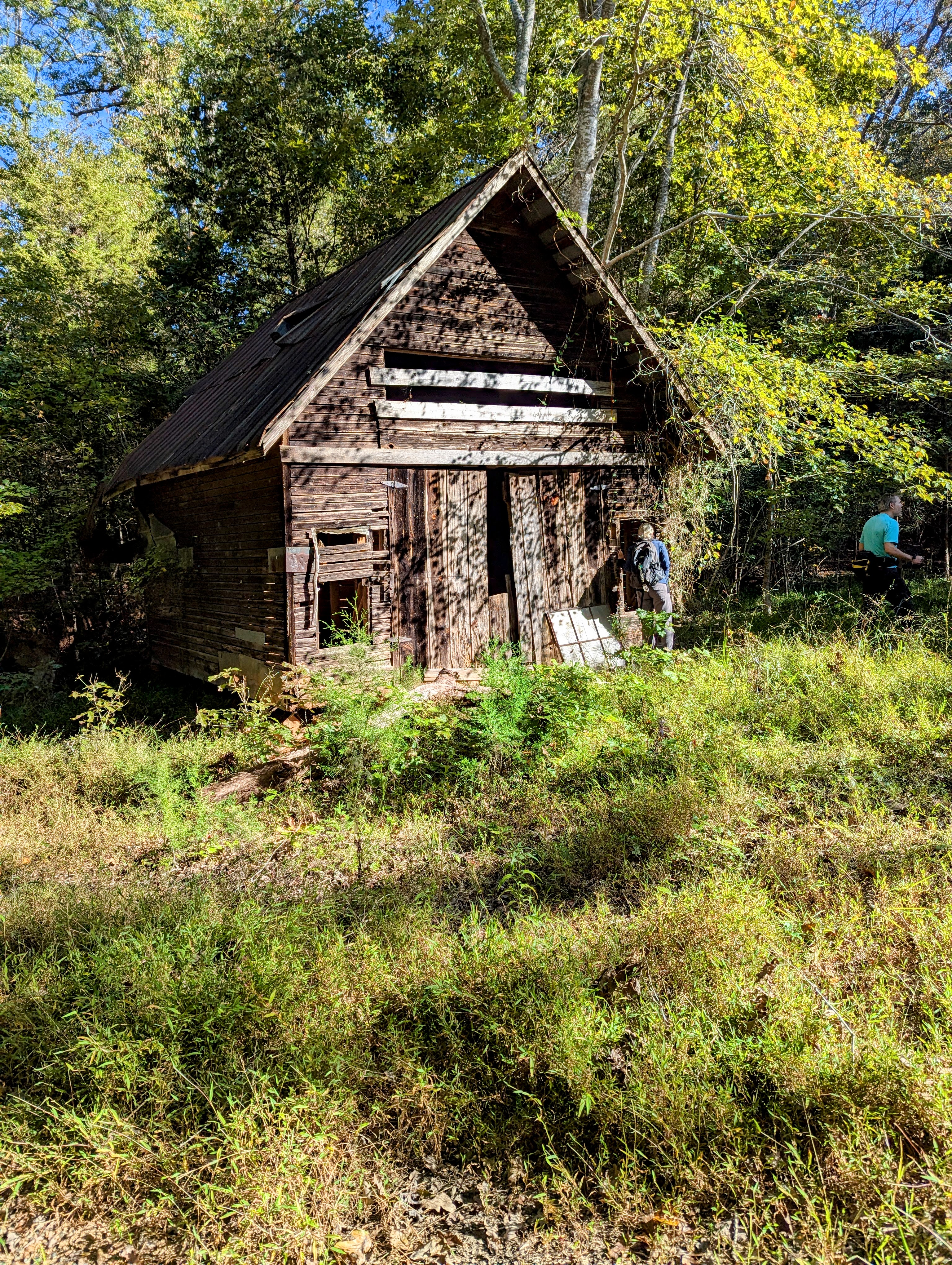
The barn has survived due to the roof being almost fully intact. It is slowly succumbing to weather and nature.


The skinny purlins indicate to me the roof had always been metal. The ladder accesses a hayloft. The right side of the barn has several animal stalls. 

Possible grain storage bins


Mortise and tenon joints are solidly held in place with pegs throughout the structure. The wood beams show circular saw blade cuts.


Strawberry bush. However, I prefer the more whimsical "Hearts A'busting". Deer love the leaves. Often all you see is the sleek green woody stem. Don't try to sample it, for us humans it is poisonous. So poisonous it plays its way into the Grimm's fairy tale - Sleeping Beauty. The strong woody stem of the European counterpart - Euonymus europaeus (our version is Euonymus americanus), was used to make spindles. You'll recall that an evil fairy caused the young princess to prick her finger on a spindle. Instead of killing her, a good fairy was able to save her from death by changing that to 100 years of sleep. 


This creative bridge looks like a troll hangout. Several 55 gallon drums filled with concrete act as buttresses for the timber bridge. We found several large timbers down creek. 


Our tour of the property included following a creek for about a mile. It was a lovely rock filled creek with many snakeskin liverwort covered rocks. Liverworts are nonvascular plants. Without a vascular system to transport moisture and nutrients throughout the plant, liverworts tend to be small and grow in moist areas along creeks. 


The property had a long dry ridge of large rock outcrops. 


One member of our party had to depart early and encountered this dam. She texted a photo, so the rest of us altered our course to check it out.


This dam appears to have impounded several acres of flood plain along an unnamed tributary of the Uwharrie River. It is completely built of dry stacked stones probably from the creekbed. The dam has been breached where the creekbed is, on creek right. Lots of stones are just downcreek as a result of the breach. There is a small stone portion on far creek right that survived. That portion has a small conduit opening with no water flow. The dam does not appear to have spillway abutment walls like the check dams of Caraway Creek. 

About 130 feet in length, 5-6 feet wide with a level top and varying height, 8 feet at its highest point. It is located in a narrow area with rather steep hills on either side. 

Just downstream is a flash board riser laying on its side which appears to have been recently made (within 10 years). It likely was secured in the breached area for raising and lowering the pond level. 


Friday, October 11, 2024

Oct 10 Inside Sally Coggins Mine


Hidden in the Uwharrie National Forest, on a tract with no curated trails, is this mine. To get to it, you need to follow a number of old forest tracks and a lot of offtrail just using dead reckoning (I know that is a nautical term).  During a previous visit with Will here, we were able to locate the mine entrance for the Sally Coggins Mine but getting down a steep embankment to it was too risky. Since then, another friend, Matt, made a visit and was able to get down and in. However, without light he entered the mine and took a photo. The flash startled a Vulture which in turn startled Matt who does not startle easily. This trip, we had multiple ropes and light sources.

Ed. note: Some conflicting information indicates this might be Morris Mtn mine or Sallie Coggins mine.


After repelling down the embankment, there is a small space right in front of the opening, flanked by steep sides and this water filled vertical shaft. Matt attempted to measure the depth of the vertical shaft using a rock tied to a string. It is at least 10 feet deep. 


At the very end of the mine shaft this Camel cricket makes its living. Also known as Cave crickets, they are wingless and unable to fly or chirp. They can jump a surprising distance. 


For safely repelling and climbing out, two safety ropes were used. 

Measuring the vertical shaft.

Matt looking at an upside-down Russula mushroom 

We saw several upside-down mushrooms on the mine ceiling

Looking out

The shaft goes in about 30 feet, then turns for a short distance and we can easily stand up the entire way.


Looking in

After visiting the mine we climbed back out using our ropes and continued our exploration of the mine area. 


Nearby is another vertical shaft. This one measured about 6 feet deep. Matt saved a Box Turtle that had gotten down to water level and could not get back up the steep sides. 

Then it was off to find the Morris Mountain mine which we never found but had a nice hike in the woods. 

A White Oak cradles a Red Maple.

Fresh patch of Jack-O-Lanterns


Sep 5 A Big Meal for RIFA


RIFA - Red Imported Fire Ants. The photo above is a recently killed toad which is being consumed by Red Imported Fire Ants. It appears the ants are building a mound encircling the toad. RIFA can kill toads and other small prey. I don't know if this toad was killed by them or died some other way. I saw a smaller toad nearby that was just a skeleton with a similar ant structure around it. 

Wednesday, August 7, 2024

Aug 3 Lilies, Cheetos and Chiggers, the Legacy of Eastwood Preserve


Lilium pyrophilum, the fire loving lily, otherwise known as the Sandhill Lily. Its range is a narrow strip of sandy bogs along the fall line separating the piedmont from the coastal plane in NC, SC and a possible population recently reported in Georgia. Reports of populations in VA are questionable. It has not been known to science for very long. Beginning in the 1950s, botanists from UNC Chapel Hill were confused by it but they lacked the ability to fully define it. Bruce Sorrie, after moving to NC in the 1990s was tasked with inventorying the flora of Fort Bragg, now Fort Liberty. Jay Carter alerted him to be on the lookout for the lily the UNC group had reported back in the 1950s. Sorrie teamed up with Mark Skinner, a lily specialist, and fully documented the species in 2002. Today I got to see several of the lilies in bloom at Eastwood Preserve after trampling through chigger infested terrain. This one above is quite brilliantly at its peak. 


There was a very nice community of these yellow or orange fringed orchids in a boggy area. I was told a white fringed orchid was on a nearby property. It was described as the whitest white can be. 


Bog Cheetos, more commonly known as Yellow milkwort and more formally known as Polygala lutea grow close to the ground often hidden in tall grass. Why is it Yellow milkwort and not Orange milkwort? Lutea is Latin for yellow. Why not Polygala aurantiacus (Latin for orange)? Well, the species was dug up in America and shipped to Carolus Linnaeus, the Swedish scientist credited with establishing the binomial system of naming and classifying all living things. So, Linnaeus received the species months after it had been dug and it had turned from brilliant orange to yellow. Hence, we still call it lutea. I'm sticking with bog cheetos. 

Meadow Beauties

Orangegrass but looks yellow to me


Summersweet or Sweet pepperbush. The flower has a sweet fragrance and blooms in the summer. The mature fruit resembles a peppercorn but does not taste spicy. The peppercorns we use as a seasoning come from a vine that is native to India but now grown in tropical areas around the world. 


I think this is White camas or Death camas. That sounds like you would not want to eat it.

Blazing Star. Which one?


Beaked pencilflower. I've heard it is called pencilflower because its color resembles a #2 pencil's color or a school bus.

Jeff Marcus of the Nature Conservancy gives introductions. Jeff lives on the preserve so he knows this place like his backyard. 


My souvenir from today's hike. If chiggers have a redeeming feature I don't know what it is.  


Jul 26 Caraway Creek

Very fresh Chicken of the Woods There must be a decaying log or stump below.  Laetiporus cincinnatus is the whiter version of this fungus. I...