Thursday, February 3, 2022

Jan 26 Grotto Falls


It began as a cold hike. Hand warmers were in our gloves and we were bundled up as much as possible. The scene above was part of the burned area from the Chimney Tops 2 fire in Nov 2016. It is recovering and the contrast of green undergrowth and dead tree is picturesque.  


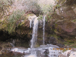
The area near the falls was too icy to go behind them. I watched a gal with microspikes gingerly step behind them but I kept my distance. The spray from the waterfall had frozen on all nearby surfaces.


This trail was rehabilitated recently by the Trails Forever crew. Their work is just phenomenal. These steps are made from locust logs and beautifully constructed. We saw their work all along this trail.


Ice on all the trees blew off all day making it seem like it was snowing.


In the summer, Grotto Fall is a short walk but winter adds another dimension. We parked at Rainbow Falls trailhead and walked 2 miles to the Grotto Falls Trailhead. We walked on the trail and on the road alternately. 

Big burl

Jan 25 Jim Carr Quiet Walkway


This quiet walkway is also alongside the West Prong of the Little Pigeon River. A continuation of the old road we saw back at Balsam Point was apparent. 


It has been a cold January and here we see daffodils ready to bloom. That is not what I expected but here they are. Obviously this is an old homesite. We could make out the foundation right where the above daffodils grow. 


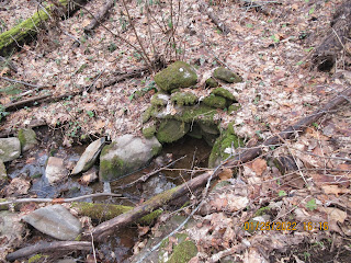
This springbox is just steps from the homesite. There is a very nice walkway along the river here in both directions.

Jan 25 Balsam Point Quiet Walkway


There re 14 Quiet Walkways in the GSMNP. I have been to a couple and decided this trip to visit more. There are 3 on the NC side of Newfound Gap Road. We drove past them all. They are not identified except by a small green sign at the start of a trail. The trails aren't marked. There is no brochure for them. They are not in guidebook and not part of the Smoky Mountain 900 mile challenge. So finding them is the first challenge. Once this became apparent, we started looking at every pullout to see if there was the small green sign. Finally at Balsam Point we spotted one in time to pull over.


The path led down to the West Prong of the Little Pigeon River. There was an old road with a nice stone wall alongside it. We meandered around. Many social trails went this way and that. If you had time and were adventurous, that old road would be an interesting exploration.


Jan 24 Uwharries Cedar Rock Mountain


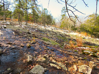
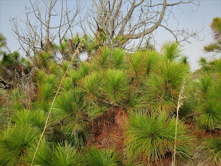
A great spot in the Uwharrie mountains is this place in the Birkhead Wilderness. I walked in from the NC WRC trailhead on High Pine Church Road. There is an old road off Camp 3 trail that leads to the mountain. I'd heard of some Long Leaf Pine at the base of the mountain but did not find any on this trip. 


There is a limited view to the north of Mt Shepherd. I could just make out the towers on top.


Jan 13 Stokes' Bostick & Hairston Plantations


In Stokes County, along the Dan River, two large plantations thrived on the labor of enslaved people years ago. Both dated back to the late 1700s. Absolom and Bethenia Bostick owned the 3000 acre Shoebuckle Plantation on both sides of the Dan River from 1775 to 1804, a year after Absolom's death in 1803. Peter and Alcey Hairston bought most of the Shoebuckle Plantation in 1804, adding it to their Saura Town Plantation just upriver from the Bosticks. Surveyors have recently discovered a cemetery on the former Shoebuckle Plantation. We decided to search for that first.  


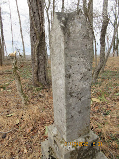
It took a short period of time to locate it on a hill overlooking the Dan. There were a half dozen marked graves. We assumed they would have been descendants of former Hairston slaves. The area nearby had what seemed to be another 40 or so unmarked graves, just depressions in the ground. We found a couple unmarked stones which may have been used as headstones. Possibly, these were the graves of enslaved people of the two plantations. Nearby, we located a flat area with a view of the Dan which could have been the location of the plantation house. There was an old road leading to it. Absolom and Bethenia were both buried in unmarked graves on the property. It's possible they are here as well.


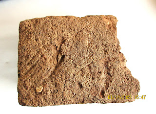
After completing our tour of the area, we headed upriver to the Hairston family cemetery on the former Saura Town Plantation. The property has been logged in the past few month with the exception of the cemetery. The location of the house is not known. While viewing the cemetery, we note a flat area nearby with a grand view of the Dan. At first, I noticed a number of small river worn stones. There were quite a few and in many colors. It was a good way to the river, so these had to have been brought here. Then I found a few chards of glass and ceramic and finally a bunch of broken bricks. All of this had been exposed during the logging operation and likely would have been below leaves and partially buried prior to logging. Thus, we think this is the location of the house.


The Hairstons are buried in the rock enclosed area below. The Goolsby graves are outside that area. It is speculated the Goolsbys are descendants of an African king. They were a highly thought of family and there are many tales of John Goolsby and his fascinating life as a slave and free man. 


Peter Hairston grave exposed to the elements


This is where the seven islands bridge crossed the Dan before it was moved.

Two species of trees join up

Tuesday, January 18, 2022

Jan 1 Bird Island


Maritime Grasslands

Our "First Day" hike is a new one for me. Bird Island Nature Trail is accessed via Sunset Beach NC with a one mile beach walk. Just before reaching the Kindred Spirit mailbox, a nondescript sign atop the sand dune, indicates the trailhead. The beach walk was into a stiff headwind. Visibility was impaired due to the wind kicking moisture and sand up to resemble fog.

Salt Marsh

Once we stepped over the dune, the wind relented and visibility improved. The trail is less than a mile and is a lollipop loop. 


Bird Island is no longer an island. Mad Inlet separated it from Sunset Beach, a barrier island itself. In 1954, Hurricane Hazel moved the inlet about a mile east which now would be where the main road deadends at the Sunset Beach pier. Over the next 45 years, it migrated back to its original location. During this time, it significantly narrowed, going from 1700' feet to 200' in width. Hurricane Bonnie, in 1998 shifted sand in the inlet and over the course of the next year, closed it up altogether. Previously, one would only have been able to access Bird Island by wading across at low tide. Now you can barely see where Mad Inlet used to be.

Salt and Mud Flats

The island is a North Carolina Coastal Reserve. The previous owner had plans to develop the island and build a mile long bridge from Sunset Beach to access it. The developer requested permission to build the bridge. That action prompted locals to form the Bird Island Preservation Society. Their effort resulted in the state denying the request in 1996. Several entities teamed up to purchase the island in several transactions during 2002 and 2003. 

Maritime Shrub Thicket


Sand Dunes

Sunday, January 9, 2022

Dec 23 Sandy Island


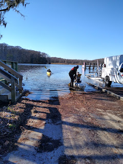
Today's paddle is with Black River Outfitters on the Waccamaw River in Murrells Inlet. Our guide is Mike Eady, a charter captain who grew up in Pawleys Island. His knowledge of the rivers here, goes back to his youth which was spent fishing and exploring this wild area. 


Beginning at the Wacca Wache Marina right on the Waccamaw. We paddle upriver for a few minutes and then head into a creek. The waterway is really just a channel of the Waccamaw but is is given a name, Vaux Creek. On one side is Vaux island, a very small island. The other side is Sandy Island, the largest inland island in the eastern US. At 6 by 8 miles it would be over 30,000 acres.


The southern tip of the island is inhabited with about 50 residences. The only access is via boat. The state has provided school transportation via a school boat. Is is said the residents are almost all related to Phillip Washington who purchased several hundred acres after being freed from slavery at conclusion of the civil war. Rice plantations were numerous in this area. One of those plantations was Brookgreen.  There is a road which runs the length of the island - Brookgreen Road. We walked on it for a short distance. All roads here are sand. 


We passed a spooky looking place on Vaux Creek. A fishing camp, we guessed. I must have been too spooked to get a photo of it.


Mike gave great commentary, some based on his experiences in the area. He pointed out birds as we saw them. Along Vaux, I saw a couple Bald Eagles, a Kite and lots of Red Winged Blackbirds. 


The northen part of the island is owned by The Nature Conservancy. They maintain a dock and cabin for research. 


From the Nature Conservancy website:

1993
THE THREAT
Businessmen Roger Milliken and E. Craig Wall, Jr. file for a permit to build a bridge from the north end of Sandy Island, where they own more than 9,000 acres, to the mainland. Their stated goal is to harvest timber, but the proposal quickly raises concerns about future development.

Objections from residents and conservation groups lead the state to issue a conditional permit, contingent on a study of the bridge’s environmental impact on the island’s endangered red-cockaded woodpeckers. The delay opens a short window for advocates to find a way to protect the island.

1995
Public opinion turns against the bridge, thanks in part to coverage from The New York Times, The Los Angeles Times, The Washington Post and local news outlets.

An updated application still fails to address the bridge’s full impact on the woodpeckers. The permit is denied by the U.S. Fish and Wildlife Service and the state Office of Ocean and Coastal Resource Management. 

1996
SUCCESS
After nearly three years of meetings between Milliken, Webel, Beach and then-Conservancy State Director Pat Morgan, Sandy Island Preserve is officially protected for $11 million.

The South Carolina Department of Transportation (SC-DOT) contributes $10 million, creating a mitigation “bank” to offset the environmental impact of future road construction.
The Conservancy contributes $1 million, agreeing to steward the land and take full ownership once SC-DOT uses up its bank credits.
Milliken and Wall agree to forego $1 million of the $12 million appraised value.

2000
The $3-million Winyah Bay Bioreserve Endowment is created with a spectacular $1.2-million closing gift from Diane Terni and The Diebold Foundation, in honor of Dorothy R. Diebold. The endowment funds a full-time land steward for Sandy Island and a project director for Winyah Bay.

2011
The South Carolina Department of Transportation officially transfers Sandy Island Preserve to The Nature Conservancy.


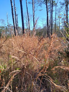
We dock out kayaks at the Nature Conservancy's dock and begin a hike through the Long Leaf Pine forest.


Among the Long Leaf Pine, we spot a couple Red Cockaded Woodpeckers and a Piliated Woodpecker. The Red Cockaded Woodpeckers nest in cavities of dead Long Leaf Pine. Researcher have identified the nesting trees by painting the base white.  


We also learn Pitcher Plants, Sundew and Venus Fly Traps occupy a boggy area in the vicinity. Feral hogs in the area, pose a menace by rooting through the landscape like rototillers. 


Our island tour is a slow jaunt in a loop of about a mile. We end up back at the dock. Shove our kayaks off and paddle back out Vaux Creek to the Waccamaw. 


The long paddle across the Waccamaw is pleasant and considerably more comfortable than our first crossing which was in 38 degrees temperature. Our destination is Collins Creek. This creek is wide as we start up it but it closes up rather quickly. There are a couple private boat launches along here.


Mike guides us into the Cypress swamp in a narrow channel. We have to maneuver around Cypress knees. Finally, at a dead end, we have to turn the boats and head out. It is a short paddle back to the marina.  


Sep 9 Jostedal Glacier - On the Ice

  Our guides for the hike today are from Nepal. We are on the Jostedal glacier. The largest glacier in Europe. The ice is dirty and granular...