Tuesday, March 23, 2010
Central Land Trust and the Uwharrie Trail
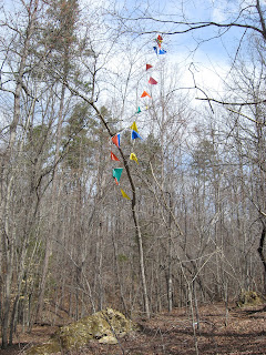
The Land Trust for Central North Carolina does wonderful work in the Uwharrie area. One of their projects is to create a corridor filling in the gap between Birkhead Mountain trail and the present Uwharrie Trail. The original UT crossed private land through this gap and was later abandoned as land changed hands and areas were timbered. Central acquired King Mountain and surrounding land a couple years ago. Long Mountain is owned now by the Plant Conservation Program (PCP), a state organization that manages for native plants. And now this final small gap between the two, Little Long Mountain or Bald Mountain, is for sale and Central has an option to buy pending a funding source. At the trailhead, Jason Walser, Central's director, stood on the back bumper of a pick-up to address the 35 or so people gathered. In his remarks, Jason stated that funding at the state level had dried up but despite the feds being in even worse financial condition, they were still writing checks and this could possibly be an earmark target.
Everyone made the mile hike up to the top where there are terrific views in all directions. There were so many kindred spirits and wonderful folks on this outing. Carol Fountain with PLC made the trip. My buddies, Matt Bennett and Mike Chisholm were there. Mike actually blazed the UT through this area 40 years ago. The NC Zoo snakeman, Mark Lewis kept a constant vigil for snakes of any type. I think he spotted and Northern Ring, all 6 inches of it. Boon Chesson, the longleaf pine conservationist joined along. There were fellows from Clean Water and Wildlife there too. And one fellow from Salisbury called Tux. Tux appeared to be a native American. He carried a beautiful staff with a leather grip and leather tassels. Attached to two were a Bald Eagle feather and a Golden Eagle feather. Tux happily pointed out, "white men can't possess these".
LOST in Linville Gorge
LOST = Lower Original Scramblers Trail
Thanks to PHOC member Marshall Weatherman for leading this scramble on the west side of the gorge. Armed with a GPS full of data from http://www.linvillegorge.net/ , Marshall led us on a route among the walls and canyons below Rock Jock and between Conley Cove and Pinch In. The route did at times have the semblance of a trail. I believe it may have been the route Bob Underwood cut through this area many years ago. My Seagrove buddy, Mike Chisholm also did some work on this trail. Apparently, Bob constructed this trail without the Forest Service's knowledge and once it became known, it became an official trail. The original route was just too rough for folks so Rock Jock was re-routed in most areas to a higher elevation.
We parked on the Kistler Highway just north of the Pinch In trailhead. Rock Jock Trail leaves the road here and winds its way through the charred remains of a vast forest fire area. Very few trees survived this intense fire. Scrubby brush, galax and mosses and grass is about it for vegetation now. We stopped at a spot where the red fire retardant, dropped from the air, was burnt into the rock. Blowdowns slowed us in a few spots but because there were so few trees still standing, this area is probably in much better condition than other trails right now.
Finally at a nondescript point along the trail, Marshall announced we we're leaving the trail. Now the real work began. Every step had to be thought out and carefully placed. Every few steps, I would search for a route through the next 20 or 30 feet and then proceed. Our first stop was a cave. We were able to stand and walk in about 100 feet before it narrowed. Pushing on, we scrambled down a chute and then through a keyhole and finally out on a point which made a great lunch stop which I believe was Little Seneca Point.
There was a steep scramble up from here to Zen Point before another descent to Razor's Edge. The climb out of Razors Edge was long and steep but finally we were back on the Rock Jock Trail and headed back. We retraced our steps over and around the blowdowns. It was on the final ascent to the road where I cracked, only able to walk a few feet at a time. The sight of the cars was welcome. I swallowed the last of my water and gradually made the transition from whipped, bruised and scratched scrambler to a more civilized state, ready for re-entry to the world.
More Photos of this hike.
Monday, March 22, 2010
Winter is Done and Spring has Sprung
Birkhead Wilderness Hike
It was a pleasant day for a hike around the Uwharries. Five other PHOC members joined me for this Sunday jaunt starting at Tot Hill. We visited Rush's Mine/Camp 3. I noted that the boy scout's aluminum marker/sign was missing. It was there just a couple months earlier. From there we traveled through Fern Valley and took a short break at Fairview. Landy's sharp eye's spotted what I think was a Northern Ring Snake. The first snake of my year. Also got my first tick of the year.
After a brief visit to Bingham's Graveyard, we found a campsite at the confluence of Robbins and Hannahs to enjoy lunch a taste of some single malt scotch.
As we hiked on, I noted that the campsite I had reported to the Forest Service a couple months earlier, has been removed.
We finished up by hiking Robbins Branch Trail and then Birkhead Mountain Trail back to Tot Hill.
Trout Lilies were blooming along the creeks and someone spotted a single hepatica .
Thursday, March 18, 2010
Big Spring Day at Morrow Mountain
We hiked a 5.3 mile loop beginning from the horse trailer parking area, up Sugarloaf, through the park office, up Hattaway, off trail to an old road and finally onto the perimeter bridle trail.
When we parked, there were 2 horse trailers parked in the parking area. When we returned, there were 25. We also heard most of the motorcycles registered in North Carolina roaring through the park. However, we did find a secluded pond to sit at for a few minutes, far enough away that the motorcycles were just a muffled roar in the distant.
A bit of Doughton Trail maintenance
This hike was up and down Flat Rock Ridge Trail in Doughton Park. The upper couple miles were through snow and many many downed trees. Without saws we were able to clear only those branches we could drag out of the way. And there were many. Once at the top, it appeared the trail was blocked by downed trees in both directions.
Thursday, March 11, 2010
Pizza Again
Tuesday, March 2, 2010
Snow and Ice in Rock Castle Gorge
It began as a nice day back in Greensboro and on into Virginia. When we turned onto the final road to the trailhead, we realized we'd not be taking the trail up to the Parkway. There was about a foot of hardpack on the ground. Plan B was to follow the old road up to the Parkway. Of the 9 of us only 3 did not have foot traction. It was slick but not too bad. We made our way up the road about 2 1/2 miles and ran into a lump of ice the covered the road and prevented any further progress. So, we turned back, had lunch in the old barn by the one house along the trail.
After finishing, I hiked up a short trail at a private park and took the last photo here, a great view looking north.
Subscribe to:
Posts (Atom)
Jan 4 Upper North Prong Hannahs Creek
Hiking from the dam at Plantation Road, up the creek toward Fern Valley. I've did this years ago but don't have any photos, so he...
-
In May of 1963, a Piper aircraft carrying 5 persons crashed into the north side of Hanging Rock Ridge. Two persons died as a result of ...
-
Hidden in Hanging Rock State Park are many scenic gems. This is one of those places. Along Cascade Creek, you will find this pool of re...
-
In southern Randolph County, tucked away in a secluded field, in the flood plain of a tributary of Deep River, sits this Indian mound. It is...