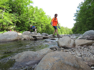
Marianne from Derry NH is leading our hike up Sugarloaf today. It is the first day of the 2017 Appalachian Trail Conservancy's Biennial event, held at Colby College in Waterville Maine. There are just 7 of us on this hike but it is a wonderful group with lots of hiking and outdoor experience.
The hike begins at the end of a 4 mile dirt road. We pass around the gate and hike up the road a bit further. Shortly, the AT crosses and we turn left toward the mountain. There is a short walk downhill to a very rocky river. Immediately, we all wonder how we are going to cross this river. Then we see that a board crosses half the river. The rock hop was not difficult and shortly we are all on the other side. Now we head uphill.
The wonderful weather we started in has flipped to the dark side. Clouds drape the mountains and begin to move down the ravine above. The trail turns into a scramble in a section just past here. We move in a birch/spruce forest, then out in the open in heath bald, then back into forest. We are moving very slowly at a rate of about 1 mile per hour. That is what my Vermont Long Trail experience has been. The last glaciation left a mess of rocks all over these mountains.
Finally we reach the spur trail to the summit but we have all decided to forego this final leg since the views will be obscured by clouds. It is also raining lightly.
The spur trail, above, is only .6 mile long but it rises between 500-600ft. Look at the mess of rocks going up. It is hard to make time here.
We turn back to return the way we came after donning rain gear. It isn't much easier going down but just not as tiring as headed up.
It is very windy here. The photos may not show that. Flower close ups were impossible.
One of group, Tony from Reston Virginia, called this section the Hillary Step of Sugarloaf. Named for Sir Edmund Hillary who first summited Mt Everest with Tensing Norgay, the step is a near vertical rock about 200 feet below the summit. It has been reported earlier this year, the step is gone. I don't know if this makes the climb easier and don't plan to find out.
The downward journey continued under less threatening skies. The light rain had subsided but the wind continued.
We are back on the gated off road here and just a few minutes from the cars. Thanks to Marianne for taking time to lead us today.


No comments:
Post a Comment