Tuesday, January 29, 2019

Jan 28 Birkhead Sign Setting


The Uwharrie Trailblazers have advocated for better hiking trail signs in the Uwharrie National Forest. A couple years ago, the UTB established a a program to redo all the trail signs along the Uwharrie Trail and for the trail system in the Birkhead Wilderness. Working with the Forest Service, Andy Newcomb, Daniel Alexi and his Boy Scouts, the UTB used mileage complied by Don Childrey in preparation for his hiking guide, Uwharrie Lakes Region Trail Guide, to design, built and install the new signs. The signs for the Uwharrie Trail were made with treated wood, painted Forest Service brown with yellow routed lettering. For the Birkhead Wilderness, natural cedar with routed lettering was used.


We began the setting process for the Birkheads. You may see new signs now at 3 of the Birkhead trailheads. High water and muddy conditions prevented carrying signs and tools to the more remote areas. Because the Birkheads are a wilderness, the Forest Service desires signs only at trailheads and major intersections. Getting lost in the Birkheads will still happen but it will be a bit harder now.


Yes, there is an app for leveling a sign


Don and I let the scouts do the hard work. We didn't even supervise, these guys are well trained and a great group of young men. After the sign setting for the day was done, Don and I decided to explore a bit. Someone had blazed some yellow spray paint on nearby trees, so we following the blazes until they ended, then explored some more. We visited a homesite I visit every year to see daffodils bloom. This one is unique in that it has a pond. Following old roads, we saw another homesite which probably also served as a timbering loading deck. It was a really pretty stretch of woods with easy to follow old roads.


Monday, January 28, 2019

Jan 27 WHW Big Creek and the Big Chimney


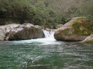
As we congregated at the Big Creek trailhead, I suggested we switch the hike to Baxter Creek and see the big chimney. After some agreement and disagreement, we decided to do both the chimney and Mouse Creek Falls. First we're going to look for the big chimney. Sherri had been in the area many times and was skeptical of its existence. So off we went, up Baxter Creek Trail for about 15 minutes and then off trail where I remember it being. When we saw it, it was stunning. A huge chimney, bigger than life. It was part of the lodge built by Crestmont Lumber Co, right next to Big Creek. After a few photos we head back to trailhead and the journey to Mouse Creek Falls gets underway.


Big Creek Trail was a lumbering railroad bed and quite easy hiking. We made stops at Midnight Hole and what we earlier thought was Midnight Hole. A bit farther upriver is Mouse Creek Falls. The Mouse Creek enters Big Creek in a big way. On the way back, Sherri points out a natural rock formation known as the blockhouse. There is a scramble route to it but not today.

A Rhododendron in bloom!

Wendy brought the big gun today

The real Midnight Hole

Mouse Creek Falls enters the turbulent Big Creek

Jan 26 WHW Albright Grove


This is Plan B. The creek crossings on Grapeyard Ridge were described to me and I switched my hike to Albright Grove. Named for the 2nd director of the National Park Service, Horace Albright. To get there requires a 2.7 mile hike up Maddron Bald Trail. The loop through the grove is .7 mile. Just 3 of us today. Three old guys going to see old growth trees. We encountered a group at the trailhead. They were headed to Henwallow Falls. Once again we flicked debris off the trail all day. There were a couple blowdowns we couldn't handle but could easily get through (until we got to the grove).


When you see this bridge, you are just minutes from the grove. Already the trees are big.


The trees in the grove escaped lumbering but have not escaped the Hemlock adelgid nor the elements. Most of the big Hemlocks have succumbed to the tiny insect. Many are still standing but are mere skeletons. Once that protective canopy disappeared, changes took place. Possibly, the protective canopy sheltered the tops of nearby trees from wind. We noted that many of the upper branches and tops of giant poplars had broken off despite the rest of the tree being healthy. Besides the giant poplars and hemlocks we saw large Fraser Magnolias, Silverbells (above), a few oaks and several I could not identify.

Hollow Tree

Hemlock Shelf Varnish with tanin icicles


Here is the blowdown that almost turned us back. It is quite possible this tree came down in Wednesday's wind. No one else had attempted to get around it so we knew it was fresh. Tom and I slithered over it using a couple handholds. Stanley scrambled around the root break. He said he could not see the hole from which it came, so it may have slid a ways before blocking the trail.


A giant dead poplar next to a healthy one

Tom peers through a hole in this Hemlock


Great hike! One of my favorites. We took a small detour on the way back to check out Madron (or Maddron) family cemetery. 

Jan 25 WHW Avent Cabin and Elkmont Chimneys


My knee needs a break today and there are already 5 WHW hikes headed out today, so my plan is to visit the Avent Cabin and head to Cades Cove which has just opened after a fallen tree closed the access road. 


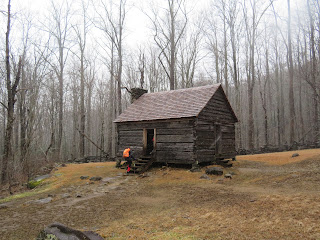
The Avent Cabin was built in 1850 by an Ogle family. They sold it to Frank Avent in 1918. His wife, Mayna was an accomplished water colorist. She used the cabin as her studio. They sold the property to the park in 1932 in exchange for a lifetime lease, putting the lease in their youngest child's name. The lease expired in 1992. Two years later the cabin was put on the National Register of Historic Buildings.


Getting to it is a bit cryptic. Two miles up Jakes Creek Trail, look for a faint trail leading to and over the creek. Most days you can see it from the trail if you know where to look. The log bridge was a bit icy today and the creek below was rushing.

I swept the floor and tidied the cabin up before leaving. On the walk back to the trailhead are the remains of the Elkmont cabins. These also, were acquired by the park in the same timeframe, the early 1930s and the owners were given lifetime leases which all expired in 1992. The cabins stood vacant for about 20 years. Many had trees on them or gaping holes. The park service removed them and now just the chimneys stand - a lot of them.


Jan 24 WHW Baskins Creek Loop

Our Crew Today


Our hike today begins on the Trillium Gap Trail, connects to the Roaring Fork Nature Motor Trail, then Baskins Creek Trail with a spur to the falls. All day we hike and do trail maintenance. Yesterday's wind brought down trees and lots of small debris. We are told the winds were as high as 60 mph. 


We encounter numerous blowdowns on Trillium Gap Trail. We clear what we can but do not have saws and have to leave most alone. Once on the road, we see a couple trees across it but mostly small stuff. The steepness of the road is hard on my knees. I am glad when we exit into the woods.


The Bales Cabin shelters us for a snack break. There is a slight wind today but temperatures are low and we are glad to seek its shelter. It appears, one of the adjacent building blew over in the wind. At first I think this was burned but you can see one roof side is a good 15 feet from the other - note the corner of that roof side to the far right of the photo above. 


Back on the trail, we walk through what was the hottest area of the 2016 Gatlinburg fire. It would appear the Rhododendron was killed but it is sprouting up from the skeletons. 


Baskins Creek Falls is on a .3 mile spur trail. It is a real "slip and slide" down to the base and most of our group manages to get down. Normally, you can cross the creek at the base of the falls but today it is not passable so we are not able to get a good angle for photos.


A couple creek crossings present some challenge but we all make it with only some minor splashing. 


This tree which appears to have come down yesterday, presents a challenge as well. It fell in a steep area. With the ground being so wet, we slip and slide by it. There are numerous other blowdowns on this section of trail.

Tom and Sandi have a good laugh at this blowdown


We rise into the mist in the eerie and burned forest. Table Mountain Pine is sprouting everywhere. Its cones release seeds only after fire has popped them open.

The hike ends with a long steep climb which saps our energy. We are all tired and muddy after this hike.


Fire has exposed the quartz rock here


Jan 4 Upper North Prong Hannahs Creek

  Hiking from the dam at  Plantation Road, up the creek toward Fern Valley. I've did this years ago but don't have any photos, so he...