Wednesday, September 25, 2013

Sept 24 Hawk Watch


As part of a raptor workshop conducted by NCDENR, I was able to join in this hawk watch atop Pilot Mountain's Little Pinnacle. Brian Bockhahn, NC State Park's Natural Resources Education specialist led the workshop. For most of the day we joined a couple experienced birders counting hawks. Pilot Mountain is one of the data collection sites for the National Hawk Migration Association. The hawk association compiles data from a number of sites across the country, mostly during September, the hawk migration time frame.


To migrate, hawks follow mountains which create thermals, allowing them to circle up high, then peal off headed to the next mountain. In the photo above, just to the left of Big Pinnacle is the rest of the Sauratown mountain range. Hawks use those mountains to rise up and head toward Pilot. Also, to the right of Big Pinnacle, perched on a smaller rock outcropping are a pair of Black Vultures. They are not currently migrating, they are locals.

The first raptors to appear where 3 Sharp Shinned Hawks. According to Phil, one of the Hawk Watch pros, those 3 hawks came in late the previous afternoon and stopped to roost overnight. Thus they were counted the day before so they were not part of today's official count. Next we saw a resident Red Tailed Hawk. We can't count that because it is not currently migrating. Finally, several Broad Wing Hawks appear low from behind the Big Pinnacle as our first migrating hawks. Then a Kestrel gets into a little aerial tussle with the local Red Tail. As the morning progressed, the hawks came in larger numbers and began passing high above.

By mid afternoon Broad Wings were so high you could barely spot them. The Turkey and Black Vultures also began rising higher and higher just to muddle the mix a bit. The 2pm hour was quite slow and Brian decided the workshop was over and we left the pros to continue the watch. 


Tuesday, September 10, 2013

Night Visitor


This is the first time a southern flying squirrel has made an appearance on the trail cam. 


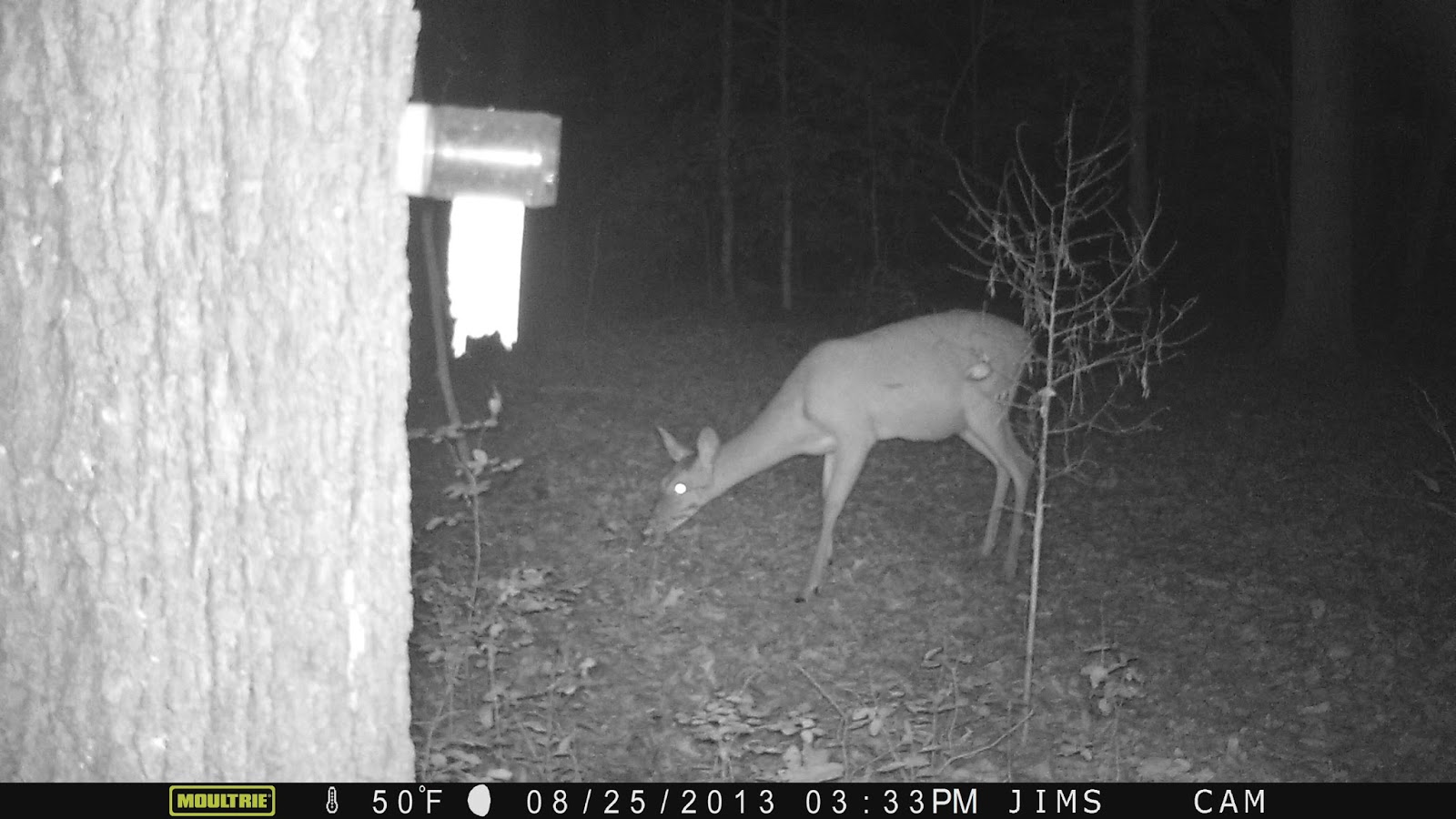
Sept 10 Trail Camera Photos


A raccoon emptied the peanut butter jar over the course of 2 nights. A little help came from an opossum and another creature I think may be a flying squirrel. 


This guy uses his paw to get at the peanut butter.


Sorry buckeroo, the opossum beat you to it.


Who might this be? Is it coyote or fox?


This fawn visited several times during the month.


Young buck


Another young buck or the same one?


Family reunion.


Doe poses for photo.


Sept 4 Update on ATT


The missing link is about to be completed. Here is the unfinished trail as it leads up to the new I-40 crossover bridge. The bridge's superstructure was put in place in July. Just 2 weeks ago the concrete deck was poured. There are a few finishing touches to be done but it will be ready for the official grand opening Oct 12.

Not many rail trails can boast a $7.5 million bridge. This one is 268 feet long spanning I-40 just south of Durham NC. The main support structure are two 30 in diameter arched pipes. All material were sourced in the US for a change. Once completed the 14.5 mile southern section will be connected to downtown Durham with the 7 mile northern section


New approach trail hugs the property border of Southpointe Mall. It is one of the only places I can ride a bicycle over the posted speed limit. The new trail sections will allow us to use the mall for a parking area and provide an array of restaurants for post ride meals.


Great Blue Herons are often seen in the wet area less than 1/2 mile from the southern terminus. Beaver Creek is impounded here to provide habitat for waterfowl and water birds.

Saturday, August 24, 2013

August 16 Camels Hump


Originally, Couching Lion. Not crouching, couching. Got that. Camels Hump, the second highest mountain in Vermont was once known as Couching Lion. If you view it from I-89 as I did, it looks like a crouching lion. I don't know what a couching lion looks like. So, it is cool place because it is the highest mountain in Vermont not marred by a ski resort. It is one of the only mountains in Vermont not marred by a ski resort. The Long Trail traverses the mountain and it is a State Park.The top is an rocky alpine outcrop with struggling vegetation. Probably very harsh environment in the winter.


We started hiking up the Monroe Trail toward the top. Paper Birch forests were quite scenic. It was a tough uphill climb with lots of rocks and roots to negotiate. It is one of my favorite places. Not sure why, but it has attained mythical status with me. Great view of Mount Mansfield and north, above.


There were 36 persons and 3 dogs on top when I passed through. All enjoying a great afternoon.


Paper Birch

August 15 Island Tour Bicycle Ride


The Island Tour Bike trail is one of the top bicycling destinations in New England. I was surprised to learn it was not signed as the Island Bike Trail but as "Burlington Bikeway, Champlain Trail, Causeway Trail and one other I can not remember. This caused a bit of confusion and caused us to ride an additional 2-3 miles due to poor signage.

As we drove to the starting point just south of downtown Burlington VT, I noted the street was lined with parked cars. Then we entered the park, paid $8 to park. Coincidence? It was full upon our return.

We started out with Lake Champlain on our left and downtown Burlington on our right. That was the case for about 2 miles until it gradually transitioned to suburbia. We rode through neighborhoods and through woods until we got to Causeway Park. Initially making a wrong turn here, we eventually realized our mistake and returned to find the most delightful trail you can imagine. The railroad had built a causeway into the lake to link the  mainland with South Hero on  Grand Isle in Lake Champlain. The causeway was lined with huge chunks of marble. Some were carved by amateur sculptors. The causeway is about 3 miles. Toward the end as you approach the island, there is a break in the causeway. I'm certain it once was bridged but is open today for boat traffic to pass. On weekend you can board a bicycle ferry for a very short ride to the other side. It not being a weekend, this was the turn around point for us. 


The wonderful tailwind we enjoyed on the ride out was negated by the 20+mph headwind for the return. It was a tough slog back.


Somehow we managed to bicycle back. Once on the mainland, the wind disappeared and we were able to ride normally back to Burlington. Our 27 mile ride took barely 3 hours. 

August 10 Mass Central Rail Trail


We're in Massachusetts. Bicycling. The Mass Central Rail Trail is a 90+ mile proposed trail. It is complete only in a few sections like this 10 mile spot we bicycled. The future is to connect the Boston area to Northampton. When that is complete, it will connect with the Farmington Canal trail, all the way to Yale campus in New Haven CT. That trail is mostly complete and a great bicycling venue already. However, today we just rode this short section mostly through a white pine forest. This is a watershed so it does have its charm.


There were many wet areas, marshes and swampy spots. Those are something we don't see much of in central and western North Carolina. It appeared to be a nice birding area as well.


This is a typical trail scene. The tread way was in great condition. A few sandy spots do trip you up but otherwise this was a splendid ride. 

Nov 9 Bryce Canyon National Park

  A quick stop in Bryce fell into our plans after learning the planned visit to Pando meant 20 miles of unpaved travel and a slower drive vi...