
To hike the Alum Cave Trail and park in a real parking spot, you need to begin your outing early as I did. The two parking areas were already filling at 8am. By mid afternoon and my return, parking along the roadway ways getting very creative.
The first 8 photos here, show the recent work of the Trails Forever Trail crew. Funded by the Friends of the Smokies, the Trails Forever endowment fund has raised $5 million for trail work. Already they have worked on the trail from Clingman's Dome parking area to Andrews Bald and Chimney Tops Trail, making them more sustainable trails. Now with the completion of Alum Cave Trail in November, another trail has been added to their accomplishments. Unfortunately, the Chimney Tops Trail will have to remain closed for years following the devastating fire last November. Alum Cave is one of the most popular trails in the park and has suffered from overuse. A number of areas needed attention. You can see in these photos the wonderful work the trail crew did. The bridge below was rebuilt using two 40 foot long Black Locust stringers hauled up by mules.


The old stone steps going through Arch Rock has been completely reworked as seen above.

The stone staircase is in an eroded area just above Arch Rock.


As you approach the Bluffs, this staircase was built using Black Locust logs, airlifted here.
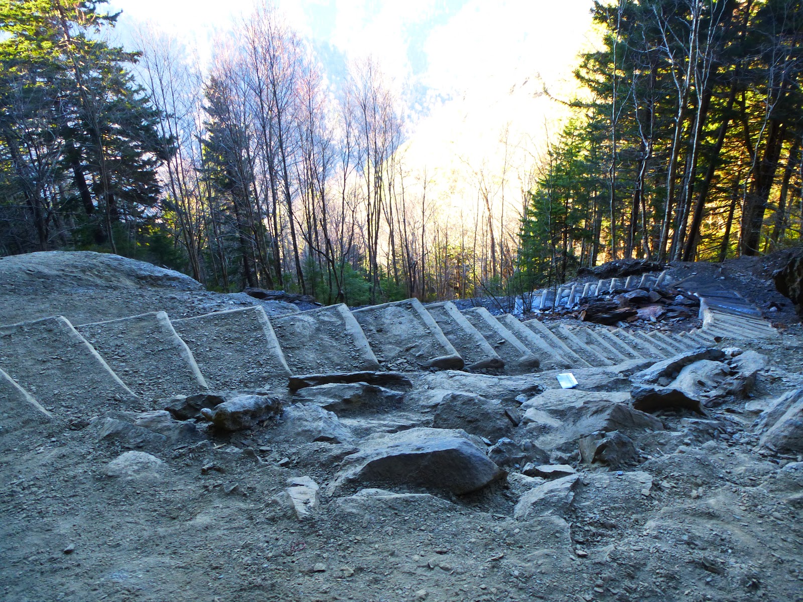
Previously, when you arrived at the Bluffs, there was a bit of a scramble which began to erode the whole area. This set of steps was also made from Black Locust. There was not sufficient rock in the area to built stone steps. Anakeesta does not lend itself well as a building material because of the way it crumbles in layers.

This staircase is beyond the Bluffs and looks like a staircase to heaven.

As I attain elevation, there is snow on the ground. It was pretty slushy so no ice to worry about today.

Nature's artwork - Is it rock or wood?

The stairway leading down to LeConte Lodge had a bit of snow. Guests had already left and the crew was busy readying the cabins for the next batch of guests.

At the very top of LeConte, 6593'; it is easy to remember that elevation. So many hikers sport the t-shirts sold at the Lodge. "I hiked it" , "Mt LeConte 6593". I turned on my Backcountry Navigator and held it, about 1 foot above ground, and it read 6594'. Pretty accurate! I sat in the pile of Anakeesta at the summit for about 45 minutes. The summit is wooded. It is a beautiful Spruce-Fir forest with a healthy growth of moss and ferns hiding the rocks and fallen trees.

When hiking this trail, you can easily see this arch. It is on a knife edged ridge, Duck Hawk Ridge. Officially this ridge is closed to scramblers. A manway exists to it just beyond the Bluffs. Signs are posted a little in along the walkway. Officially closed because of nesting Peregrine Falcons, I think the falcons have moved on and the park just doesn't deem this place safe for scramblers since it is so enticing.


No comments:
Post a Comment