Wednesday, April 30, 2014

April 27 Virginia Creeper Up and Down


That is me more than halfway up the Damascus to Whitetop Station section of the Virginia Creeper Trail. It is not a snake I'm holding. It is my broken chain. I didn't have a spare and didn't have a chain repair kit. So there was only one thing to do. Fortunately, on this trail there is almost constant declivity. On my 11.2 mile coast back into Damascus, I had to walk less than 1/2 mile. The rest of the time I was able to slowly coast. The trail doesn't have enough declivity to coast all the way. I had to lower the seat down to the frame so my feet could touch the ground and push off. 

The bicycle standing in the photo did fine on the continuation of the ride. However, Shari's bicycle came free of the car carrier on I-77 and bounced to the shoulder. I'm told it is a total loss. Were you able to save the chain? I could use it.

April 26 Hump and Little Hump

Grandfather Mountain

We are in the Roan Highland today, hiking on the AT and a side trail. The information for this hike was obtained from Brenda Wiley's blog. Otherwise we would not have been able to locate the trailhead or side trail. Leaving Rt 19E about 15 miles from Spruce Pine, we head up Roaring Creek Road. The road is not signed but there is a sign for Roaring Creek Church at the turn. The road turns from pavement to gravel and finally comes to a dead end at a forest service gate and small parking area about 5 miles from Rt 19E. At the side of the parking area, right side as you approach the parking area, Overmountain Victory Trail heads up on a two track beside a tributary of Roaring Creek. The trail goes through and along several fields. The fields look active. Finally, the forest takes over. We saw many ramps along here. In 1 mile, the trail crosses the AT at Yellow Mountain Gap. Today, the Linville Rescue crew was set up here as a relief station for the Friends of Roan Mountain Spring Naturalist Weekend. 


We spoke with the crew briefly and then head on the AT North. Immediately, we started up Little Hump Mountain. Some of the time we were in open bald, but much of the uphill was in a sheltered forest. The Spring Beauties and Trout Lilies were just opening in the early morning sun. The top of Little Hump is partially open. Soon you head back into the woods where the Spring Beauties make it look like some snow has fallen.

Hump Mountain

When you emerge from the woods, your climb up Hump Mountain is laid out before you. You can see it all and everyone on it. We saw many day hikers and backpackers today. We paced ourselves up the mountain. On top the wind was stiff enough to keep you from sitting for lunch. However, just a bit further along the trail, you dropped down just enough to block the west wind. Here we sat for lunch.

Spring Beauties 

After eating and getting prepared to retrace back to the trailhead, I can see a group of 7 hikers about 1/2 mile off, headed our way. The tall fellow with the white brim hat looks familiar. We wait and sure enough, here come 7 of my hiking friends on their 15 mile 4500 ft forced march toward Carver's Gap.


We hike with them briefly and fall back, pass them at lunch and see them again at Yellow Mountain Gap. On our descent from the AT, we see a couple loading up two sacks with ramps. I pick a few and have them on pizza that evening.

April 25 Hunt-Fish Falls


A short 1 mile trail leads to Hunt-Fish Falls on Lost Cove Creek. The trail is also part of the MST. If you are continuing on the MST, ford the creek above the falls. Possibly in dry weather it would be a rock hop.

It appears this is a popular camping spot, especially just down river. So popular there is absolutely no firewood left. Even some live trees have been felled here.  

Tuesday, April 22, 2014

April 21 Guess What's for Dinner


April 19 Coastal Cycling


This year's trip is a repeat of last year's. We began before light in Beaufort for the 39 mile ride to the Cedar Island Ferry Terminal. After stopping at McDonald's for breakfast, it was light enough to see well and we rolled out into a stiff wind. As the morning progressed, the wind grew. We had almost 4 hours to make the 10:30 ferry. Everyone expected we'd have an hour to spare as we had done the same trip last year in plenty of time for a 9:30 ferry. The route became more open as we left the outskirts of Beaufort. With no tree protection, the wind became a factor. It was almost a direct headwind. And when it wasn't, it was hitting us so hard it was tough keeping the bicycles going straight. The bridges were even more exposed.


The final 10 miles were so strenuous. Pete, our strongest rider, led the final 7 miles in. That took almost an hour. We rolled up to the ticket booth with 3 minutes to spare. Of course the 10:30 ferry had been cancelled and we had to wait until the 1:00pm ferry. Finally, we made the crossing to Ocracoke, arriving about 4pm.


The village of Ocracoke has a few "must see" attractions. They include the Ocracoke Lighthouse, built in 1823, the oldest operating lighthouse in the US. It is 75 feet high and tapers from a base diameter of 25 feet to 12 at the top.


Another stop on the tour, is the British Cemetery, with 4 graves of British sailors killed by a German U-Boat in 1942. The British government leases the land and a British flag flies over the cemetery.  


Springer's Point is the piece of land by "Teach's Hole", the hiding spot for Queen Anne's Revenge, Blackbeard the Pirate's ship. In 1718, Blackbeard aboard his ship, Adventure, was attacked here by Robert Maynard on his HMS Pearl. Blackbeard was caught by surprise with a reduced crew. He was killed in the battle and beheaded. His head was attached to the bowsprit of the Pearl while his body was thrown overboard. We are told, his headless body swam 7 times around his ship before sinking.


Howard Street is lined on one side with small family cemeteries, above.

Our second day of cycling was from Swanquarter ferry Terminal after the 3 hour crossing from Ocracoke. Then it was a 28 mile ride into Belhaven. About halfway, the wind finally lined up behind us and we were able to make the trip in about 2 hours, still in daylight. The final 2 days were plagued by rain and wind and we did not ride.  

Tuesday, April 15, 2014

April 12 Linville River Trail

Rickmo atop Babel

Today's PHOC hike is led by Angry Ben. The nine participants cluster at Pine Gap Trail parking area in Linville Gorge for a long day of hiking along the river. After a dusty car shuttle, we are headed down to the river.The first 3 miles take us 3 hours to cover. While on point, I managed to lead everyone off trail for a 15-20 minute scramble. I believe the 5th time I mentioned to Ben, "this doesn't look like the trail", he agreed. A quick look at Rickmo's GPS showed we were right on the trail. Finally we had to slide down a rock slide chute one at a time to avoid getting hit by the rocks dislodged behind us. We were about 200 feet off trail but to a GPS it would have looked like we were on trail with the elevation taken out of it.

Lunch was at the base of Babel Tower. Six of our group scrambled up and about Babel and Avatar. The views down river were quite impressive.


Following lunch, we continued down river. We stopped to identify various places, like Devils Hole crossing. With the water up today, nobody was crossing the river. Although we did see several people on the opposite  side near the Spence crossing. The river is very difficult to cross even in low water. Since the Spence Bridge washed out, I bet it doesn't get crossed much. Last fall, our group crossed at Devils Hole and then again at another spot we located further upriver. 


Early flowers were blooming. Trailing Arbutus, Halbred, Common Blue, Sweet White and Early Yellow Violets, Bloodroot, Wake Robins, Star Chickweed, Large Flowered Bellwort and a few others were out today.


We saw no one camping until we were within a half mile or less of Conley Cove. I appears there might be a new trail cut from one of these camps up to Conley Cove Trail but I failed to see it when we headed out. The 1.4 mile hike up Conley Cove took me 45 minutes. The full length of out hike was about 9 miles in 8 hours. That is typical gorge hiking.

Click Beetle

Table Rock?


Returning to Pine Gap, we encountered a rescue operation ongoing in the area of Old Sandy Flats Trailhead. 20-30 vehicles, with a ambulance, rescue vehicles, command post in a trailer and an ATV seemed to indicate the seriousness of the rescue.   

Wake Robins

April 11 Mingus Creek & Mingus Mill

Someone's Lunch

Mingus Creek Trail is situated in the area of a former community. Before you even step on the trail, a side trail leads a short distance from the parking area to a slave cemetery with unmarked stones. The grave below is from another cemetery on a side trail about a mile from the trail head. 


The trail passes through the site of a former CCC camp. Remains of its water supply are evident in the creek. The trail finally moves away from the creek and rises to a gap and junction with other trails. Heading back, I made the obligatory visit to Mingus Mill. Built in 1886, the mill was one of the first buildings in the park to be restored.

A ladder leads up to a water diversion gate

The sluice carries water from the creek

This mill was modern in 1886. To generate power, water was diverted to mill in a sluice. However, rather than have the water spill out of the sluice to turn a waterwheel, the sluice spills water into a tall water tower of sorts. The pressure created by the water in the tower, turned a turbine at ground level. The turbine has a shaft attached to it which turns a belt. The belt can be used to turn 3 shafts, all utilizing a crude clutch. The 3 shafts would have been used to run various fans and machinery on the 2nd and 3rd floors as well as two stones. One for grinding wheat and other for corn. The hard stones needed to grind wheat came from France and were ordered 2 years in advance of the mill being built. Corn grinding stones were cut nearby in the Raven Fork quarry.

A wooden sluice narrows as it approaches the mill

The builder's initials

Turbine operated by water pressure

April 10 Charlie's Bunion - The Real One!


Again this morning, I walked from my tent site to the Bradley Fork Trail and beyond. I had intended to hike only up Dry Sluice Trail to the point I entered it yesterday but it was such a nice day, I had to continue on to the AT and Charlie's Bunion.

Above, some Fraser's Sedge in blooming.


For years I have heard there is a "tourist" bunion and the "real" bunion. I never paid attention to which was which. I saw a narrow trail head steeply up. So that is where I went. It was a steep but short climb to the top of this bunion. The views west were spectacular. I stayed here for a bit just enjoying the scene.


I could see people on distant rocks. Other bunions perhaps. Later I asked a friend and was told I had been on the real deal.

Looking East

April 9 Sweat Heifer/Grassy Branch/Dry Sluice and AT Loop


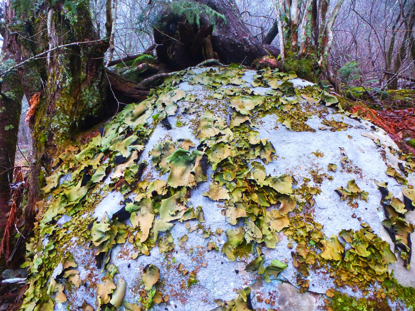
The rain which got some of my gear wet last night, fell as sleet on the mountaintop. My hike began at the Newfound Gap parking area on AT North. It wasn't long before I found myself at this junction with Sweat Heifer. Down I went on a very scenic trail. This big dome tent shaped rock was so pretty with its partial covering of Rock Tripe. Again today, the water was flowing well. I passed several creeks with cascades nearly across the trail. A couple miles down, I could make out an old road or railroad bed paralleling the trail. It appeared to connect with 2 others at a gap. There were large pieces of metal here. I could not tell what they had originally been but assumed it had something to do with logging. 


About noon I arrived at Kephart shelter for a snack to fuel me for the climb ahead. Grassy Branch proved to be a tough climb. Finally I arrived at Dry Sluice Trail which would take to the AT. I anticipated this to be another hard climb but it was not and quickly I was on the AT South. Views were limited by the overcast and misty conditions. I did not make any of the cool side trips in this area. I just headed back to Newfound Gap.


Along the way, I met many hikers and backpackers. The crowd thickened as I approached the trail head. Muddy conditions were the rule on the AT.


April 8 Cabin Flats & Chasteen Creek


Today's hike is a long one, encompassing 4 trails. Beginning and ending on Bradley Fork, I also walk on Cabin Flats, Hughes Ridge and Chasteen Creek Trails. Having spent the night in Smokemont, I was able to walk from my tent site to the Bradley Fork Trail. This is a two track road capable of handling regular vehicles if not for the mud. In fact I did meet an park employee driving a park SUV on his rounds, checking boar traps.

With recent rains, the creek was rushing. I was told by a fisherman, the creek level receded substantially during the day but that went unnoticed by me. The creek is supplemented by many small nameless streams of silvery water, pouring down every forest draw. The roar of the creek was with me until about the 4 mile mark, went I crossed the creek on an old steel bridge and then climbed away from the water, temporarily.  


The bridge, pictured below, struck me as odd. It is only 5 feet wide and 8 feet high. Too small for a train or auto and too low for horseback riders. The guidebook calls it a trestle bridge??

From here it is a short stroll to a right turn leading to Cabin Flats, my lunch spot. Back by the creek, this large flat area appears to have supported a home and farm long ago.

My trek today, has me retracing back to the steel bridge and continuing up Bradley Fork Trail to Hughes Ridge Trail. This is a tough uphill that seems to never end. The trail is rutted from horse traffic and not terribly scenic. I'm quite glad to finally reach Hughes Ridge and start back down again.


With a much quicker pace, I descend to Chasteen Creek Trail. Much of this trail is a two track which supports horse traffic but is in good shape. The trail is well above the creek for a long stretch. I enjoy this scenic trail in the late afternoon. When I reach the junction with Bradley Fork trail, an old homesite on the left, deserves a quick look. Daffodils are in bloom and some red bushes I can not identify are located here. The trail from here back to Smokemont has a number of hikers today.

Jan 4 Upper North Prong Hannahs Creek

  Hiking from the dam at  Plantation Road, up the creek toward Fern Valley. I've did this years ago but don't have any photos, so he...